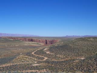
The Eminence
Break Route (RM 44) is a rugged but scenic side hike in Marble Canyon.
The route starts at river level and follows a rough cairned
trail to the canyon rim near Tatahatso Point. Most visitors
to Grand Canyon do not venture up the route as it is quite rugged
and free climbing is required at several locations, especially in
portions through the Supai, Coconino, and Kaibab Formations.
During
March-April 2005 we conducted a reconnaissance of the Eminence Break
Route while participating in a Grand Canyon River Guides training
trip. A large landslide was discovered in the vicinity of the
Eminence Break Fault. As with other megalandslides in Grand
Canyon, the failure initiated in the Bright Angel Shale and continued
up through the Supai Group.
-sharpened_sm.jpg)
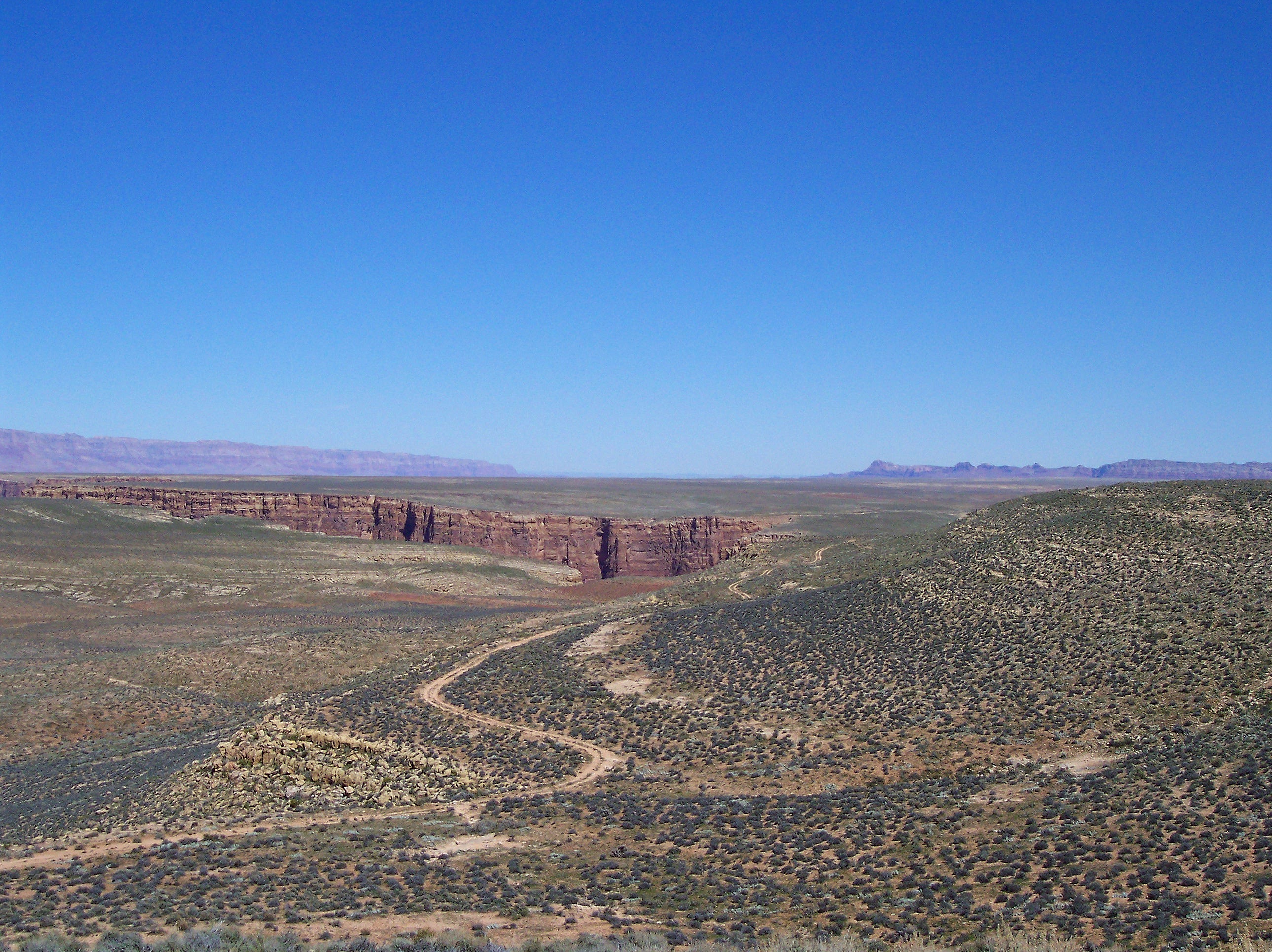
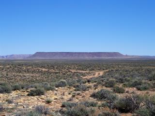
The Eminence Break Route leads to Tatahatso Point, a scenic overlook
on the west side of the Navajo Indian Reservation. This location
provides an excellent overview of the geology in the eastern Grand
Canyon Region. This picture includes an entrenched meander around
Point Hansbrough, named for Peter Hansbrough, a member of the 1889
Stanton Expedition. Hansbrough drowned above this point and
his body was later recovered and buried above the camp adjacent to
President Harding Rapid. All formations from river to rim are
visible as is the snow-covered East Kaibab Monocline and Saddle Mountain.
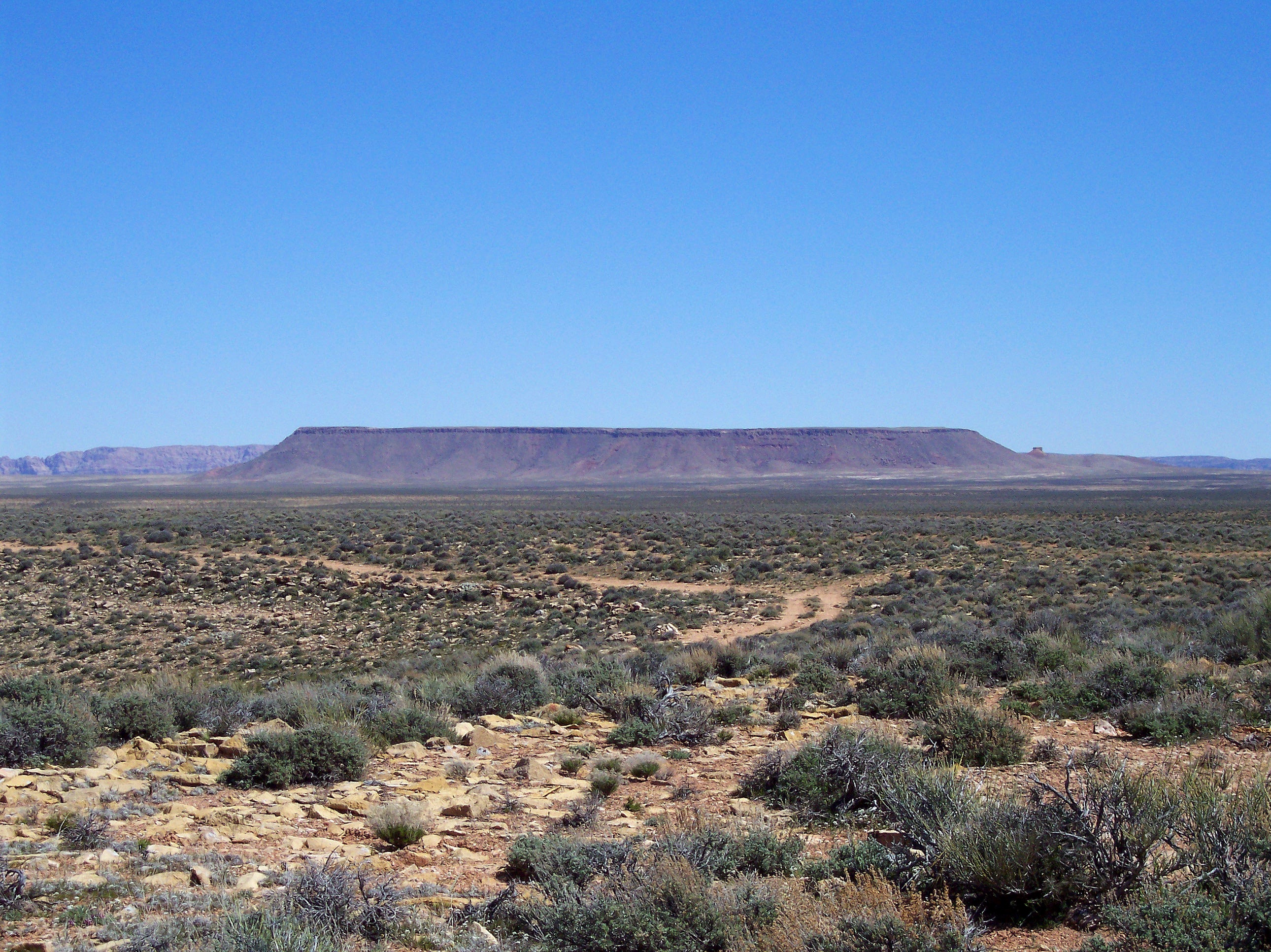
If one turns and looks to the north, the Vermilion Cliffs and House
Rock Valley are visible along with more of the East Kaibab Monocline.
To the east lies Shinumo Altar, a remnant of the Moenkopi Formation
capped by the resistant Shinarump Conglomerate. Lee's Ferry
lies to the northeast between the Vermilion and Echo Cliffs.
-enhanced_sm.jpg)
Tilted
strata of the East Kaibab Monocline is clearly visible from Tatahatso
Point.
-enhanced_sm.jpg)
The House
Rock Valley which runs between the reddish escarpment of the Vermilion
Cliffs (right) and the green East Kaibab Monocline (left), is visible
far to the north.
Lee's Ferry lies to the northeast between the Vermilion (left) and
Echo Cliffs (right).
Shinumo Altar, a remnant of Moenkopi capped by the resistant Shinarump
Conglomerate, is visible directly to the east of Tatahatso Point.
The Echo Cliffs are present in the far background.
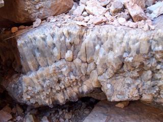
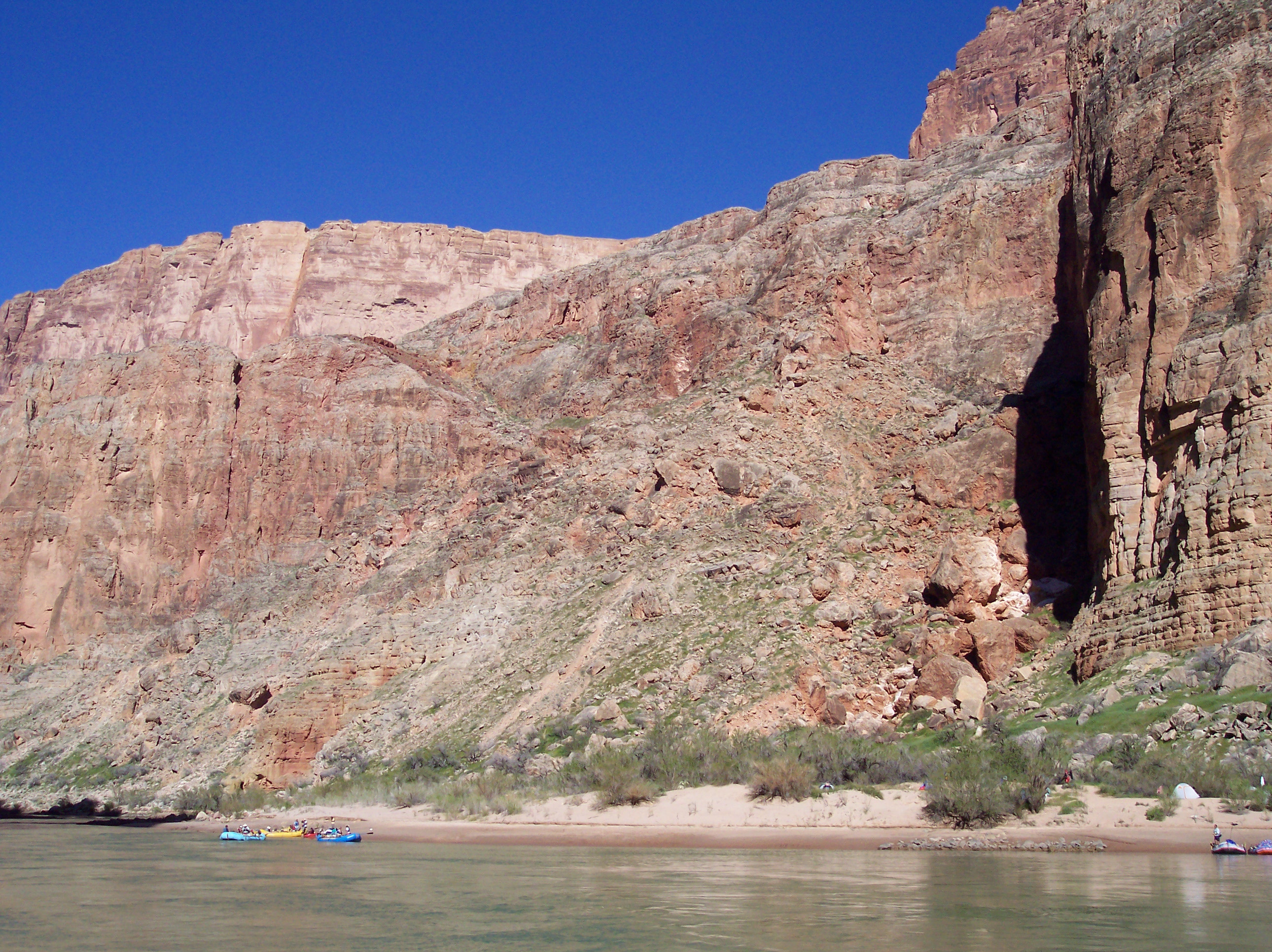
Multiple large veins of minerals (mainly quartz), were observed in
fractures along the Eminence Break Fault zone during the climb and
descent of the route. Mineralization along faults is common
and has led to the locating of many mines at fault zones.
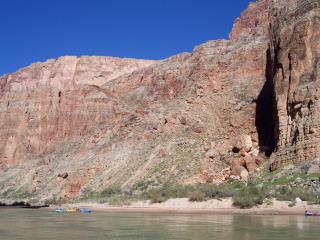
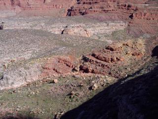
A large landslide is also developed along the Eminence Break Fault.
The headscarp of the Eminence Break Landslide appears to exactly
follow the strike of the fault. These views show the landslide
as it is seen from just downstream on the river.
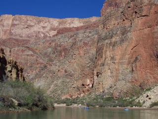
Downdropped strata (left) is observed near the headscarp of the Eminence
Breaks Landslide. This is not fault displacement as the east
(left) side of the fault has uplifted relative to the west (right)
side. Displaced strata may be seen in the upper right corner
of this photo.
Questions or comments
on this page?
E-mail Dr. J David Rogers at rogersda@umr.edu
or
Conor Watkins at cwatkin@umr.edu.

-sharpened.jpg)
-enhanced.jpg)
-enhanced.jpg)