|
| |
Mobile Highway Inventory and Measurement:
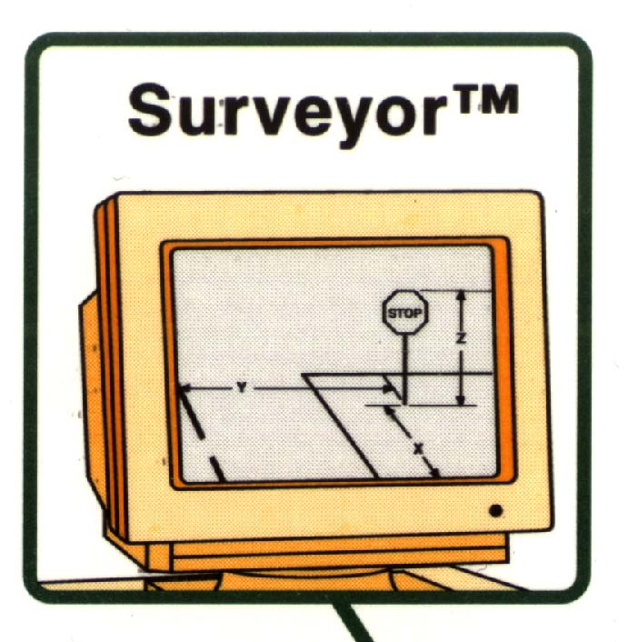 |
Surveyor™ is a mobile data collection system designed to collect
measurement data about objects, features, structures and landmarks located along highways
and roadways, for highway planning, managing, and maintenance. It measures heights,
widths, and depths of objects, as well as offsets form the center or edge of the road, and
spatial location, using GPS or inertial navigation. Surveyor was developed and is being
marketed by Roadware Inc. |
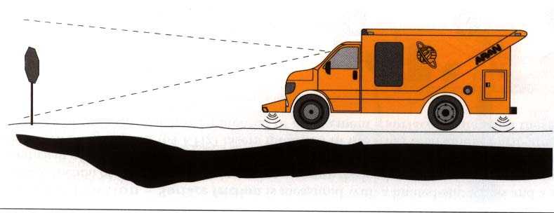 |
The first stage of surveyor is a mobile data collection system, consisting
of a calibrated video system on a vehicle. The vehicle is instrumented with an
ultrasonic grade system to reference the position of the vehicle (camera) with respect to
the road, and with a position orientation system for global positioning. |
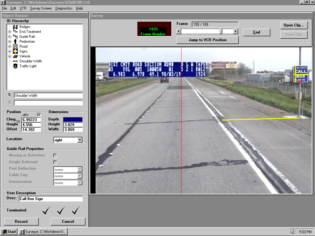
| The second stage of surveyor is an interactive workstation based software package that
is use to retrieve and select images, allowing the user to pick objects on the image.
Surveyor than calculates dimensions and position in space of the object, and stores
it in a database as an inventory entry, annotated with the results of the measurements. |
® Surveyor, is a registered trademark of Roadware Corporation.
|