Several
megalandslides in the vicinity of 205-Mile Canyon are among the largest
and least studied landslide events in Grand Canyon. Although
the large landslide on river right is obvious, a much larger landslide
block is located just downstream of 205-Mile Canyon, on river left.
The immensity of this block makes is hard to recognize at river level.
The Granite Park Fault, a west-dipping lystric normal fault, runs
through this area and may be related to the landsliding.
During
March 2005 we conducted a reconnaissance of the area while participating
in a research trip led by Dr. Robert Webb of the USGS in Tucson, AZ.
During the trip, the two largest slides in the vicinity of 205-Mile
Canyon were investigated.
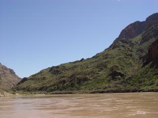
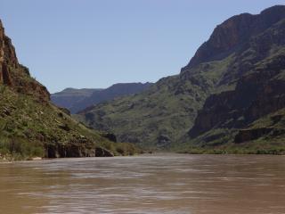
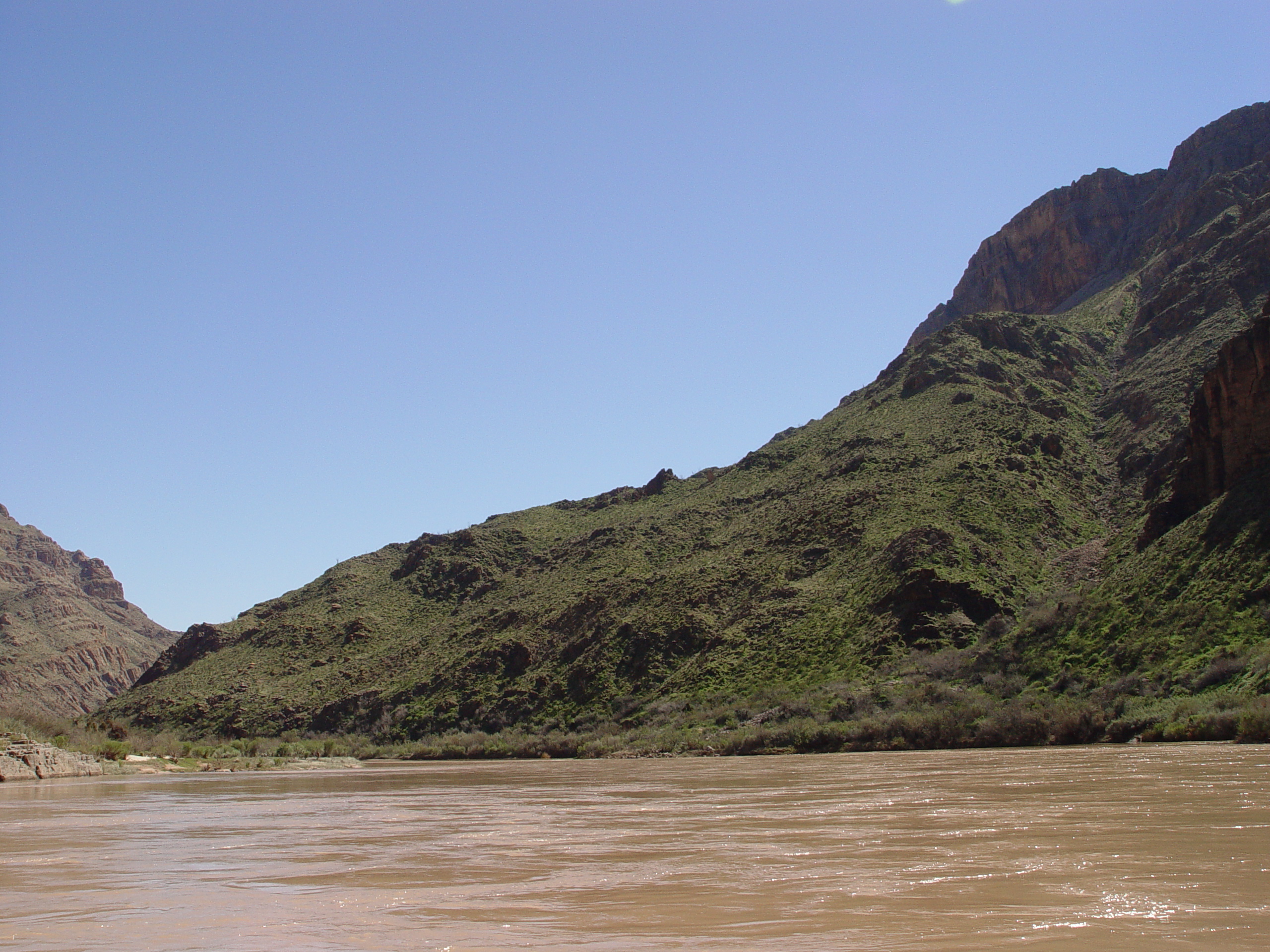
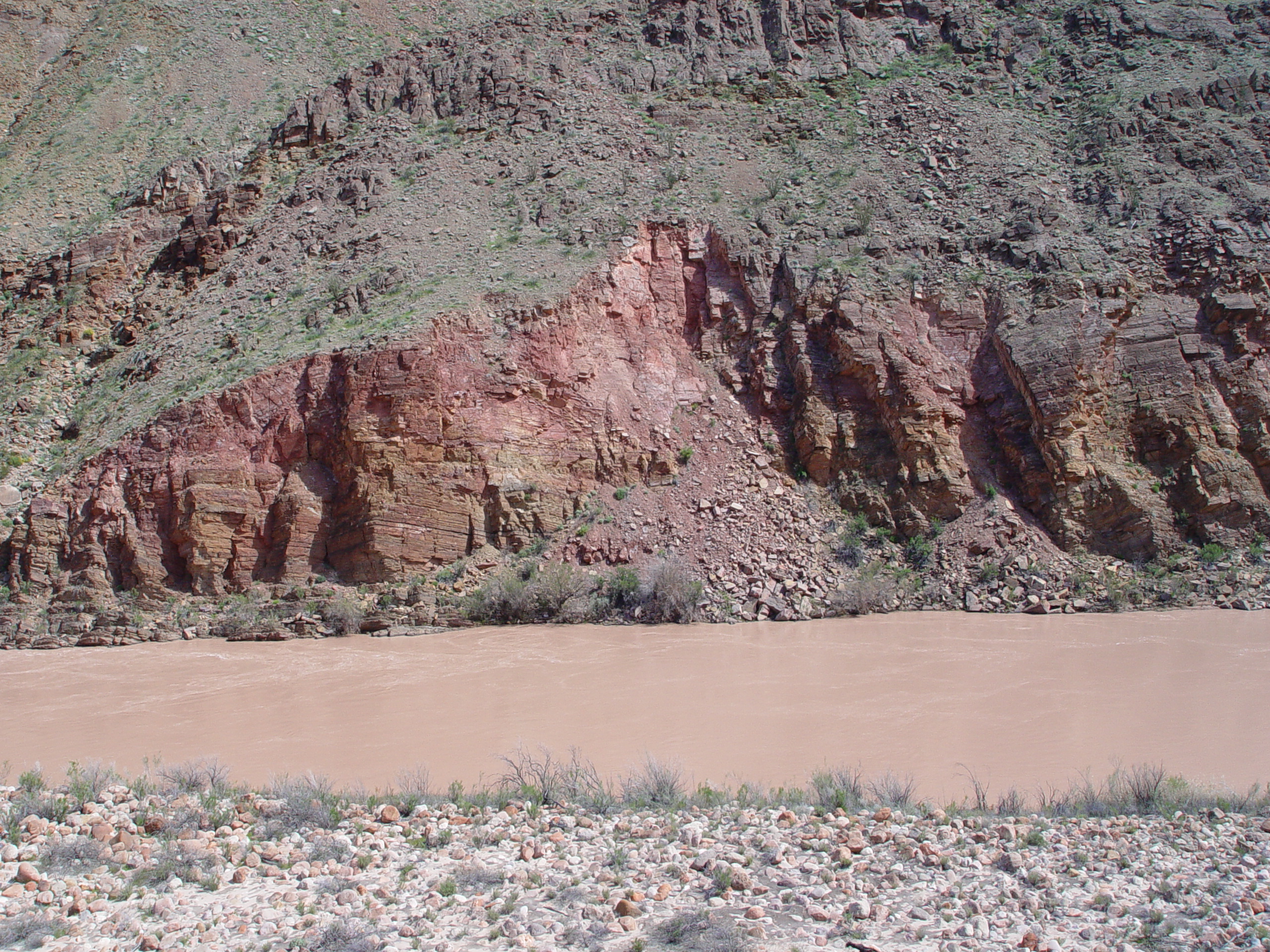
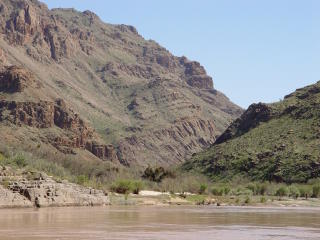
The
205-Mile River Right Landslide is easily discerned from river level.
The Colorado River channel curves around the toe of this landslide,
suggesting that the slide once blocked the river. If an old
river channel is present under the landslide, it has been obscured
by secondary landsliding and talus.
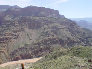
View of
the 205-Mile River Right Slide taken from the opposite side of the
canyon atop the 205-Mile River Left Landslide. Secondary retrogressive
slumps line the right bank of the channel, where the toe of the main
slide mass is being undercut by the Colorado River. Talus cones
along the headscarp are fresh, indicating the scarp is still raveling.
Talus cones along the headscarp of the 205-Mile River Right Landslide
appear young, suggesting that the scarp is continuing to ravel.
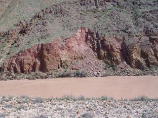
Much of the 205-Mile River Right Landslide consists of brecciated
Redwall Limestone. This texture is common to other landslides
in Grand Canyon, including the much-studied Deer Creek Slide.

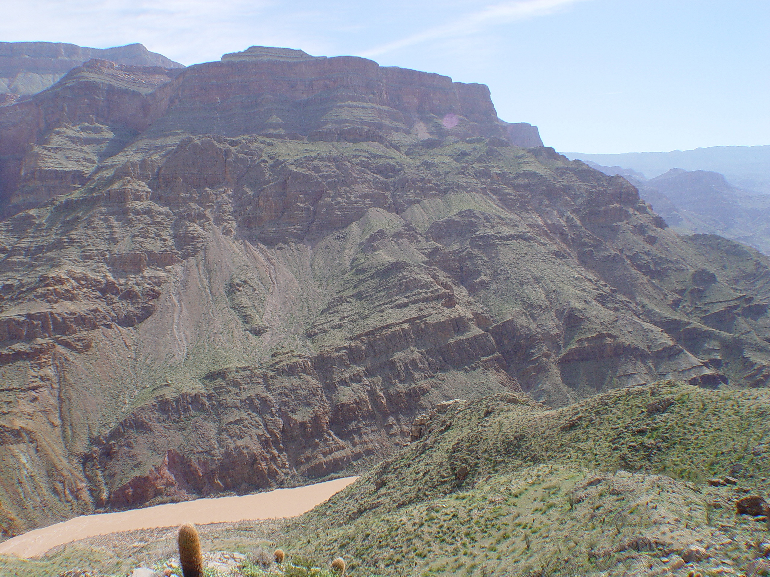
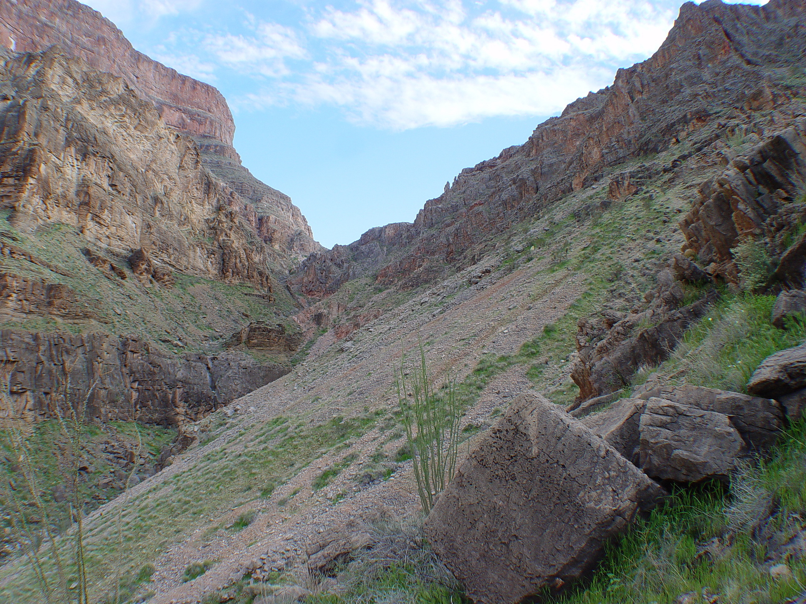
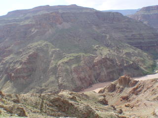
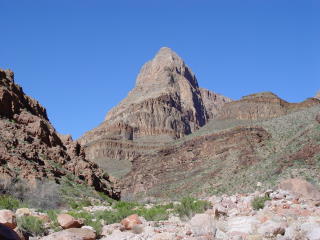
The massive 205-Mile River Left Landslide is best viewed from within
205-Mile Canyon, not from the river. It consists of a single
back-rotated block with several secondary failures along its toe.
This is the largest single landslide block identified in Grand Canyon
to date. Rough estimates indicate a volume of about 2 billion
cubic meters at the time of failure. Erosion has dissected the
slide mass, removing much of the material. The scarp of this
landslide parallels the strike of the Granite Park Fault, suggesting
the fault likely played a significant role in triggering the enormous
slide.
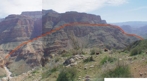
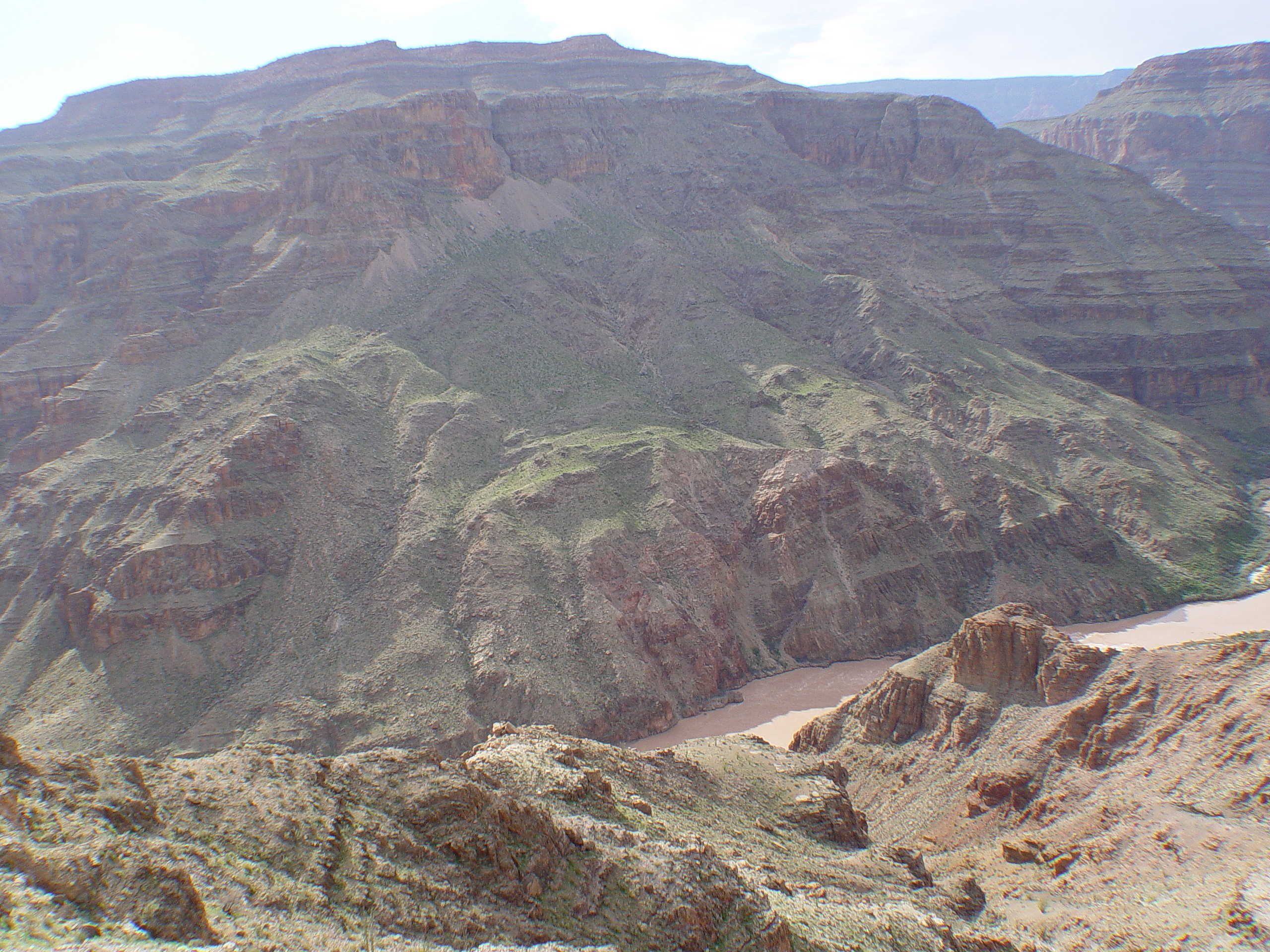
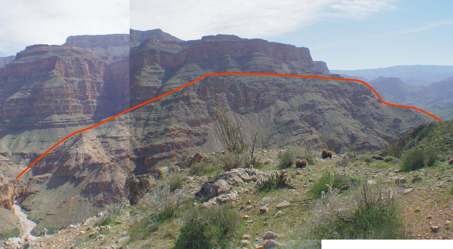
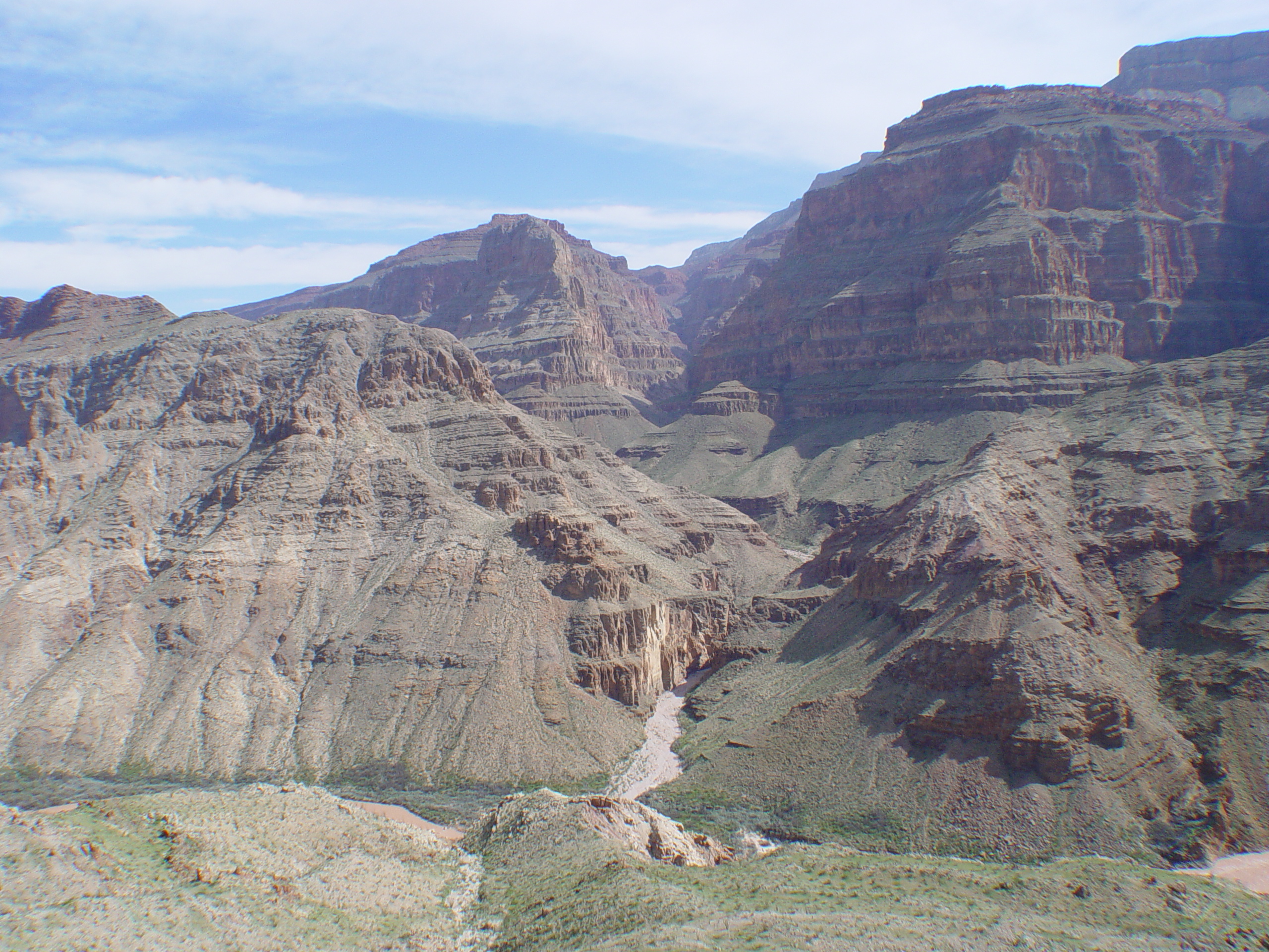
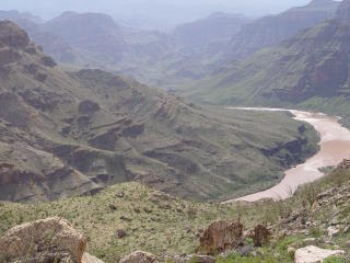
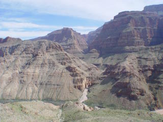
This view
of the 205-Mile River Left Landslide was taken from atop the 205 Mile
River Right Landslide. This enormous landslide block spans more
than two miles and is outlined here in red.

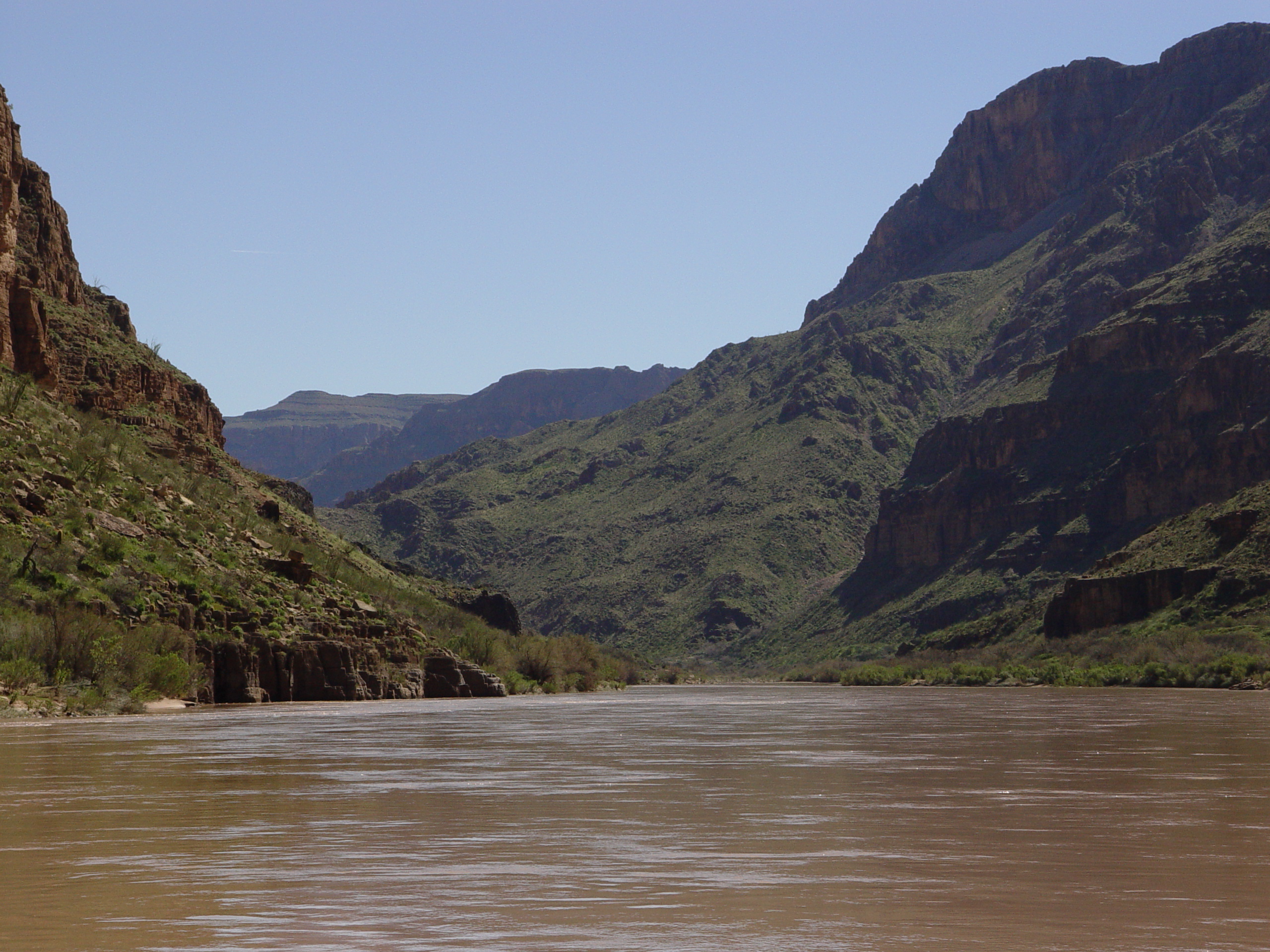
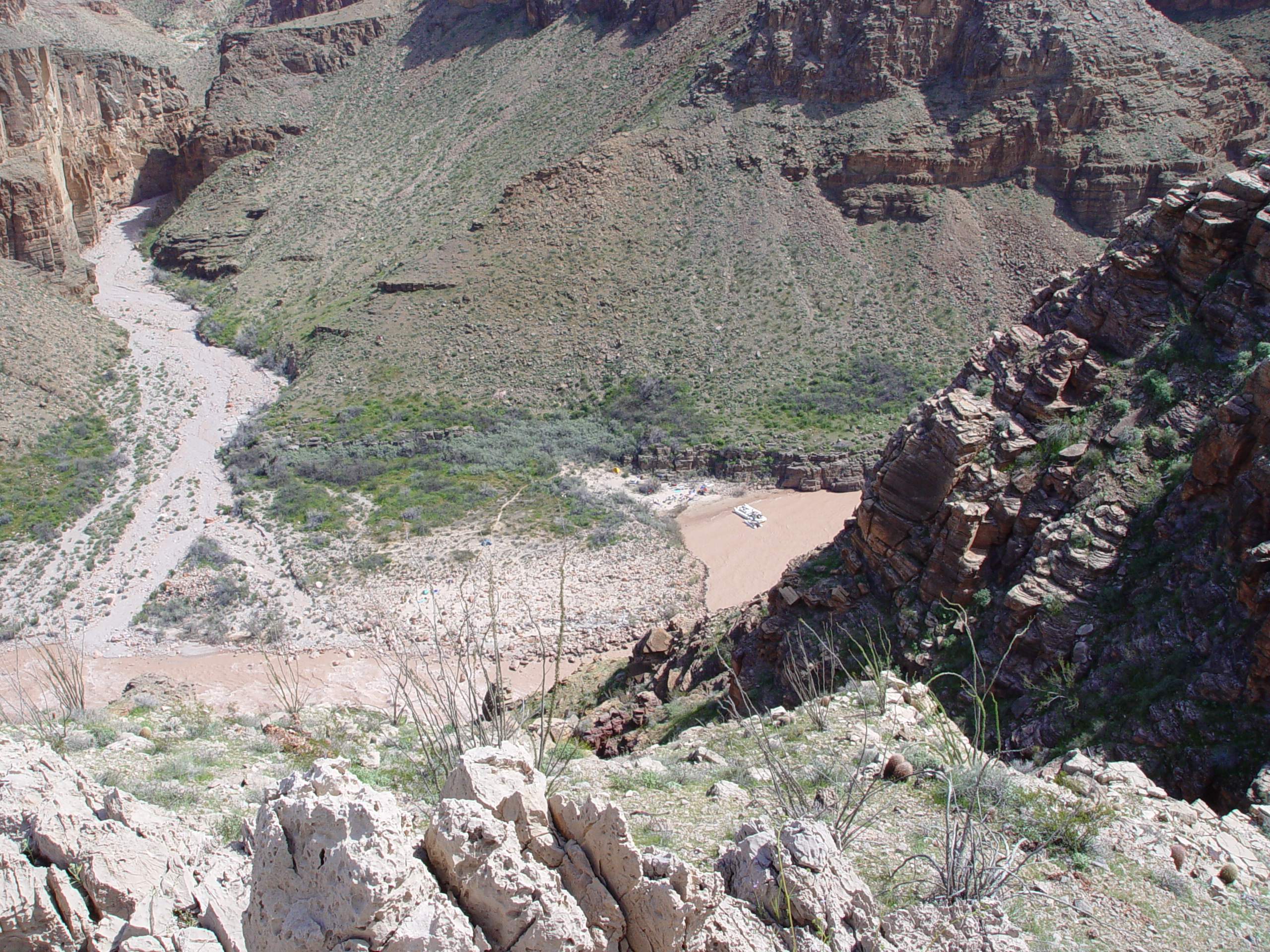
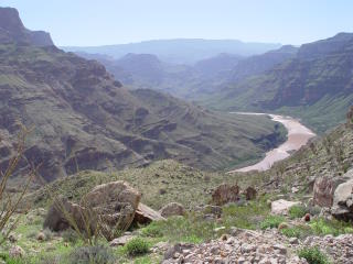
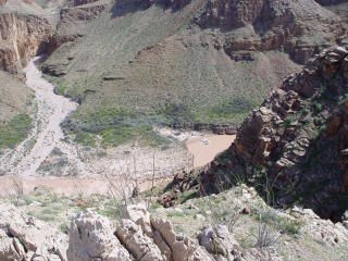
Secondary
slumps along the front of the 205-Mile River Left Landslide are clearly
visible from the river. Without further investigation, it is
difficult to discern the much larger parent landslide block.
T he large secondary slump off the 205-Mile River Left Slide is fairly
easy to discern from atop the River Right Slide.
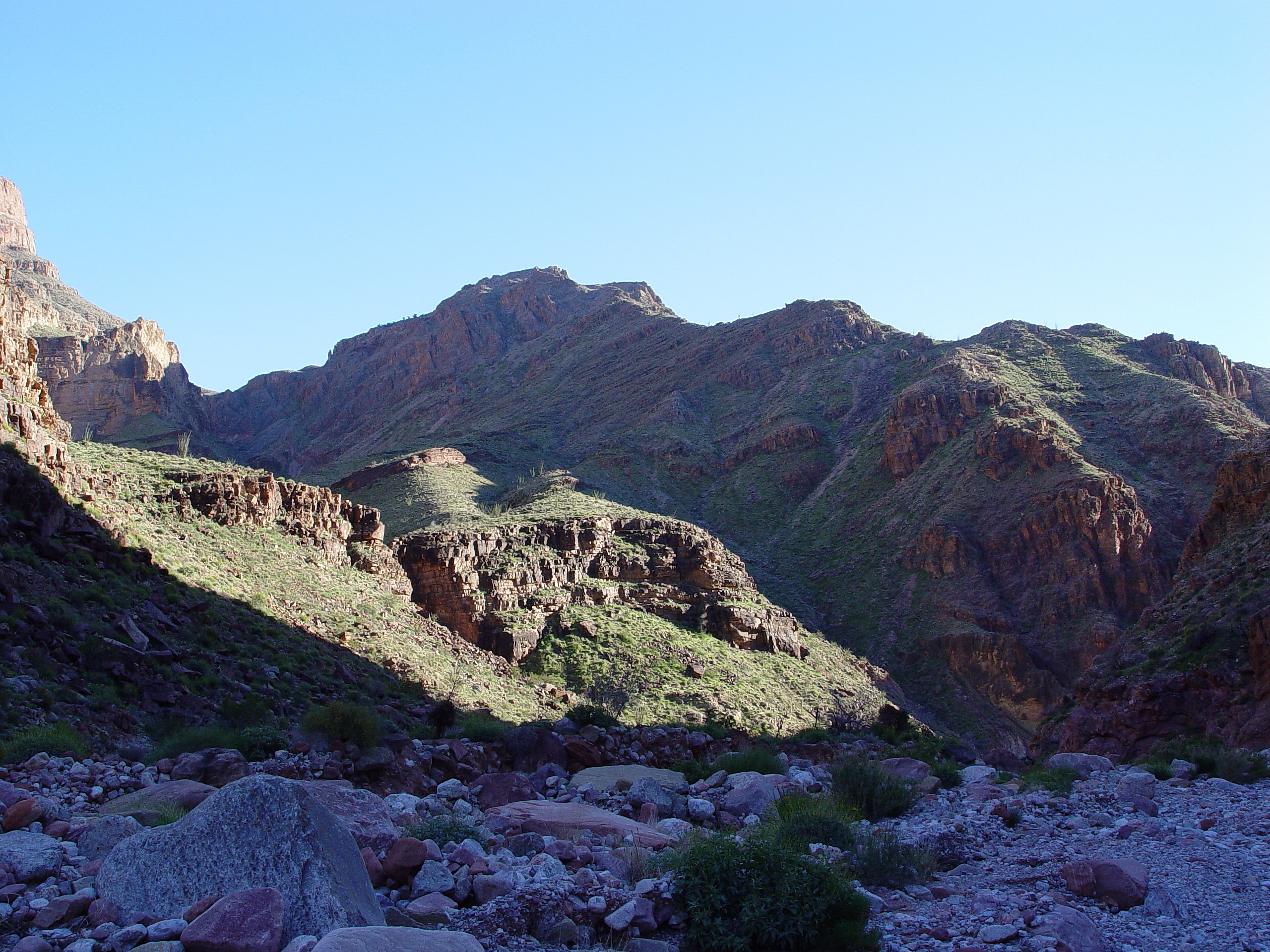
Another
secondary slump around RM 207 has calved off the front of the parent
landslide block. This view was observed from atop the 205 Mile
River Right Landslide.
The toe of the 205 Mile River Left landslide is experiencing continual
regression along the river channel. The oxidized color of the
parent slide debris suggest an old age, likely Pleistocene.
This view looking up the headscarp of the 205-Mile River Left Landslide
shows the large back-rotated block (right) against its parent cliff
(at left). This scarp closely follows the strike of the Granite
Park Fault.

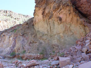
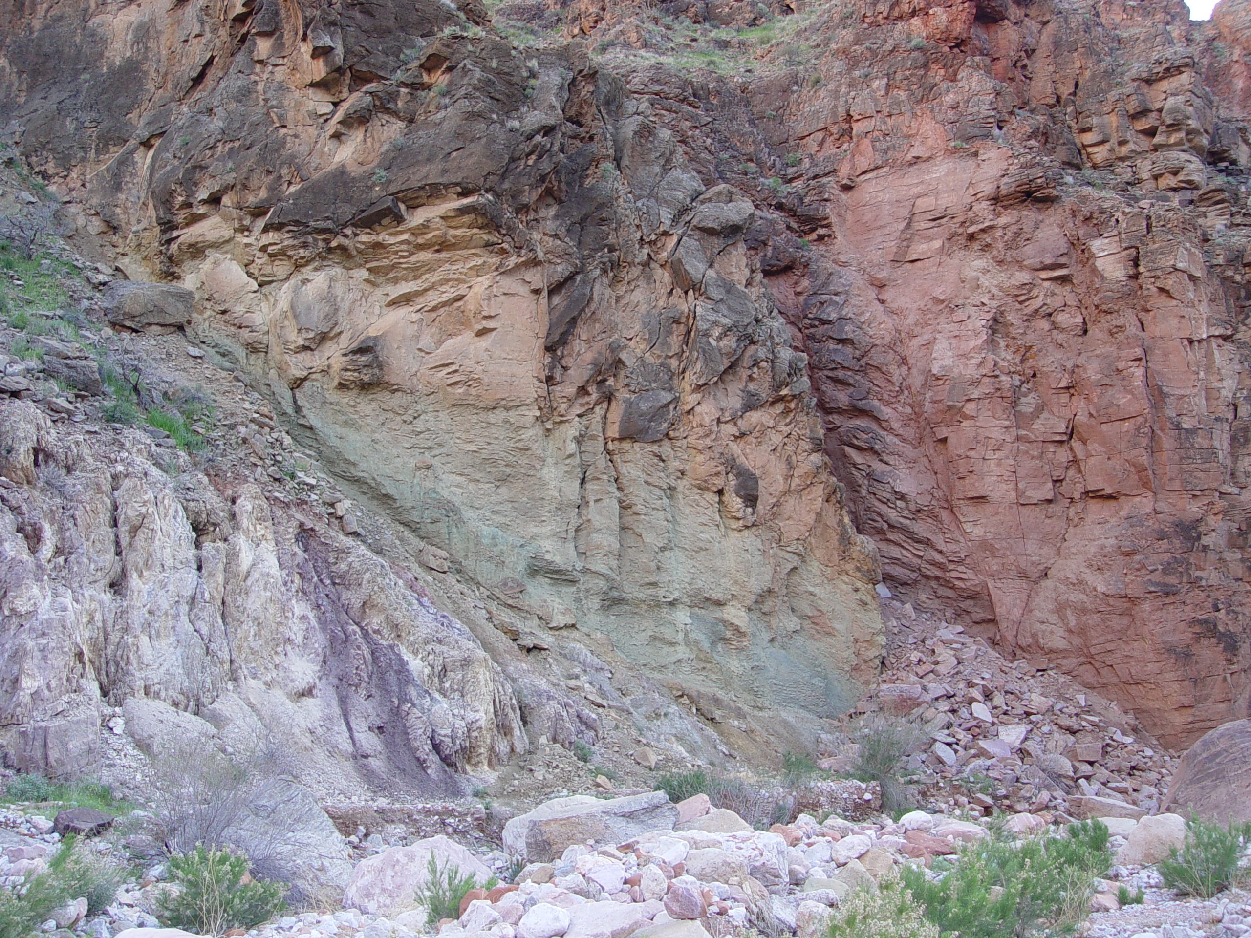
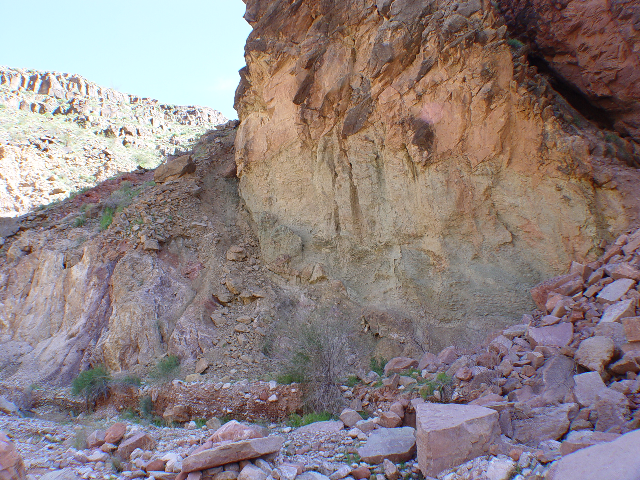
The Granite Park Fault and a zone of clayey gouge is clearly exposed
in 205-Mile Canyon. Faults usually create low permeability zones
with low shear strength, promoting secondary displacements that occur
in response to surface processes and loading. Visually, this
gouge resembles the Bright Angel Shale, but further analysis will
be required to verify this observation.

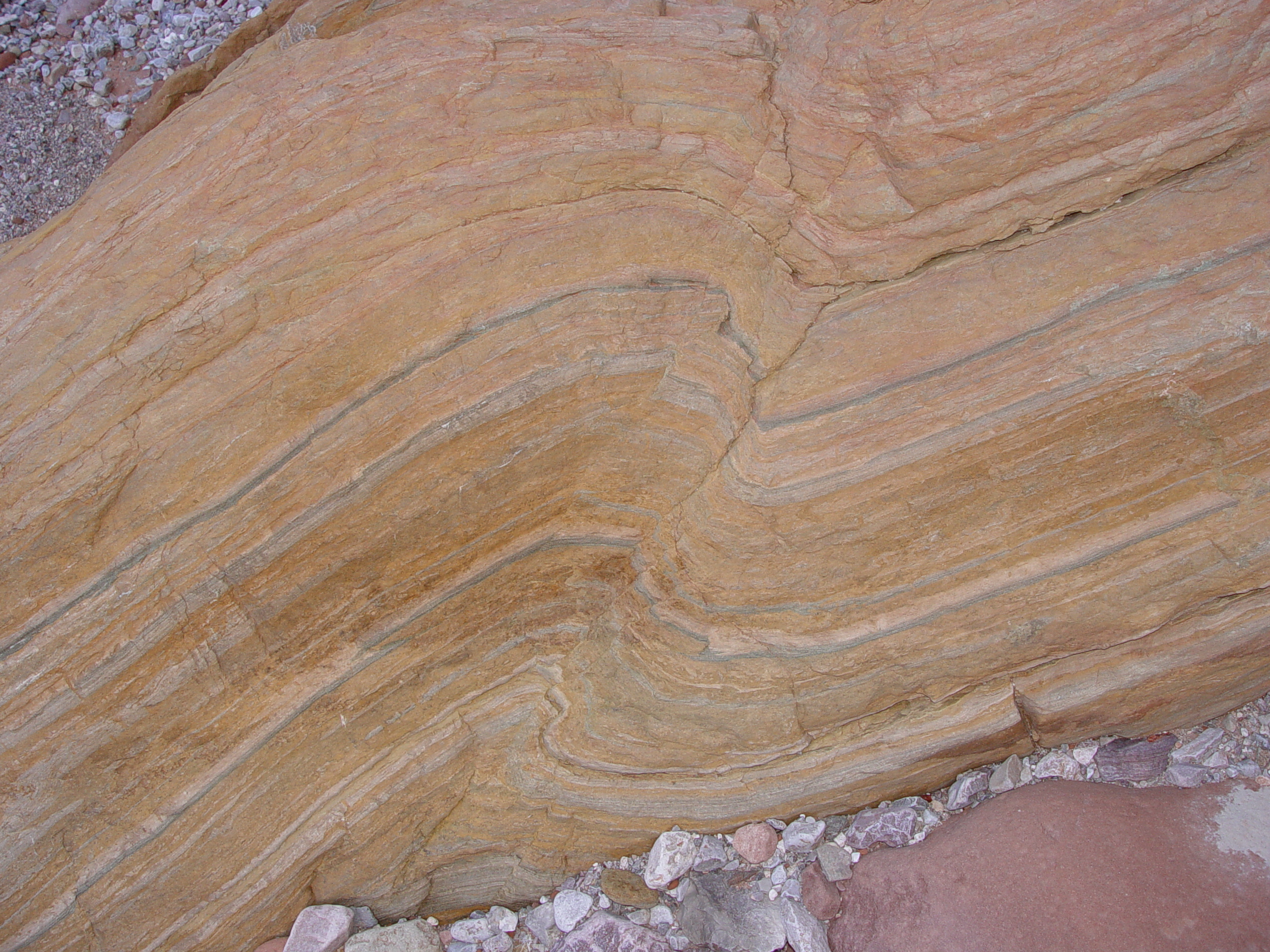
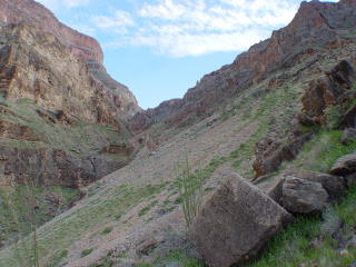
A small thrust has been preserved in a large Muav boulder in the narrows
of 205-Mile Canyon, just downstream (west) of the Granite Park Fault.
The Granite
Park Fault and/or the 205-Mile River Left Landslide appears to have
altered the course of 205-Mile Canyon. The canyon has carved
a striking narrows through the Muav Limestone on the downdropped (west)
side of the fault, but is much wider on the uplifted (east) side developed
in the more resistant Tapeats Sandstone. This suggests the Muav
Narrows are a geologically young feature. This side canyon also
follows the Granite Park Fault until the narrows, where it turns abruptly
to the west. Some reddish sediments are preserved upstream of
the narrows. Most of these appear to be debris flow related,
but some fine lenses may represent lacustrine deposition that were
collected behind a landslide dam.
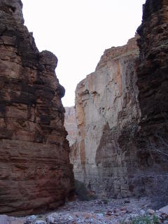
These
Muav Narrows near the mouth of 205-Mile Canyon are a geologically
young formation and seem to indicate that the course of the canyon
has been altered by the faulting and/or landslippage.
205-Mile Canyon opens up and becomes much wider east of the Granite
Park Fault. This part of the canyon is developed in more resistant
Tapeats Sandstone, so it is likely much older than the Muav Narrows.
Since
the formation of the Muav Narrows in 205-Mile Canyon, displacement
on the Granite Park Fault has continued. The mouth of 205-Mile
Canyon appears aggraded and choked with sediment to an unknown depth.
Questions or comments
on this page?
E-mail Dr. J David Rogers at rogersda@umr.edu
or
Conor Watkins at cwatkin@umr.edu.