During
May-June 2004 we conducted a detailed reconnaissance of Fishtail Canyon,
where a large deposit of Quaternary terrace gravels had been mapped
previously (see geologic map below). Field work revealed this
is actually a large bedrock landslide block, which slid on the Bright
Angel Shale, blocking Fishtail Creek. This enormous block appears
much younger than those recognized in the Surprise Valley area a few
kilometers upstream. Approximately 610 meters of stratum have
been displaced by the slide and initial estimates suggest the volume
of the slide is at least 340 million cubic meters.
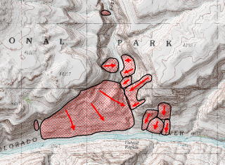
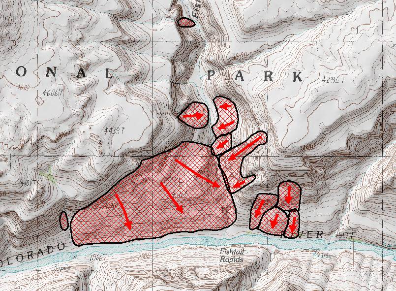
Portion of the Fishtail Mesa 7.5' Quadrangle showing landslides near
the mouth of Fishtail Canyon. Note smaller slides emanating
from both sides of the side canyon. The stream profile is diagnostic
of a landslide dam, with below normal gradient upstream of the blockage
and acute gradient through the obstruction. Well-indurated lacustrine
sediments are preserved upstream of the largest block in lower Fishtail
Canyon.
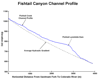
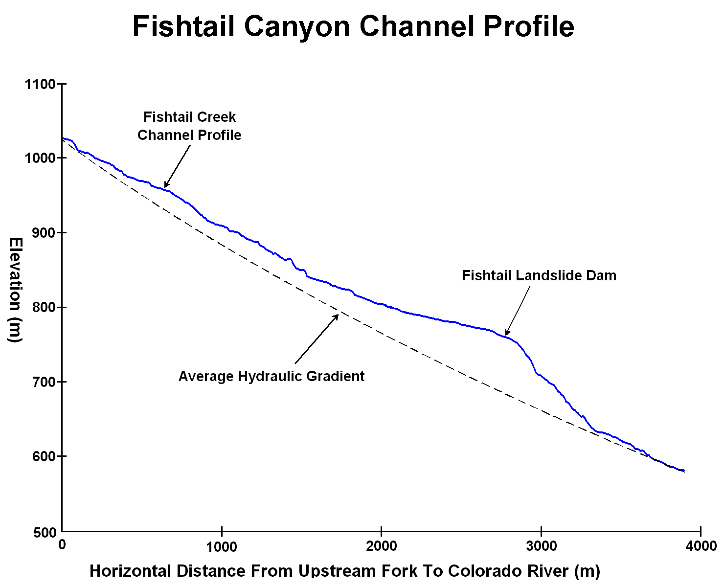
Channel profile of lower Fishtail Creek exhibits a classic choke point
formed by the landslide dam that diverts the channel.
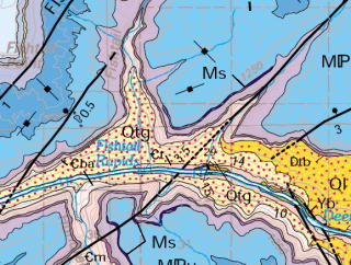
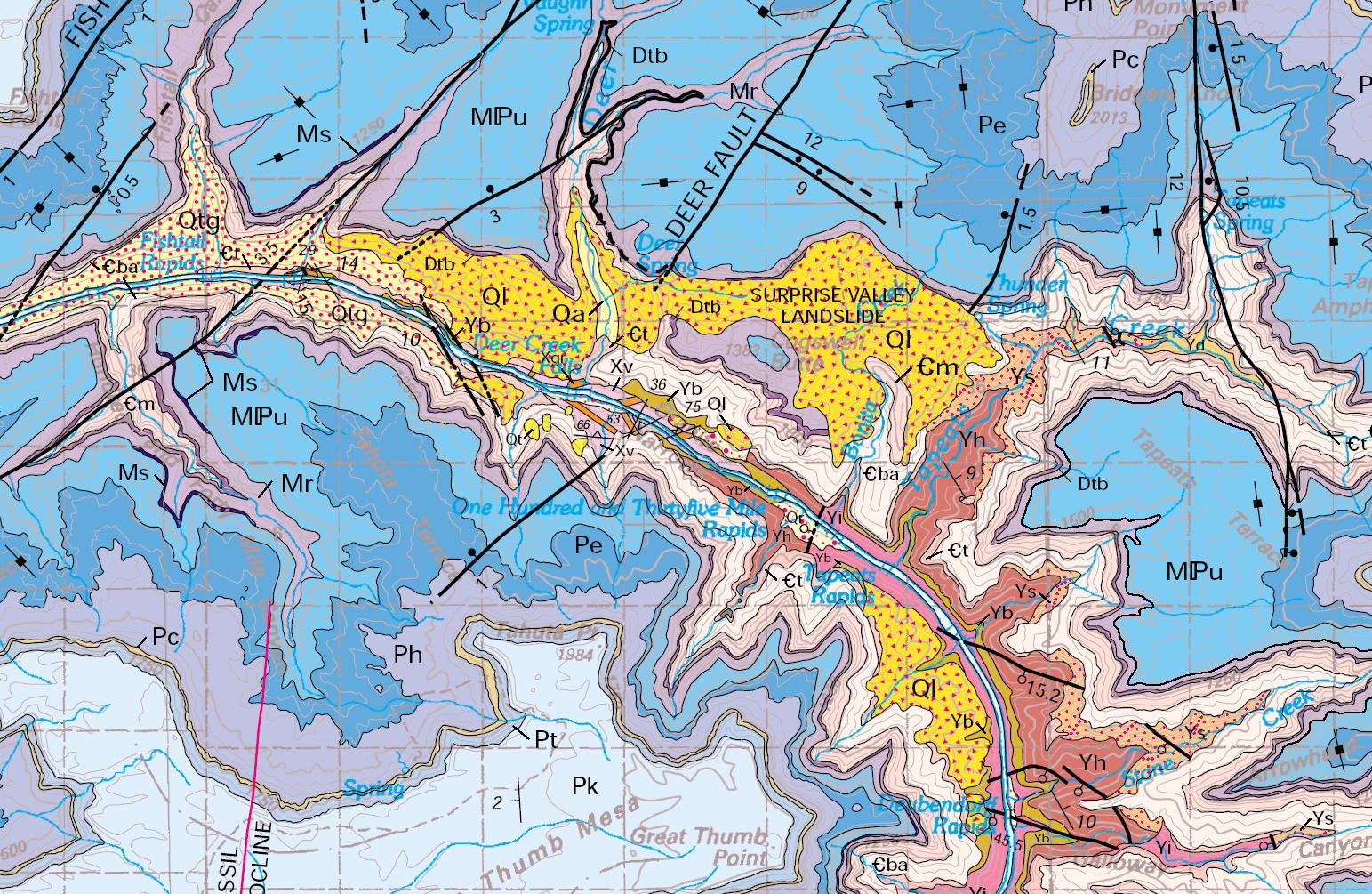
Portion of "Geologic Map of the Grand Canyon 30' x 60' Quadrangle,
Coconino and Mohave Counties, Northwestern Arizona" published
by the USGS in 2000. This map inherited previous interpretations
which assumed the lower Fishtail and Cranberry areas were blanketed
by Quaternary terrace deposits. We have observed terrace gravels
east of the mouth of Cranberry Canyon well above the present channel,
and along the lower portion of this landslide. Billingsley (2005)
believes that these gravels were deposited during an outwash flood
caused by the failure of the landslide dam at Deer Creek or river
mile 235 on Cogswell Butte, indicating that the Fishtail Landslide
predates whichever event placed the cobbles.
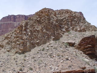
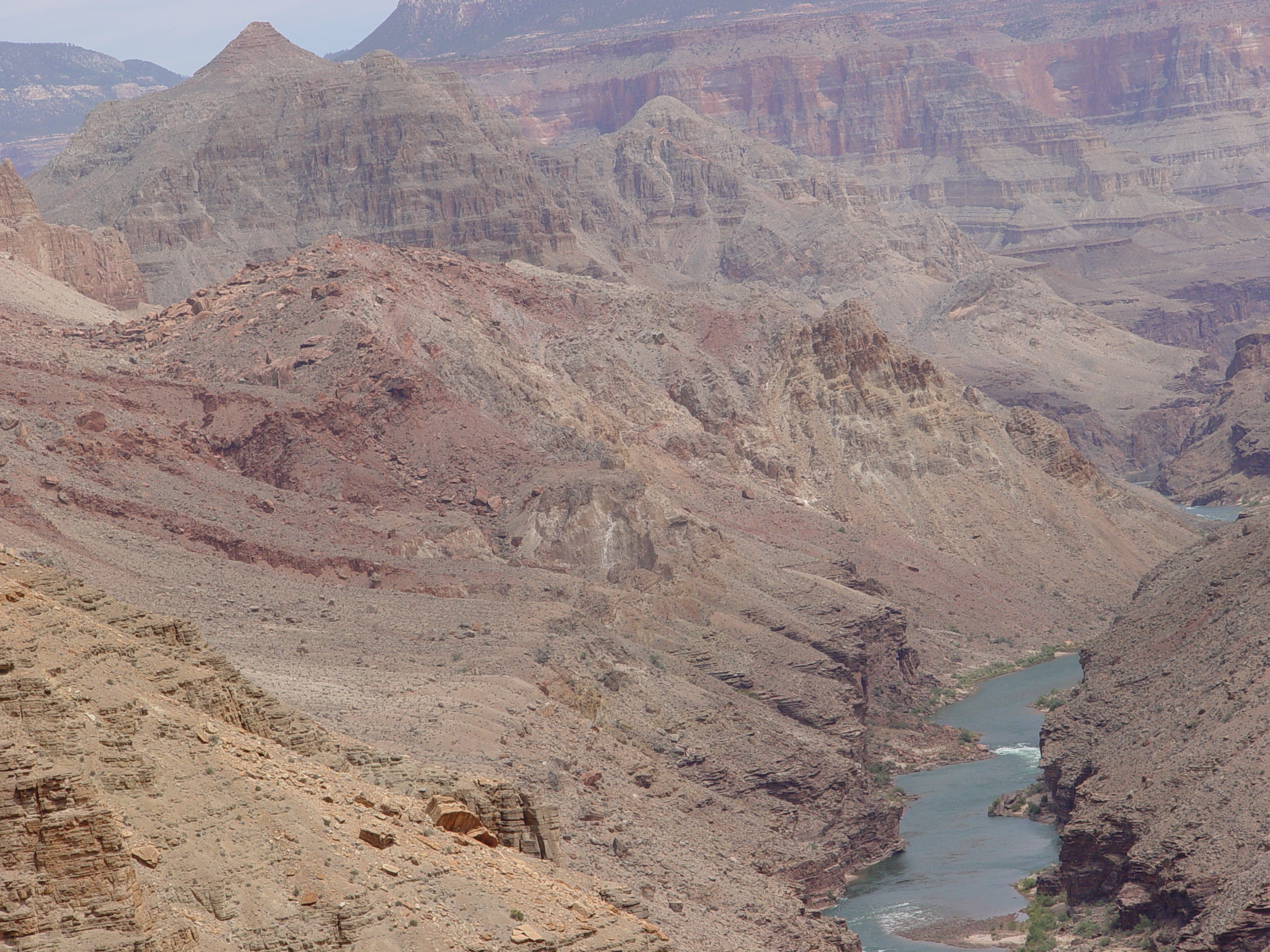
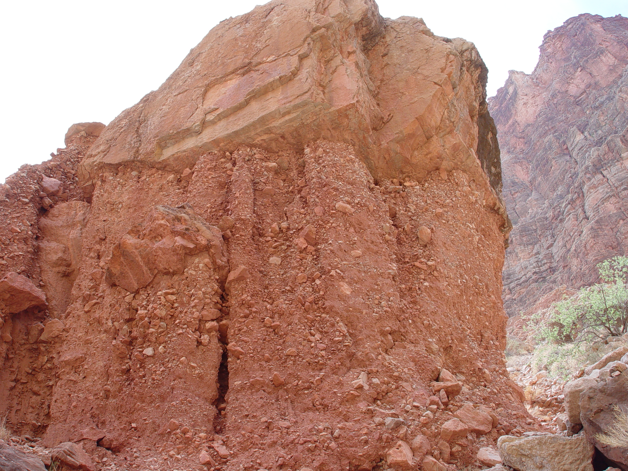
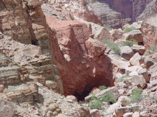
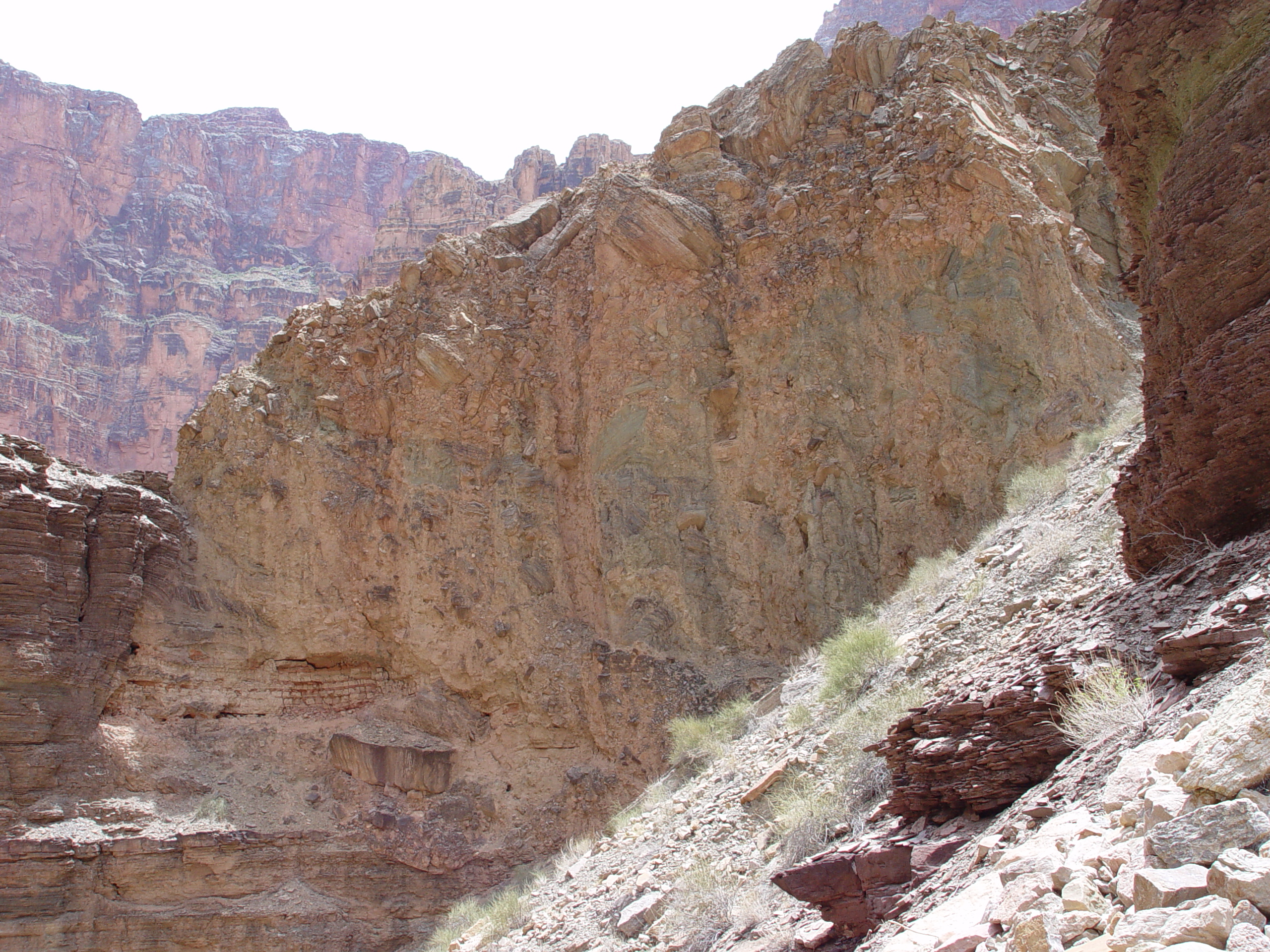
Main Fishtail Landslide block as it appears from mouth of Fishtail
Canyon along the Colorado River. This jumble of disaggregated
debris appears similar to the Deer Creek Landslide.
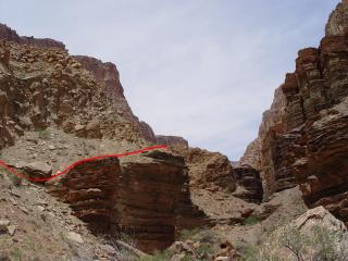
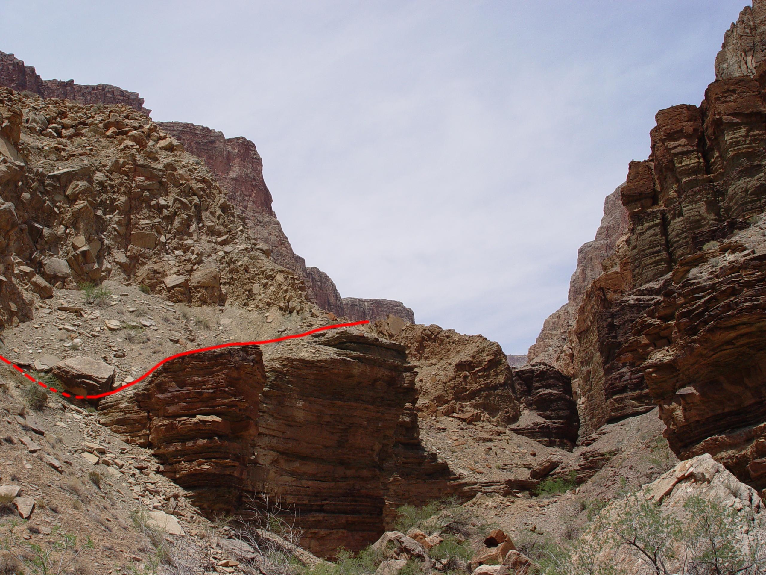
The mouth of Fishtail Canyon is incised in the Bright Angel Shale,
the unit normally associated with fomenting large scale landslippage
in the Grand Canyon. The channel profile and deflected channel
plan are diagnostic of a breached landslide dam. The red line
indicates the approximate position of the pre-slide channel, within
45 m of the present bed level.
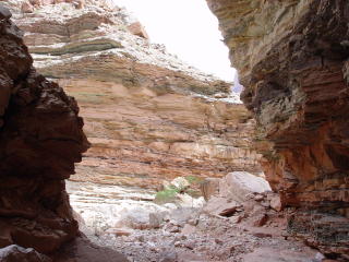
This mouth of Fishtail Canyon is deeply incised in the fissile Bright
Angel Shale, testifying to rapid entrenchment by the diverted overflow
channel.

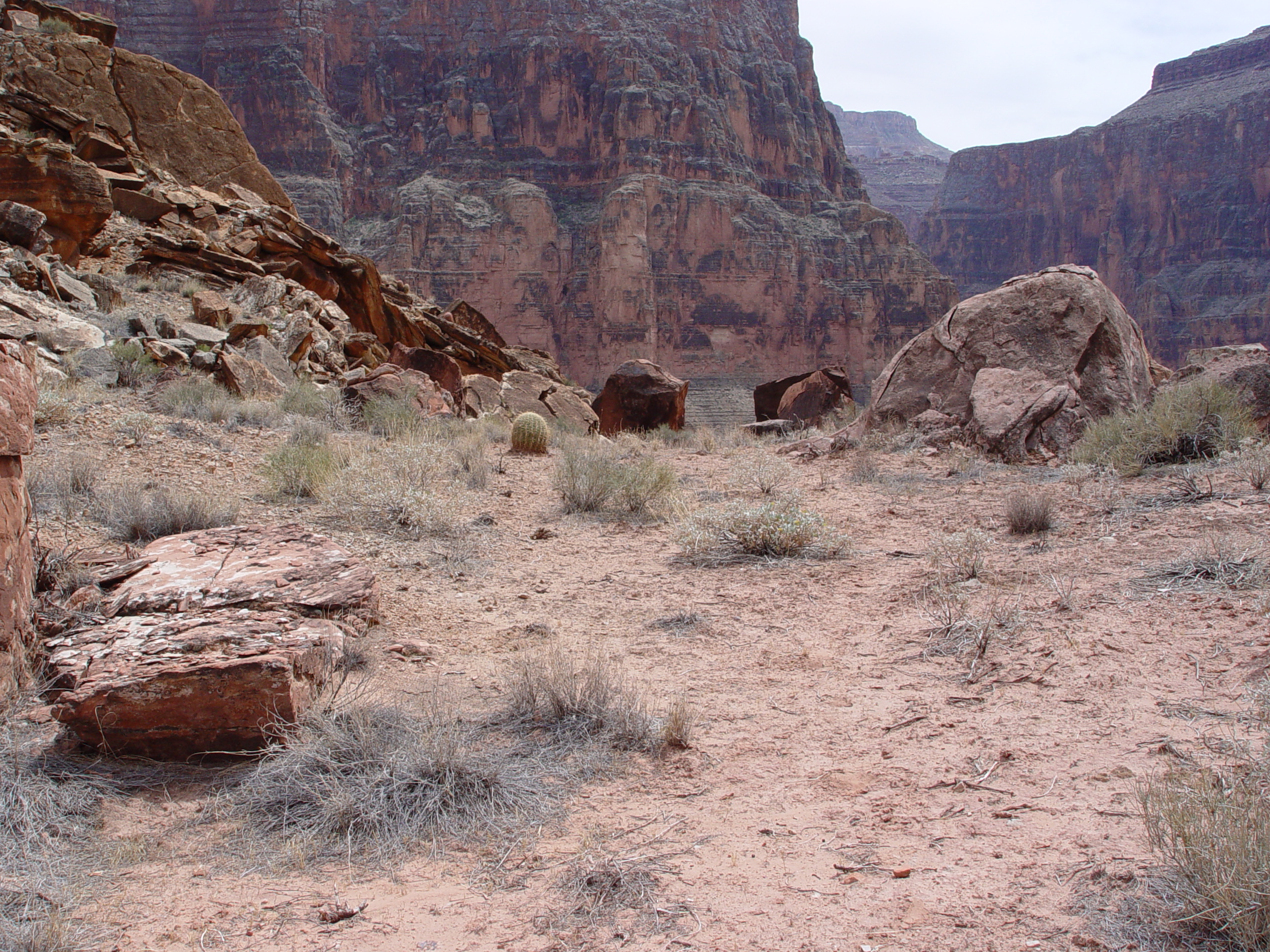
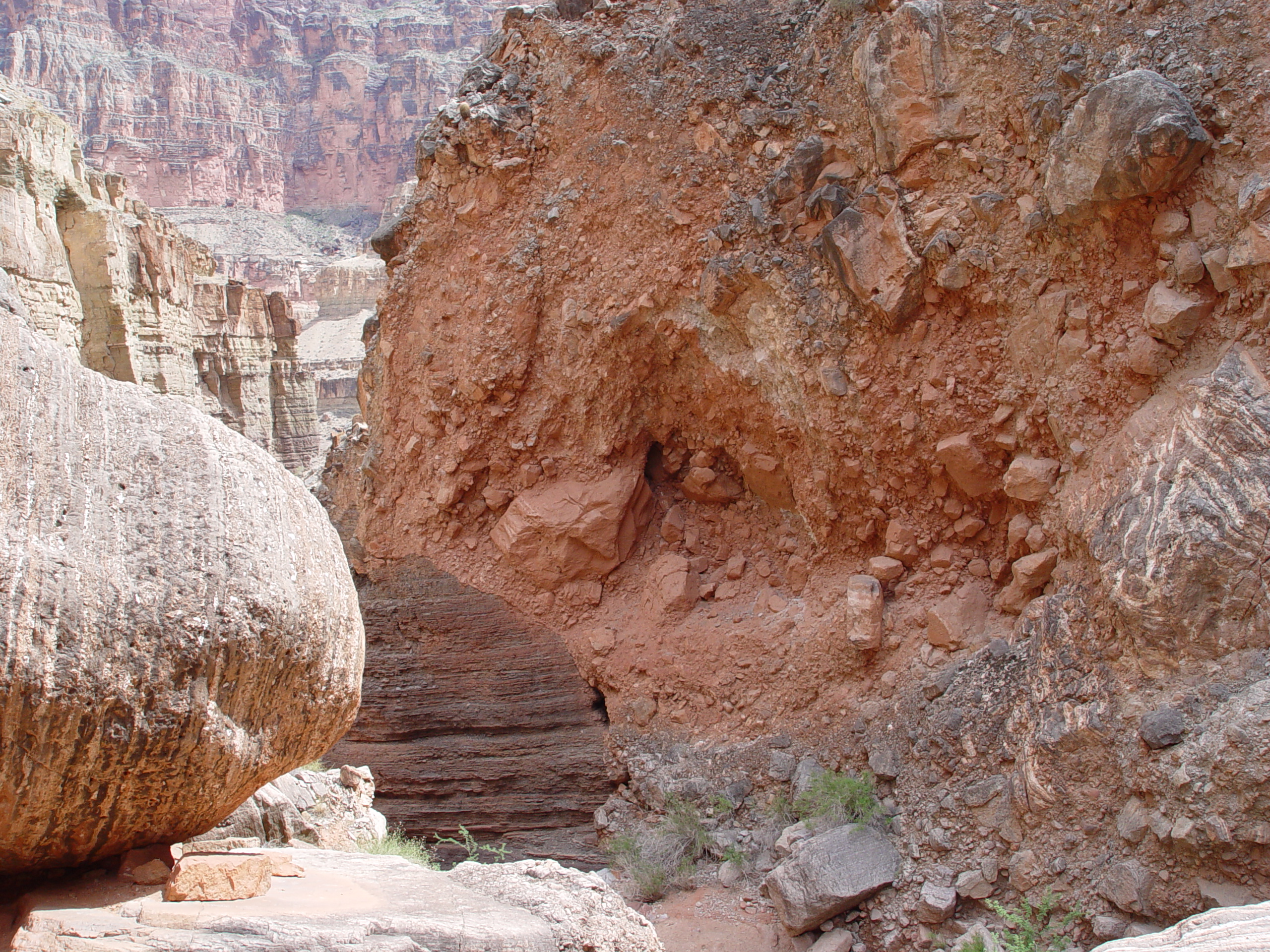
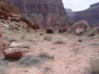
Looking downstream at the Fishtail Landslide debris infilling the
pre-slide channel of Fishtail Creek. The channel has been diverted,
creating a narrow gorge through the Bright Angel Shale, between 0
and 150 m east of the old channel. The similarities between
the mouth of Fishtail and the Deer Creek Narrows are striking.
_sm.JPG)
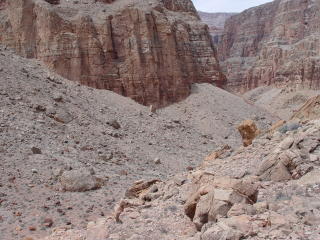
Fishtail Canyon opens up upstream of the slide block, but is mantled
by what appear to be retrogressive sliver slumps, which may have been
triggered by rapid drawdown when the main landslide dam was breached.
Prior to breachment the side canyon appears to have been infilled
with colluvial talus and lacustrine sediments mixed with debris deposits.
This shows the chaotic jumble of house-sized blocks littering the
channel of Fishtail Creek, making passage difficult and clumbersome.
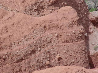
These indurated lacustrine sediments are present upstream from the
main slide block in Fishtail Canyon. Unlike the extensive talus/colluviual
sediments, these materials were deposited with near-horizontal inclination,
likely in some sort of impoundment. They exhibit alternating fine
and coarse grained materials, suggesting cyclic deposition during
high and low energy events. The boulders choking Fishtail Canyon
in the background are the size of small houses.
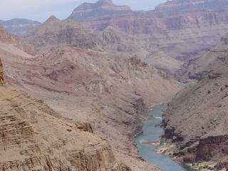
View looking upstream from summit of the Fishtail Landslide block,
looking east towards the Deer Creek Slide Complex. We created
a photorealistic render of a similar scene using a 10 m digital elevation
model (DEM) with the software package Terragen.
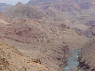
A zoomed in view of the Deer Creek Slide from the top of the Fishtail
Landslide.
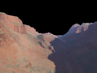
A similar view of the Deer Creek Landslide created using Terragen,
a photorealistic scene generator that uses digital elevation models
(DEMs) to render scenes. Note the similarities between the prototype
scene and the artificial rendering. This image was generated
using a 10 meter DEM. Although the resolution is only 10 m,
renderings can be useful forensic tools to ascertain where old photographs
were imaged. Images depicting the Martian landscape using Terragen
appeared on the cover of the January 2004 National Geographic Magazine.
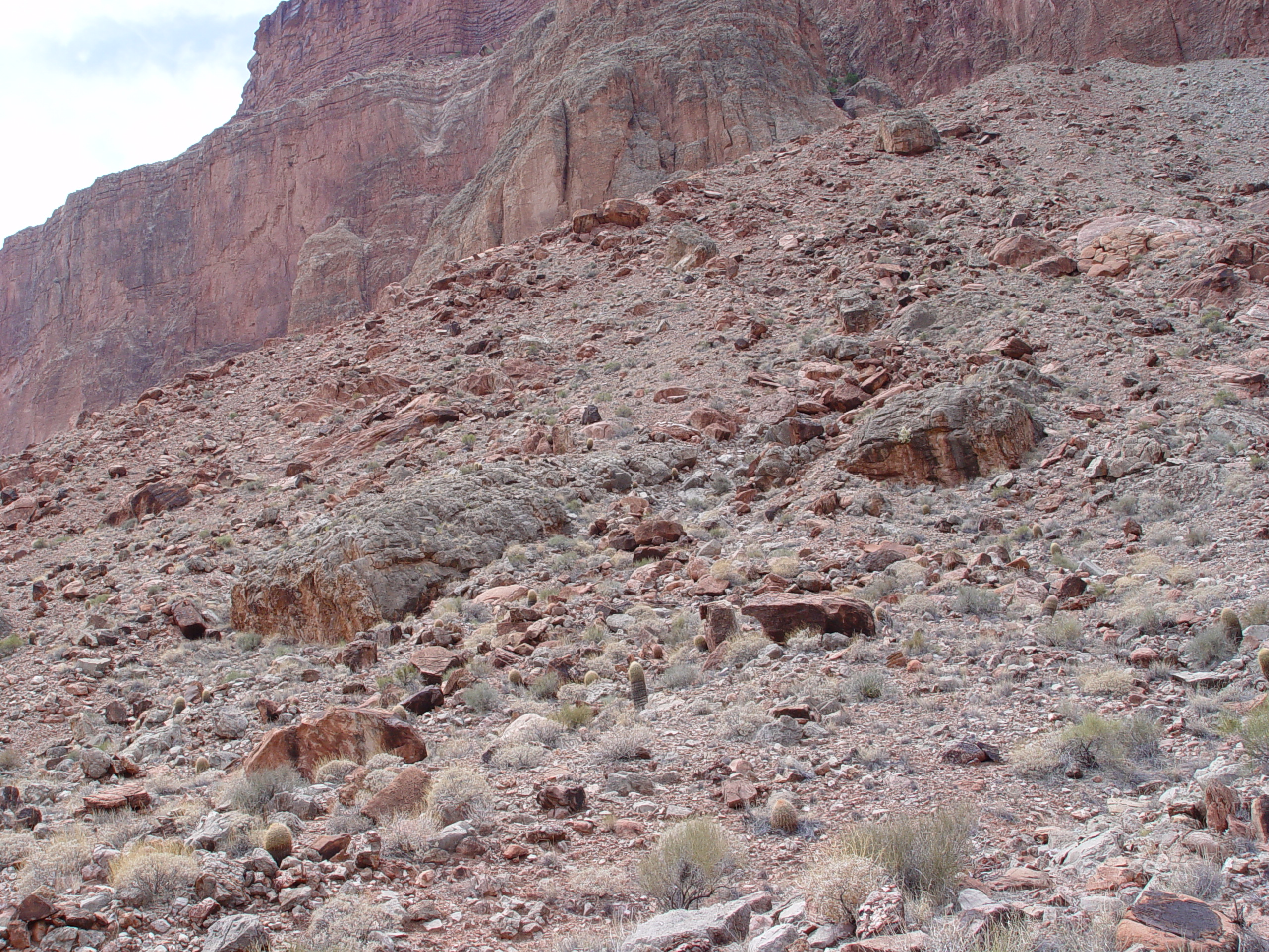
Another view from the summit of the Fishtail Landslide block looking
NNE into the landslide graben, with Fishtail Canyon visible at upper
right. Thick talus fans obscure the headscarp evacuation scars.

The landslide evacuation scarps are punctuated by secondary sliver
slumps, which are mantled by talus. This secondary slump is
barely recognizable beneath the talus. Similar secondary slides
are well documented in Surprise Valley, but also typify the Deer Creek
Landslide Complex.
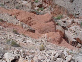
Sediment filled depression in remnant of headscarp graben of the Fishtail
Landslide, looking SW. Erosion has reduced the graben to a silty-filled
saddle between the main slide block and the talus covered scarp.
This graben likely formed a closed depression that ponded water and
sediment before dissection. These fine grained materials may
be of lacustrine origin, but have not been sampled yet.
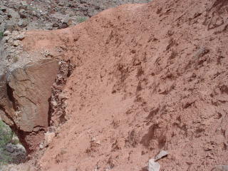
Beds of indurated lacustrine sediment deposited in lake formed by
the Fishtail Landslide Dam, NNE of the landslide graben. These
are located about 45 to 60 m above the floor of Fishtail Creek.
Detail view of the alternating bands of coarse and fine materials
preserved in these indurated sediments. The fine grained nature
of these interbeds is indicative of lacustrine deposition.
Lacustrine sediments were collected from this indurated lacustrine
unit for palynology assessment. Fine grained sediments were
sampled near the basal contact with the underlying slide breccia.

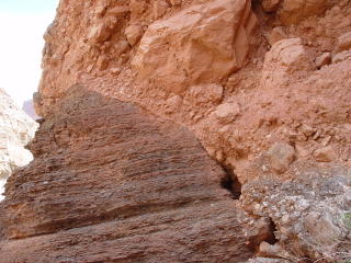
A large capstone which fell from the landslide headscarp protected
the underlying lacustrine sediments from post breakout flood erosion.

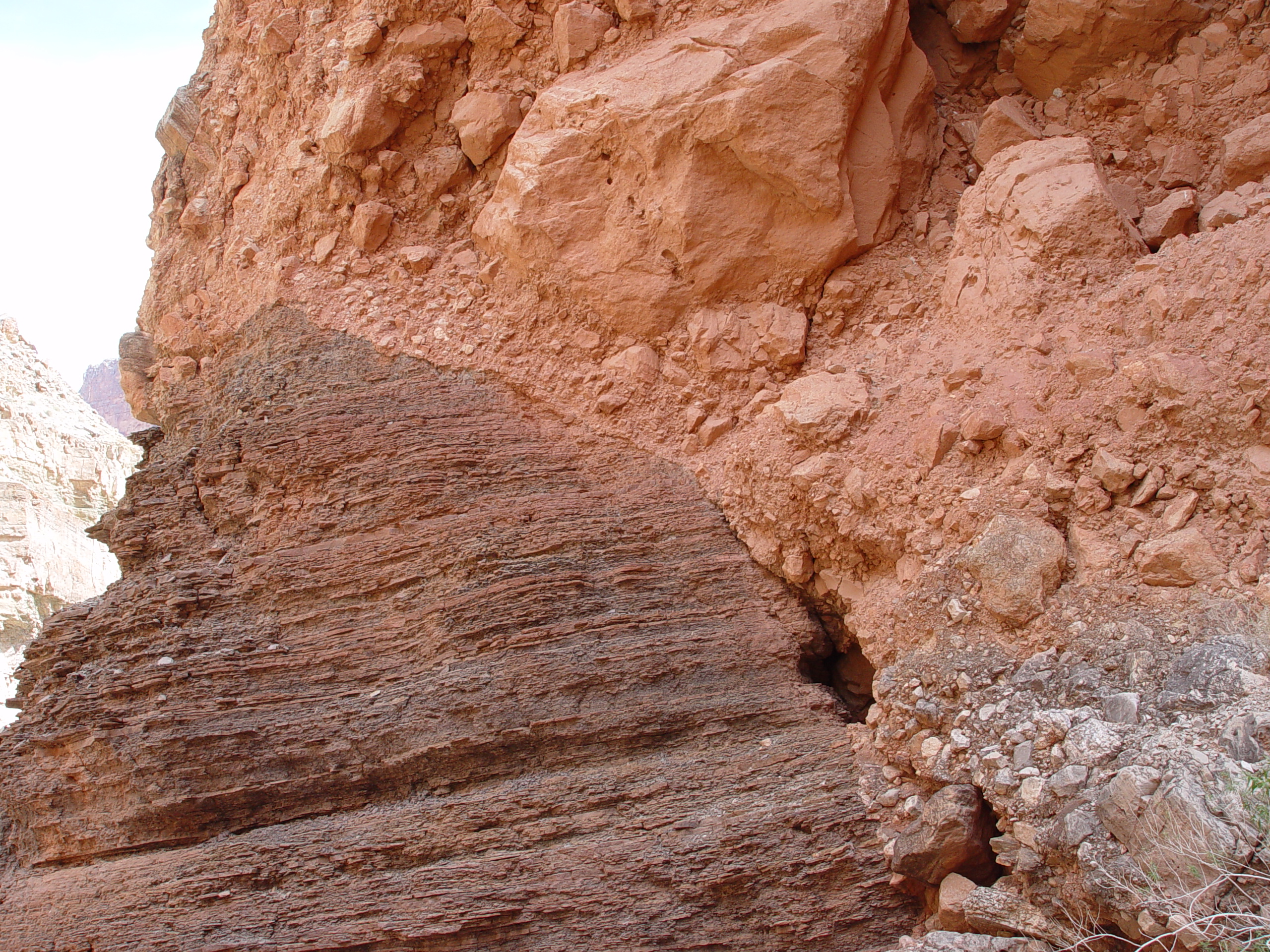
Graphic contact between the Fishtail Landslide block and the proto
Fishtail Creek channel, excavated in the Bright Angel Shale. This
view is looking downstream, towards the Colorado River. The axis of
the proto channel bed appears zero to 150 m west of the present channel,
which was presumably excavated during a breakout flood via overtopping.
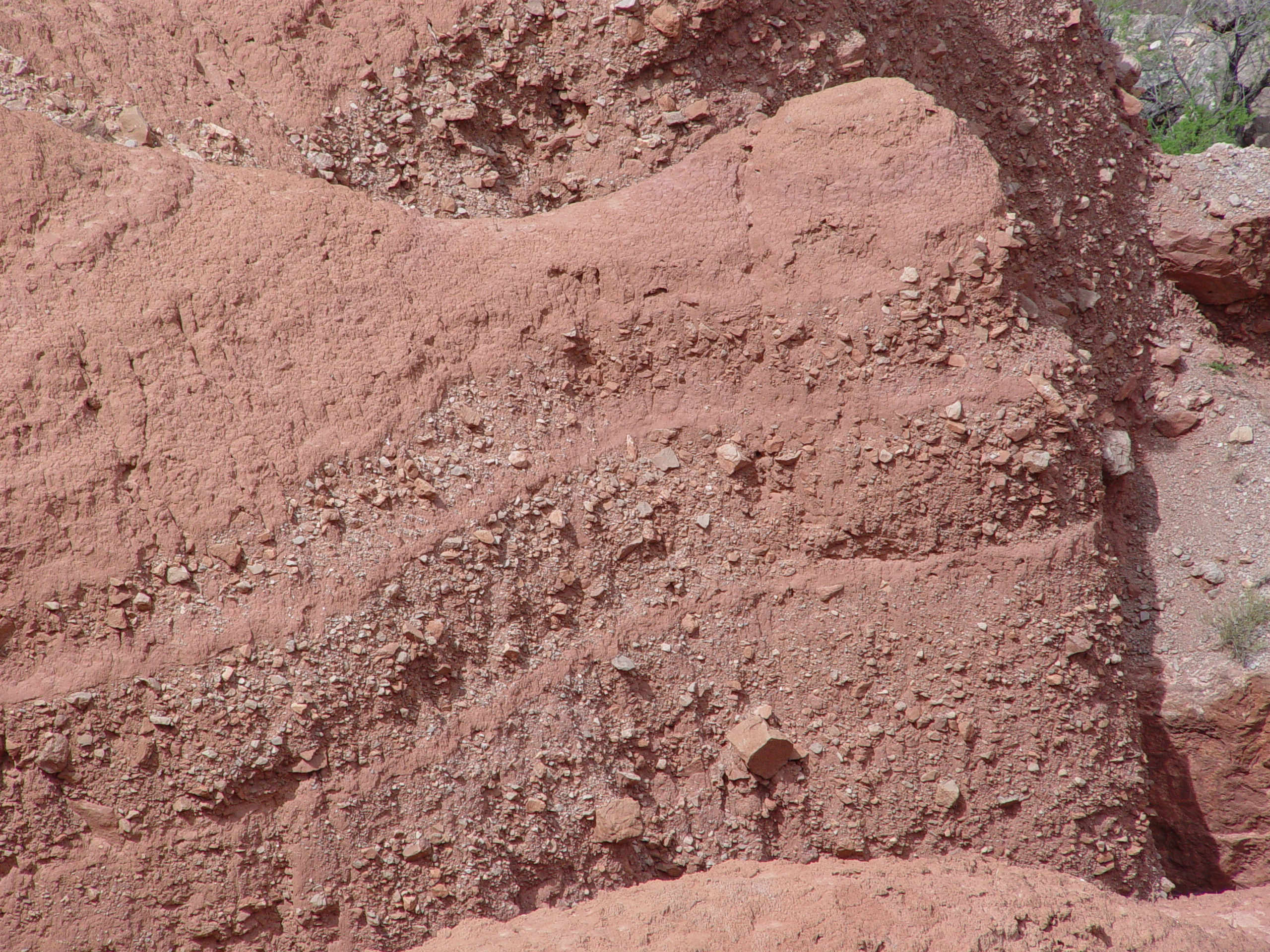
A closer view of the buried channel showing the striking contact with
the Bright Angel Shale. Note the brecciated character of the
slide fill. Some channel cobbles are preserved beneath the slide
debris.
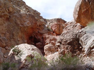
Ground view of the chaotic blocks choking Fishtail Creek upstream
of the main slide block. The house-size blocks are comprised
of travertine-cemeted slide breccia and intact blocks of Muav and
Redwall Limestone.
Questions or comments
on this page?
E-mail Dr. J David Rogers at rogersda@umr.edu
or
Conor Watkins at cwatkin@umr.edu.


.JPG)