Our
research camp was situated on a tiny spit of sand in the heart of
the Canyon’s Granite Gorge, at Mile 83.85, just upstream of
Clear Creek. From here we worked on mapping the massive Clear
Creek topple complex, a short distance downstream.
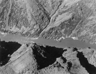
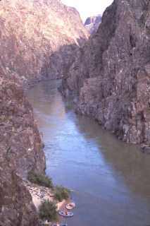
Aerial
oblique view of the mouth of Clear Creek, where it meets the Colorado
River at Mile 84. This area was the focus of my field studies in the
summer of 1978, mapping toppling failures in the Vishnu Schist. This
picture was given to me by Luna Leopold and it was taken in June 1965
during the USGS-WRD channel survey, when the flow was maintained at
48,500 cfs.
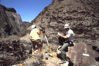
Dave Rogers (right) and Professor Jim Mitchell surveying toppling
failures at Clear Creek in the Granite Gorge of the Grand Canyon in
June-July 1978. We surveyed the toppling complex using terrestrial
photogrammetry with surveyed points of fixity.
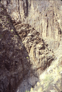
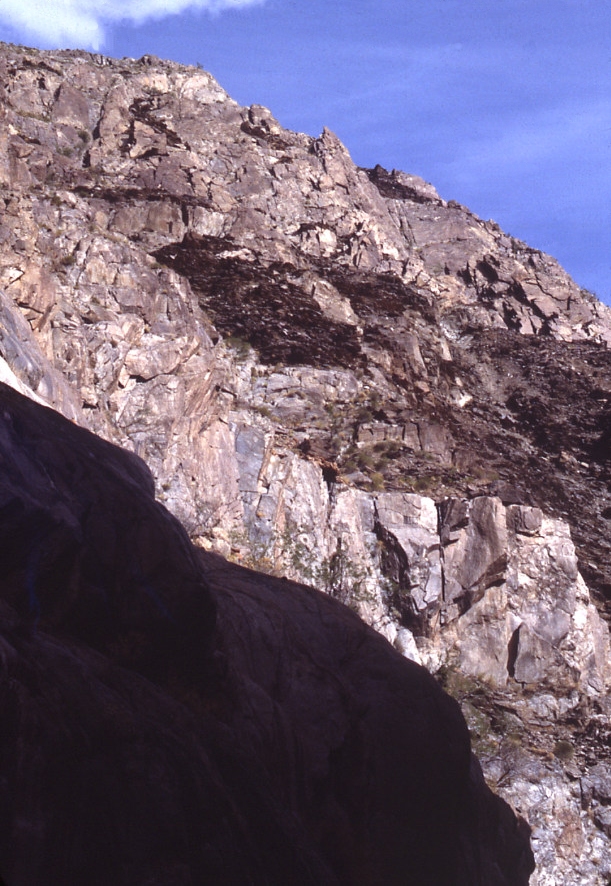
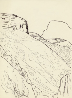
Small flexural topple that we noted some distance up Clear Creek,
not part of the 140,000 cubic yard topple we mapped. Toppling
is triggered from the slope toe headward, with strain accumulating
as an integral function. In this manner, distortion increases
upslope, but the failure is almost always triggered by toe excavation.
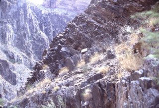
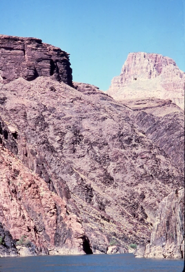
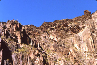
Main Clear Creek topple complex, looking in the opposite direction
(south) as the previous photo. A basal detachment surface is
seen in the foreground. The toppled blocks above this surface slid
downhill, leaving a bare slope inclined at 35 degrees. Note
the dilatent nature of the toppled mass in the background, with abundant
voids and fissures.
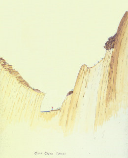
Page from my sketch pad illustrating the contrast between flexural
topples (at left) and buckling failures (at right) observed in lower
Clear Creek. We also managed to score a C-14 sample from the indurated
terrace gravels about 30 feet above the channel (shown above). Unfortunately,
it dated at > 40 ka.
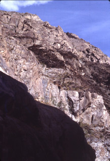
Buckling failures noted on the eastern wall of Clear Creek, in the
steeply-inclined Vishnu Schist. They looked like piles of cord
wood, stacked one upon another. I included a rigorous analysis
of these buckling failures in my PhD dissertation.

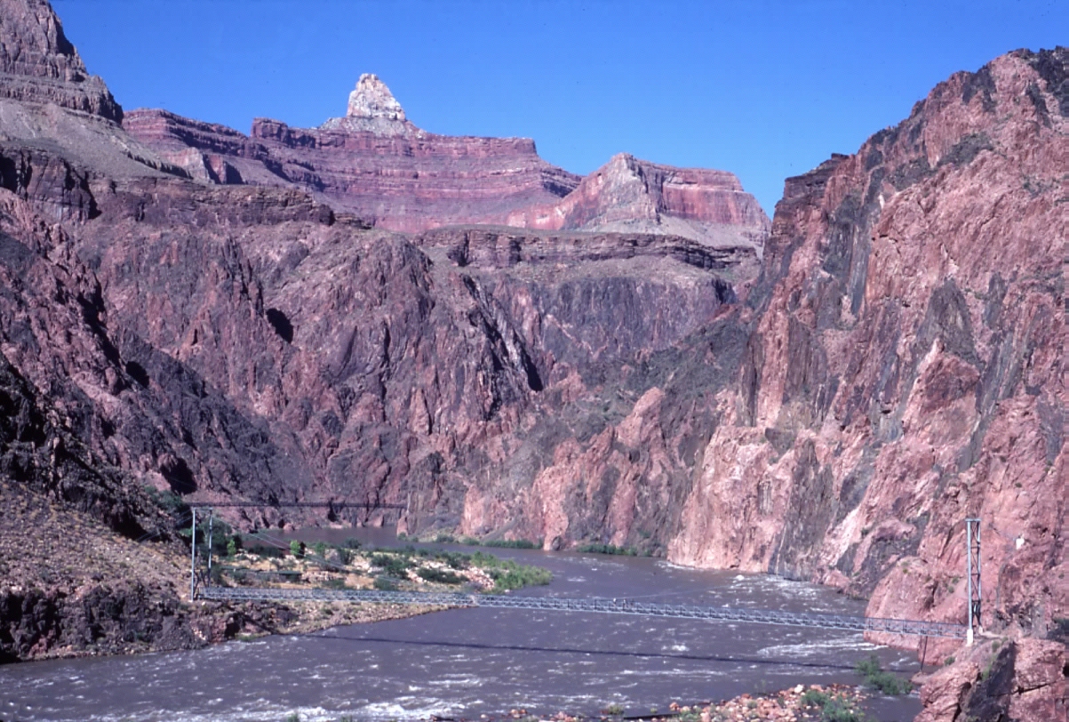
Pedestrian suspension bridges at the mouth of Bright Angel Creek near
Mile 87.5. Zoroaster Temple dominates the skyline. The
darker Kaibab Bridge in the background was built in 1928 while the
silver Bright Angel Bridge in the foreground was completed in 1965,
as part of the water supply system extending from Roaring Springs
to the South Rim. I was pretty excited when I reached this spot during
my first backpacking trip off the North Rim in June 1971. I was entranced
with the rafters passing by and vowed to return some day on a raft.
On the June-July 1978 trip we noted another toppling complex developed
in the Vishnu Schist on the western side of Travertine Canyon, near
River Mile 95.5. This has never been mapped or analyzed.

Approaching Waltenberg
Canyon (coming in from the right, at Mile 112.15) we noted yet another
toppling complex developed in the schist, continuing along the opposite
side of the Inner Gorge. This is the largest of three complexes noted.
Field sketch of the toppling complex shown above. We had not
budgeted time to study the topples at Travertine or Waltenberg Canyons
and as far as I am aware, no one else has studied them in the interim
since.
Questions or comments
on this page?
E-mail Dr. J David Rogers at rogersda@umr.edu.