J. David Rogers'
Professional Experience
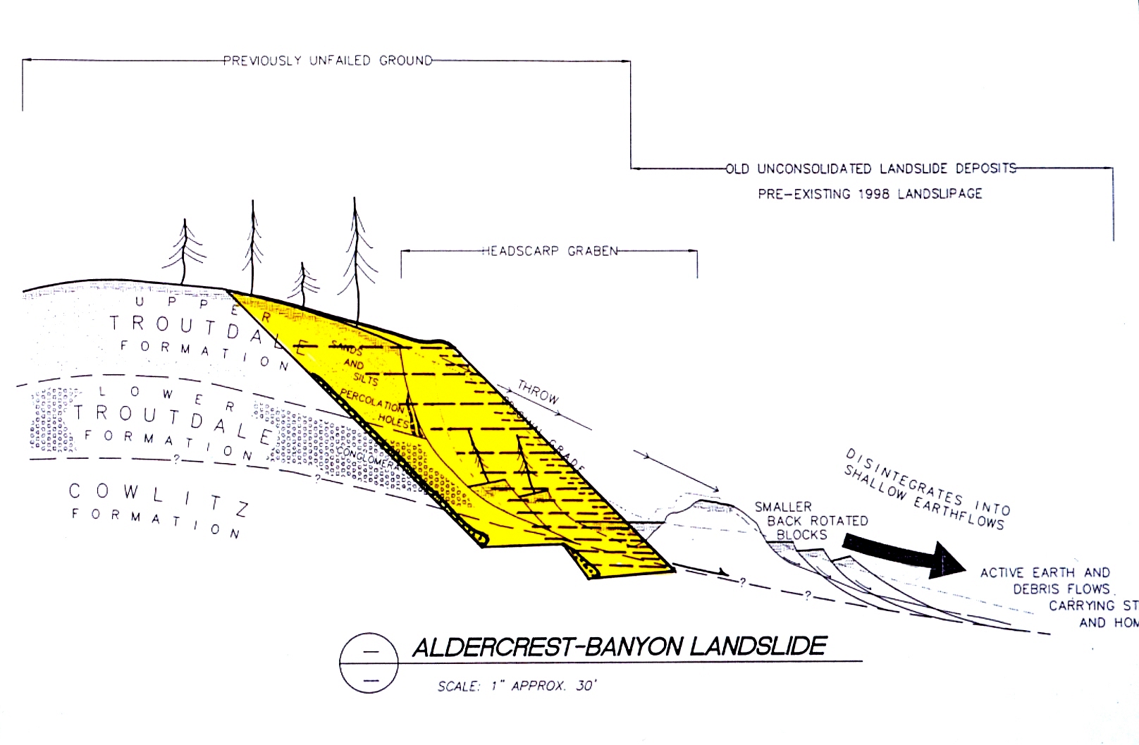
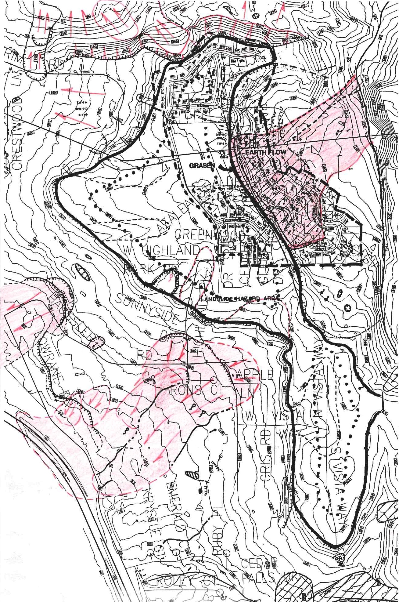
Aldercrest-Banyon Landslide Kelso, Washington (1998-99)
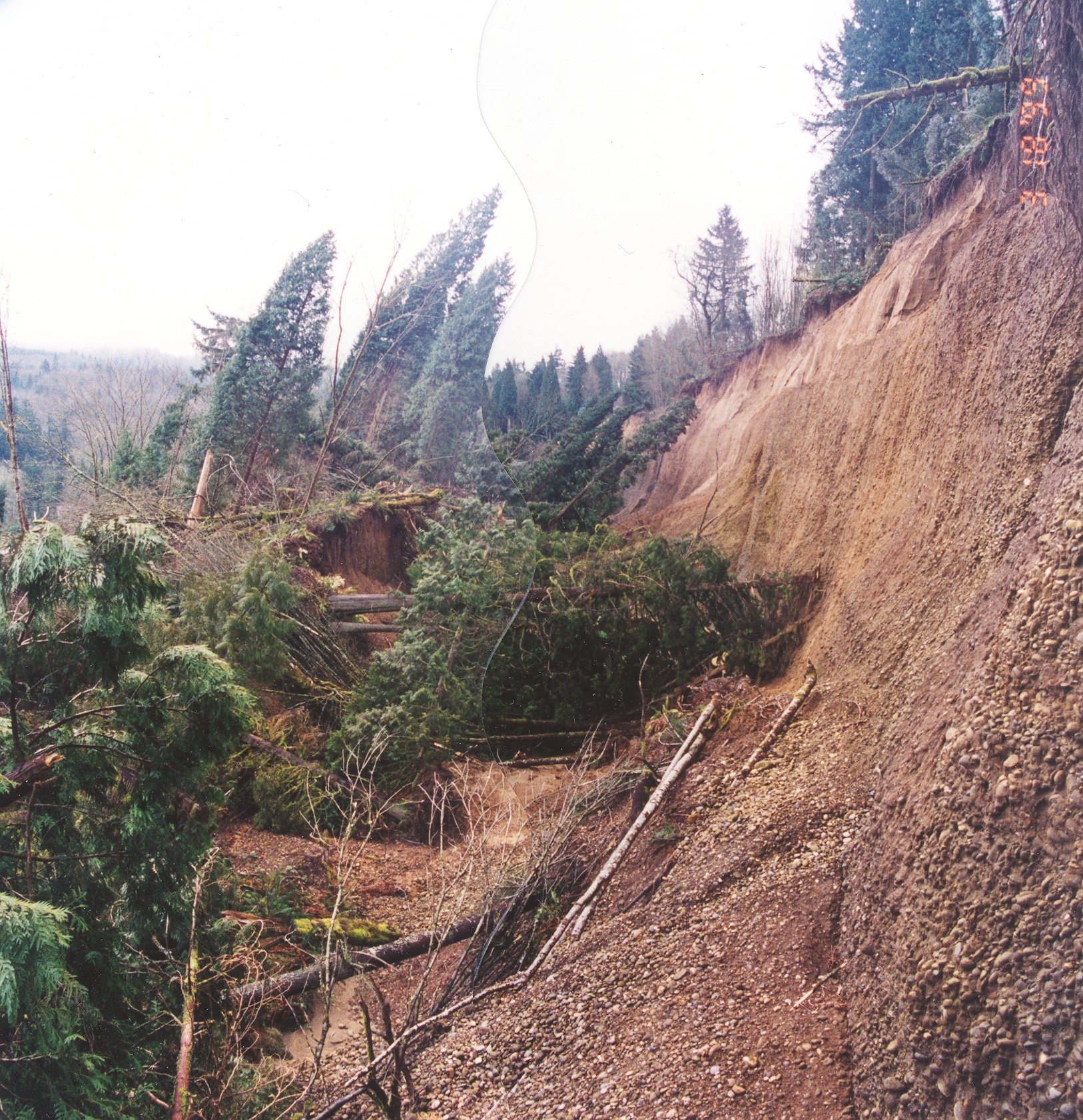
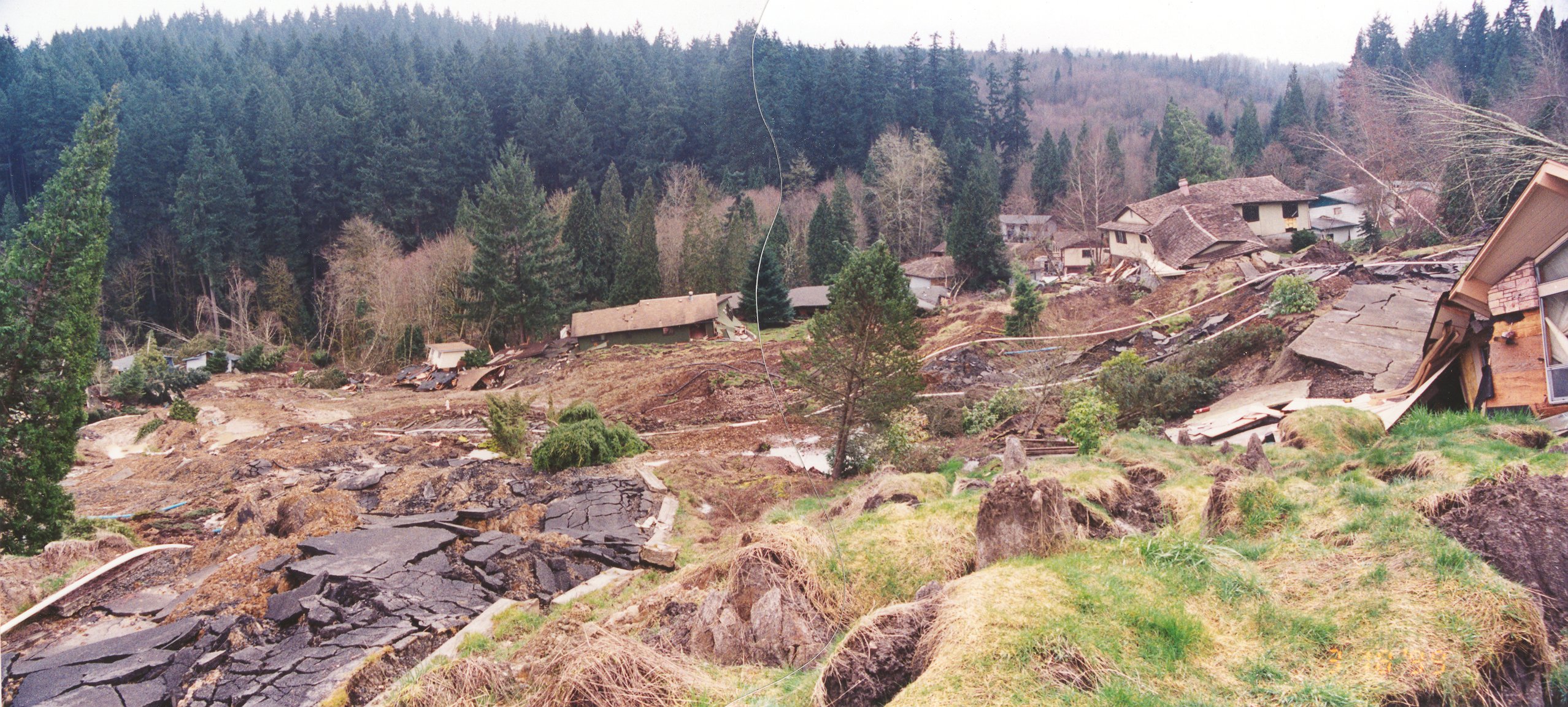
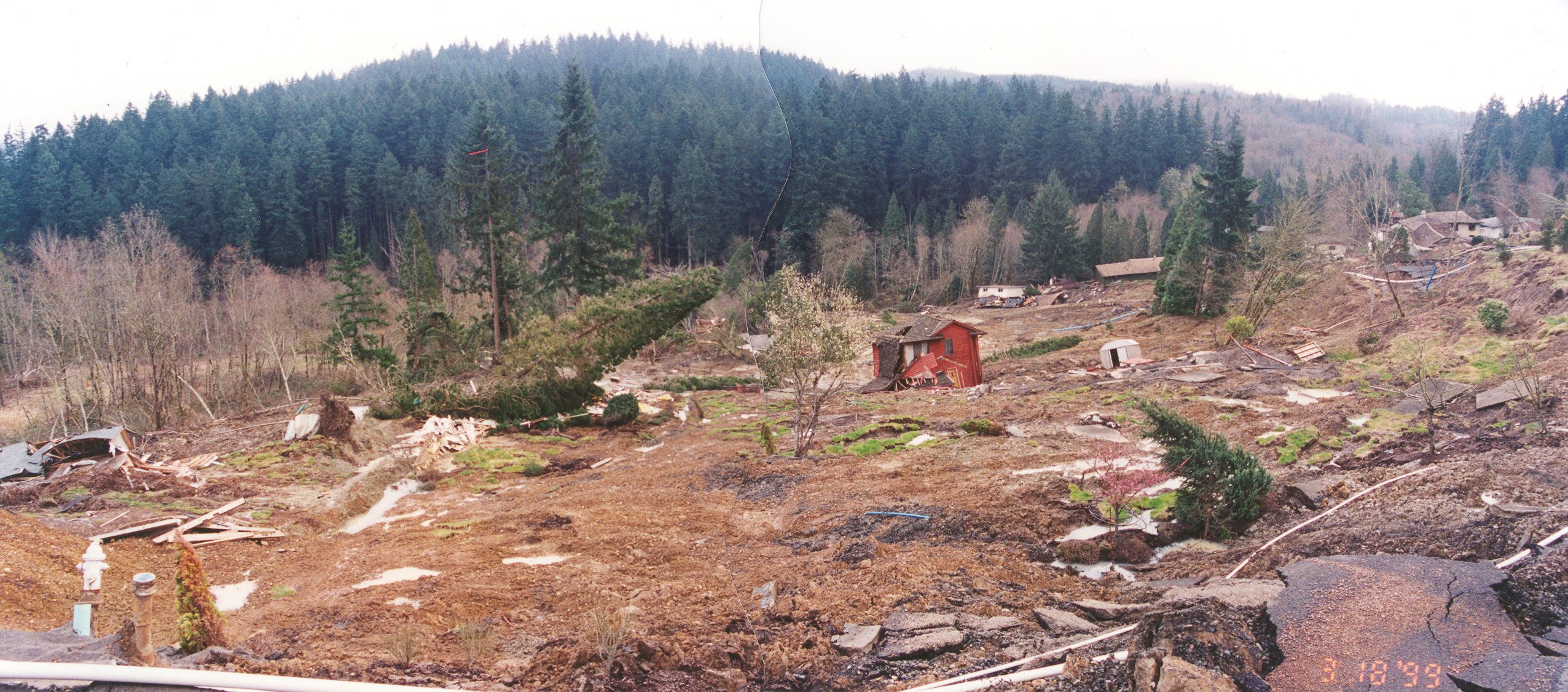
The Aldercrest-Banyon neighborhood in eastern Kelso, Washington began experiencing gross ground movements in February 1998, following 3-1/2 years of above-average rainfall. The initial signs of distress were the breakage of underground utilities. In March 1998 some framing distress was noted on a few homes. On April 10, 1998 a noticeable crack, 2.5 to 6 feet high, developed above the natural crest of slope west of Banyon Drive and north of Cedar Glen Court. Two homes on Cedar Glen Court were evacuated. The City made a valiant effort to patch streets, fill cracks and provide above-temporary above-ground utilities to the affected neighborhoods so that people could remain in their homes as long as possible.
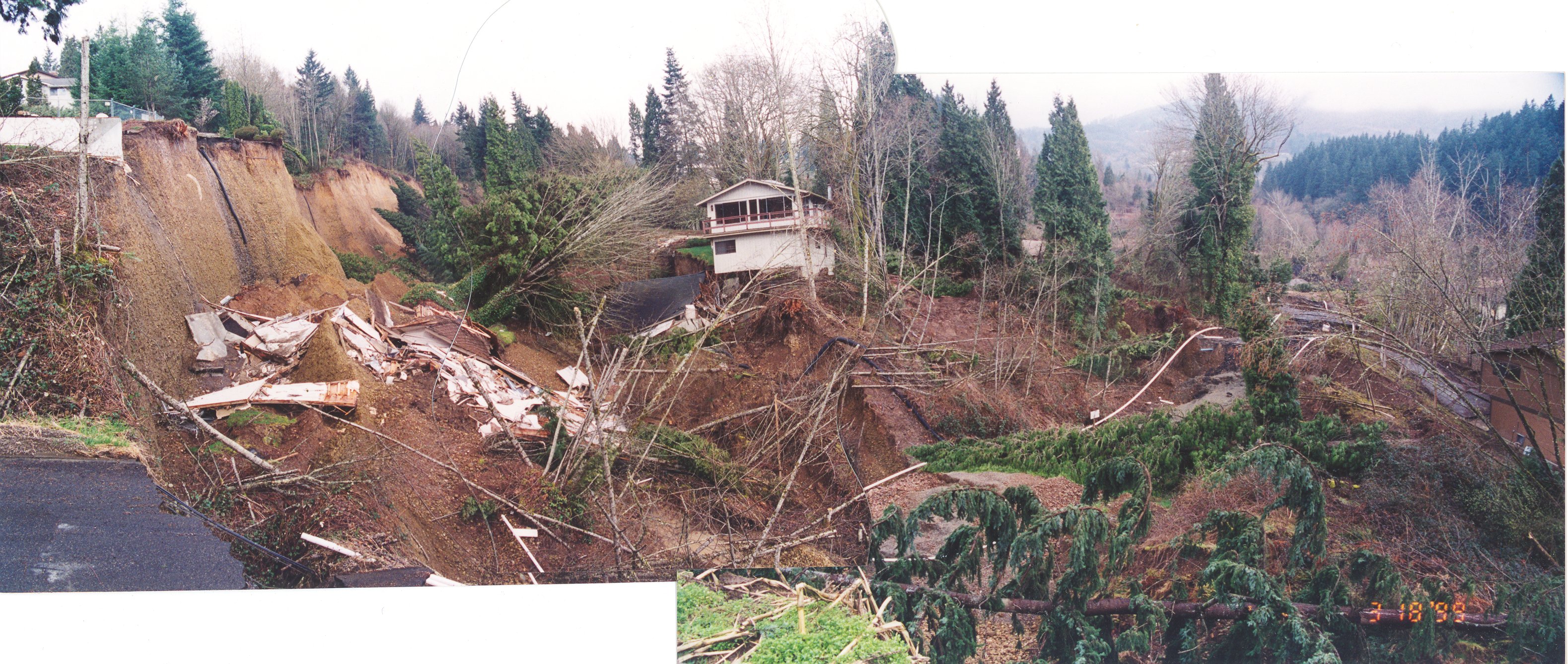
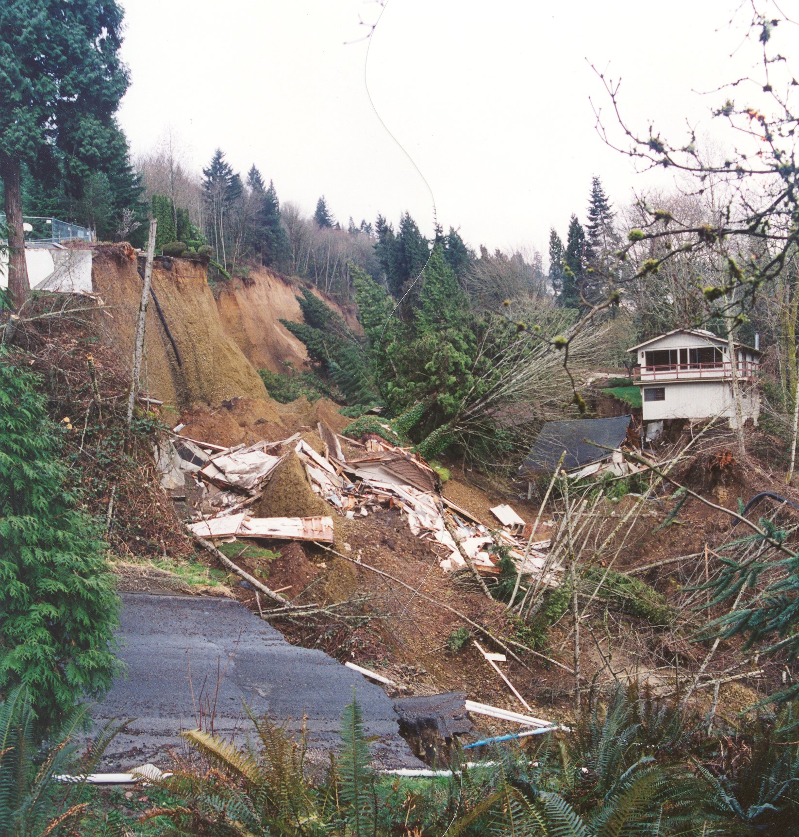
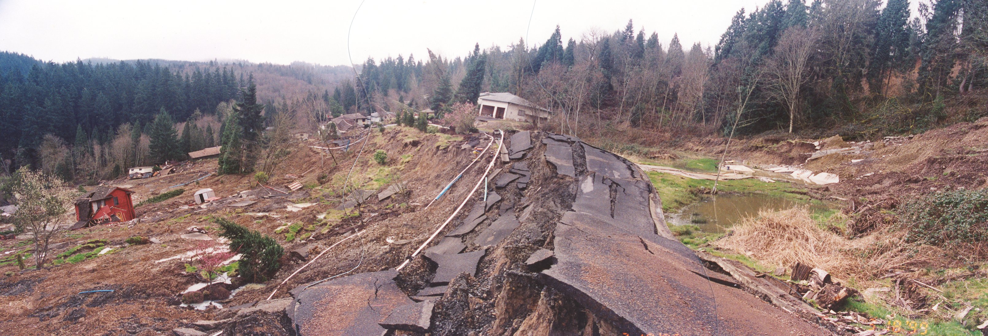
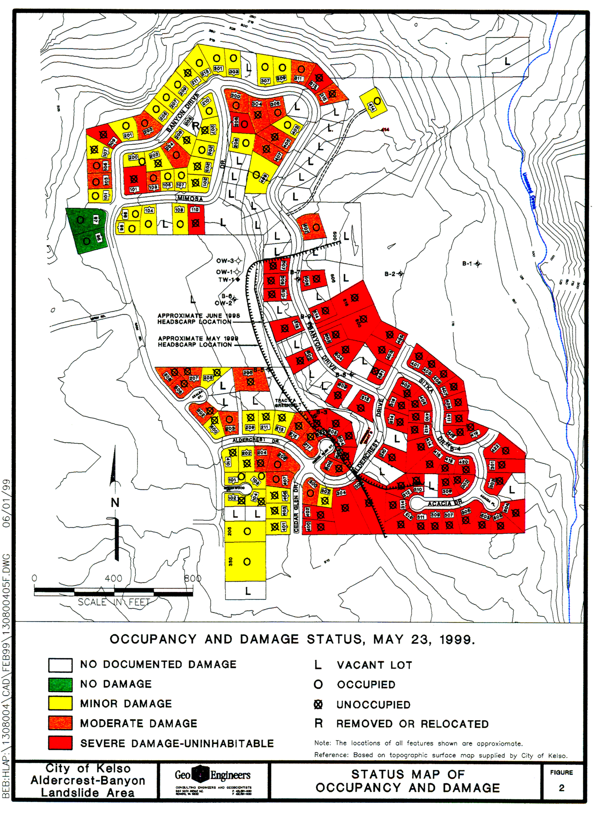
Movement of the upper block gradually increased, evolving into a continuous headscarp approximately 1500 feet long with a maximum vertical separation of 30 feet by June 1998. By the spring of 1999 this main scarp had reached a height of almost 125 feet height. 58 homes were situated in within the active limits of the landslide identified by June 1998 and another 3 homes were swallowed up during the winter of 1998-99.
The Federal Emergency Management Agency issued a Presidential Disaster Declaration on October 16, 1998 and some measure of assistance was rendered to the affected residents. The City condemned 137 homes in the immediate neighborhood and dispersed about $4.7 million in FEMA funds to the former residents. These funds were reimbursement to the City for the loss of public streets, utilities and infrastructure.
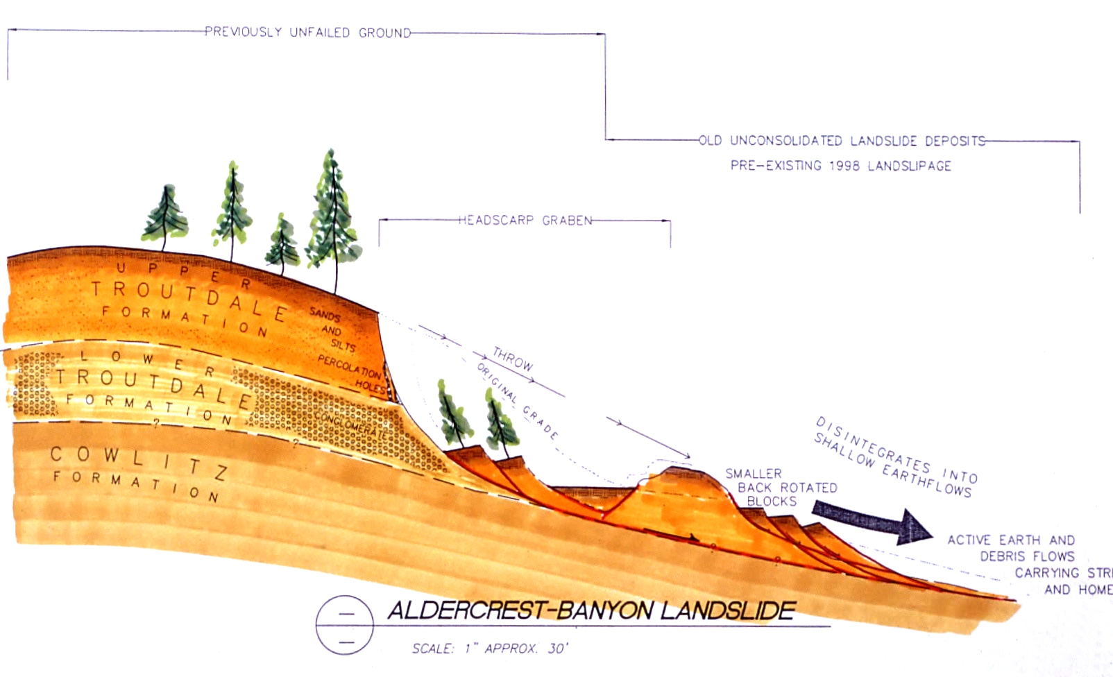
Dr. Rogers was retained by the home office of State Farm Insurance to make a review of the circumstances surrounding the catastrophe, which included a thorough review of the project history and existing documents relating to the development. The development area had been mapped for landslide hazards by the State of Washington in 1973, but this work wasn’t completed until a few months after the project gained initial approval from the City. In 1971 members of the City’s planning commission expressed concern about landslippage in the area, because Interstate 5 was being re-aligned to circumvent a large dormant landslide just downslope of the proposed development, on the opposite side of the same ridge. At that time (1971) the developer promised he would engage the services of a Seattle-based geotechnical firm to evaluate the site, naming the three largest firms of national reputation. Unfortunately, during the three phases of development (1971-79) none of these consultants were ever retained to evaluate the property.
The Aldercrest-Banyon
landslide was one of the worst urban landslides in U.S. history, causing about
$40 million in total damages in a small bedroom community with a population
of less than 12,000 people.
|
Questions
or comments on this page?
|