The UMR Geophysics group emphasizes the combination of geology, physics,
mathematics, and computer science to explore the Earth. We study the deformation
of the earth's crust using airborne remote-sensing and GPS data, image the
structure of the Earth's deep interior using elastic waves produced by earthquakes,
and study the distribution of earthquakes and volcanic eruptions in space and time.
On the practical side, we conduct research and offer courses in the area of
exploration geophysics. Applications of geophysical techniques include locating
oil, gas, and minerals, as well as objects or substances related to the study
and protection of the environment.
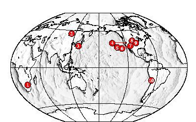
1. Deformation and structure of the oldest continent on Earth
2. Structure and dynamics of continental rifts
3. Subduction zone earthquakes
4. Temporal variation of fault slip-rate
5. Earthquake damage pattern analysis
6. Mantle deformation and structure beneath California
7. Western US earthquake distribution
8. Transition from the Rocky Mountains to the Great Plains
9. Seismic Hazard in NE Kansas
10. Mantle stratification across South America
Current and recent graduate students
Selected geophysics courses at UMR