MORAGA DEVELOPMENT CAPABILITY MAP
AND GIS MAPS
J. David Rogers, Ph.D.,
P.E., R.G., C.E.G.
Article
on Spatial Geologic Hazard Analysis in Practice (MS Word Format)
This project involved compilation of 36 different "layers" of geologic, environmental, geotechnical, hydrologic and planning data compiled on a spatial planform utilizing the Geographic Resources Analysis Support System (GRASS) developed by the Federal government (U.S. Army Engineers Construction Engineering Research Laboratory). 21 basic physical characteristics were compiled on separate maps, overlain on a City basemap compiled by the U.S. Geological Survey at a scale of 1:24,000. Five additional spatial parameters were then compiled as separate map "layers", in accordance with open space limitations that had recently been adopted by the Town of Moraga. After presentation of this data to the public, elected and appointed Town officials, six primary parameters were selected for consideration in limiting further development within the Town's jurisdiction. These parameters included: ridgelines, landslides, flood hazards, percent slope, vegetation and soil erosion potential. Landslide mapping involved identification of 23 different types of slides and the periods of occurrence, based on review of over 60 years of stereopair aerial imagery. The Town of Moraga encompasses approximately 56 square miles with a population of 35,000 in the of San Francisco East Bay Hills.
Client: Town of Moraga, Moraga, California 94556
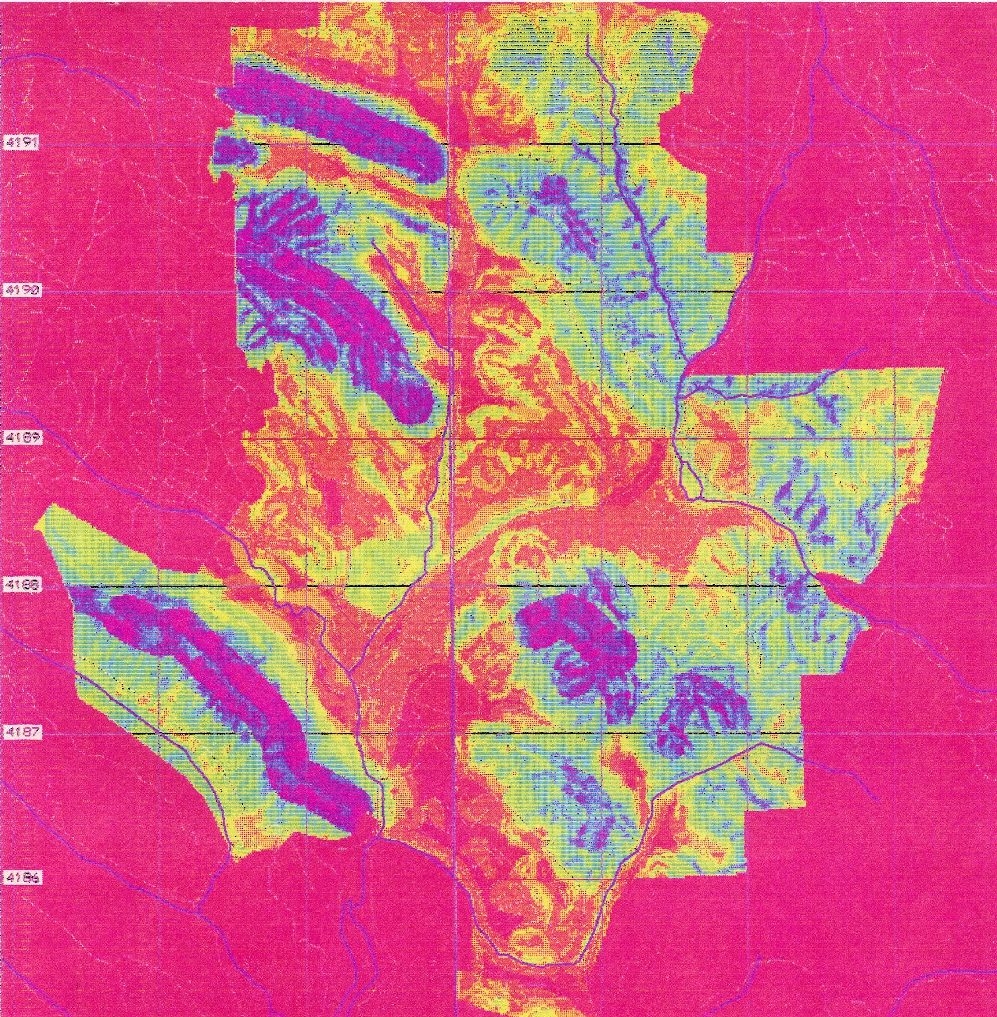
Development Capabilities Map based on addition of six factors, all weighted
equally: ridgelines,
landslide susceptibility,flood hazard, percent slope, vegetation and
soil erosion potential.
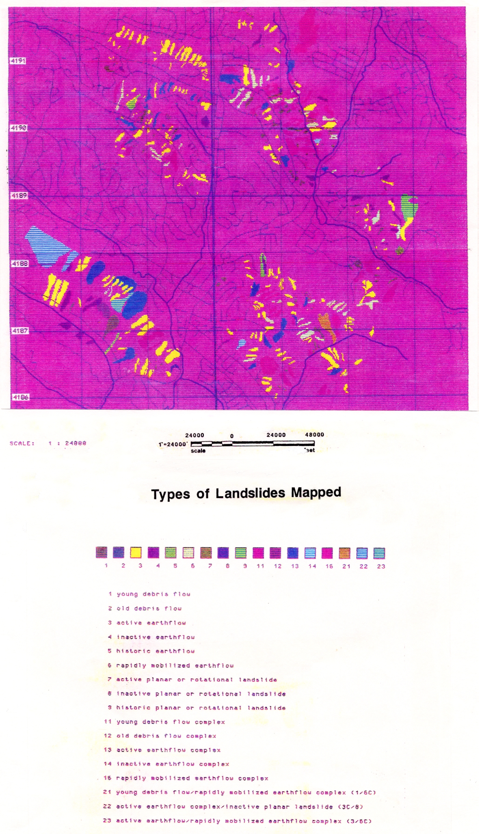
Map of Types of Landslides Mapped
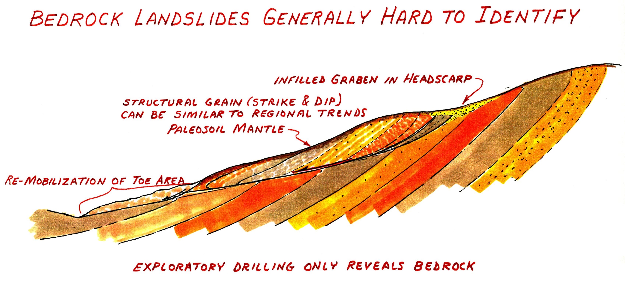
Ancient bedrock landslides can be difficult to recognize because they have
been dormant for
so long and their bedding usually mimics the regional structure, as shown
in this example from
the Lamorinda area. When the Lamorinda area was initially developed many of
the shallow
earthflow landslides were recognized and mitigated.
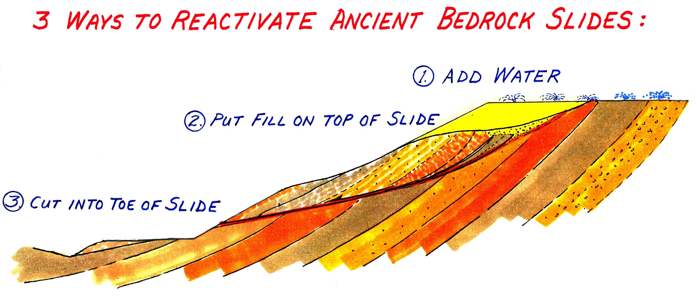
Ancient bedrock slides have been triggered by grading for development, most
often via
excavation of the toe of slopes and surcharging the heads of the old slides
with structural fill.

This sketch illustrates the cause and effect of adding fill to the head of
an old landslide, then
adding landscape watering. Landscape watering sequentially increases
the antecedent
mositure in the gound, magnifying the impacts of extranormal rain years.
Questions
or comments on this page?
E-mail Dr. J David Rogers at rogersda@umr.edu.
![]()