From Sept ’76 to May ’82 I was enrolled in graduate study
of geological and geotechnical engineering at U.C. Berkeley.
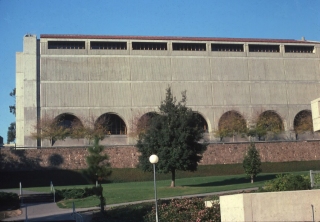
This is a picture of Davis Hall, home to Berkeley’s civil engineering
program, of which I was delighted to be a part. My desk was
at the extreme left end of the group of large arches, with a terrific
view.
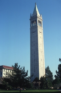
My graduate office looked out on this Berkeley landmark, the 309 feet
high Sather Bell Tower, affectionately known as “The Campanile,”after
it’s prototype structure in Venice.
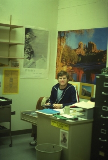
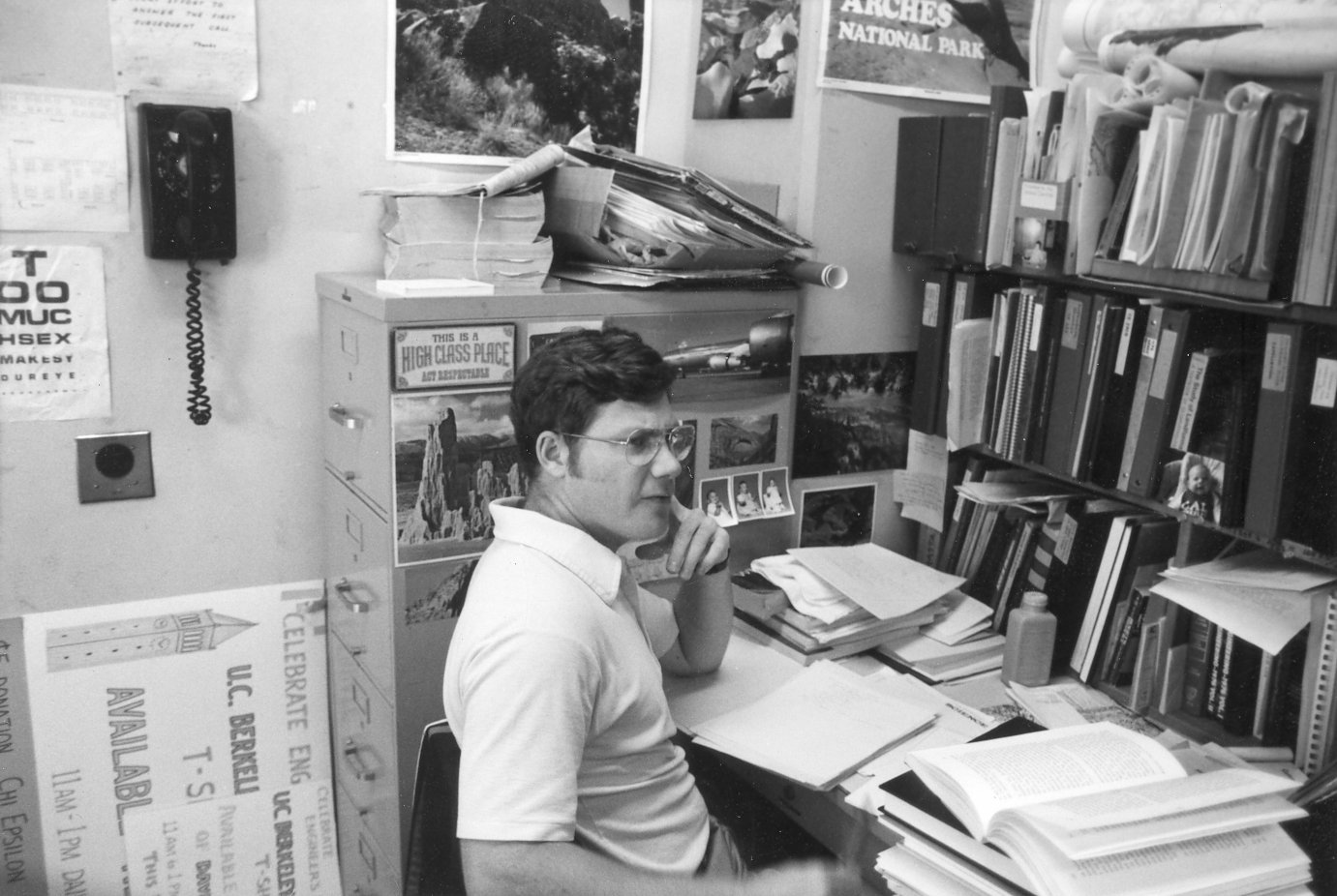
Granola Boy: During my first year of grad school I was a teaching
assistant, based in 480 Davis Hall. This photo shows me in typical
Berkeley “garb” of that era: wire rim glasses, scraggly
beard, super-size European style coffee mug, and lots of colorful posters adorning
my office walls.
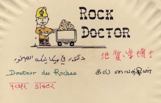
I had this paper plate attached to my desk while I was a teaching
assistant at Berkeley. We had about 95 graduate students in
geotechnical and geological engineering, drawn from all over the world.
The students called me the “rock doctor,”and the name stuck.
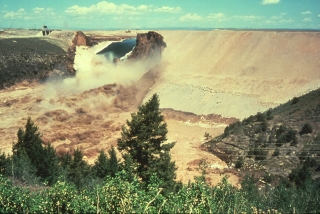
On June 6, 1976 the Teton Dam near Rexburg, Idaho failed during its
initial filling. At 350 feet high, it was the highest dam to ever fail catastrophically,
and the damages reached $1 billion. Berkeley Professor
H. Bolton Seed was appointed
to the Independent Panel to investigate
the failure.
Professor Seed engaged me to study the construction records and the
geologic conditions of the Teton Dam abutments, where the seepage
failure had initiated. This is what the dam looked like when
I first saw it as a graduate student. The Bureau of Reclamation
had a series of exploratory excavations made to evaluate
the foundation conditions and embankment quality.
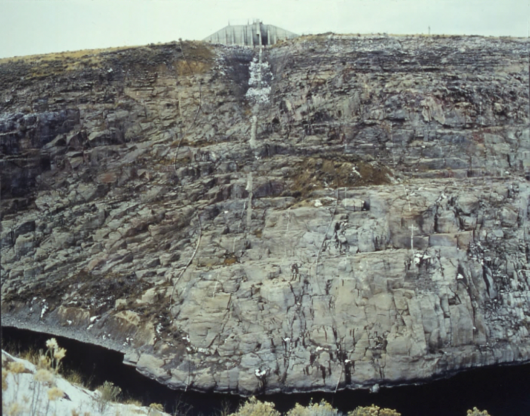
This is the massive left abutment excavation, completed
about 1-1/2 years after the failure. Wind blown loess had been
used as the basic fill material, with a sloping subdrain comprised
of river cobbles and gravel, seen here as the prominent diagonal gray
wedge. There was no intermediate filter between the cobble subdrain
and the loess.

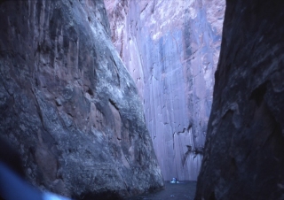
This view shows the remnants of the right abutment, with most of the
keyway notch eroded during the failure. The coarse open fractures
in the rhyolite tuff were a shock to everyone associated with the
forensic evaluations because no filter or barrier had been placed
between the loess core and the open fissures, some of which were as
much as 4 inches wide.
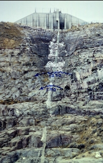
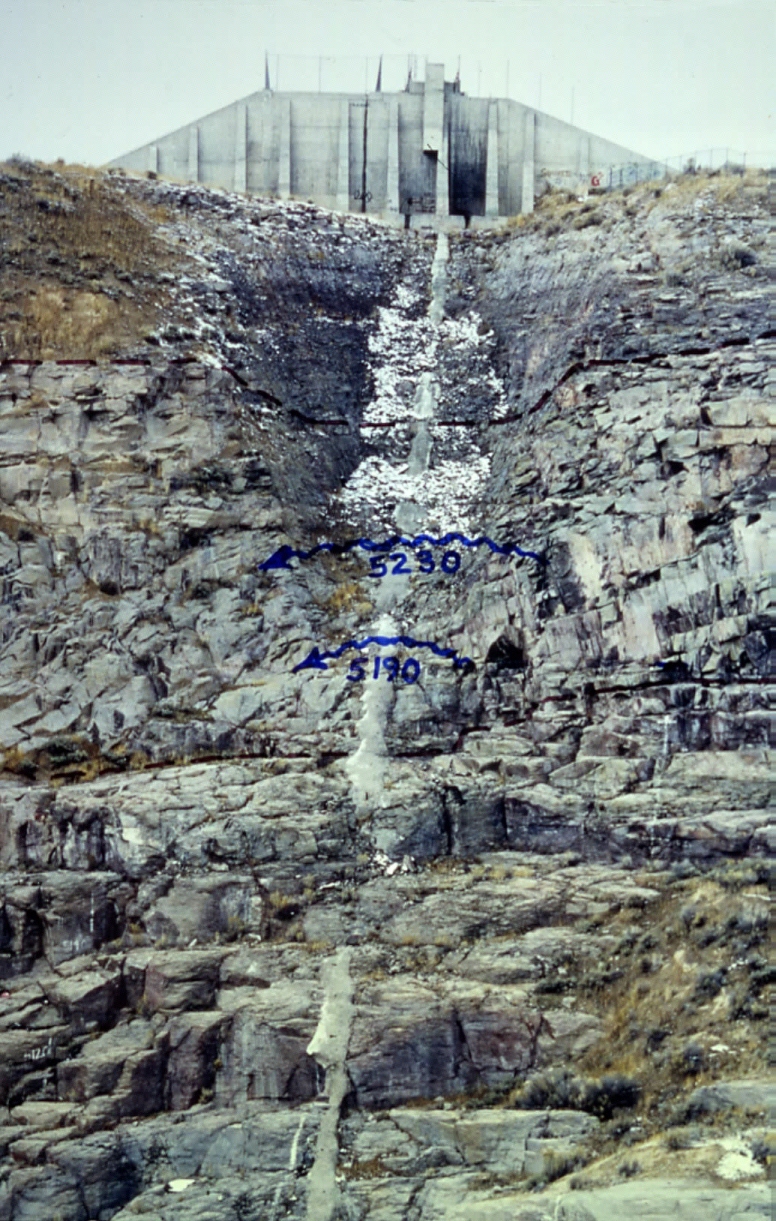
Detail of the right abutment, showing the zone where the failure was
believed to have initiated, via hydraulic piping of fine-grained embankment
material through the open fissures of the right abutment keyway, between
elevations 5190 and 5230 feet.

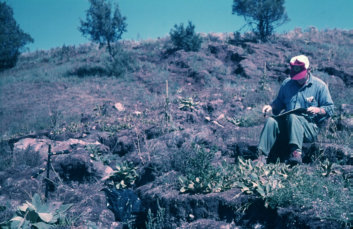
During
grad school I also measured creep of natural slopes and landslides
as part of a research project funded by the U.S. Geological Survey.
One of the sites I monitored was along Colorado Route 133 across the
Muddy Creek Landslide, upstream of Paonia Reservoir. My creepmeter
array consisted of LVDT’s attached to INVAR wires andconnected
in series, from the toe of the landslide uphill to the highway.
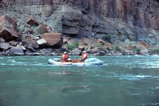
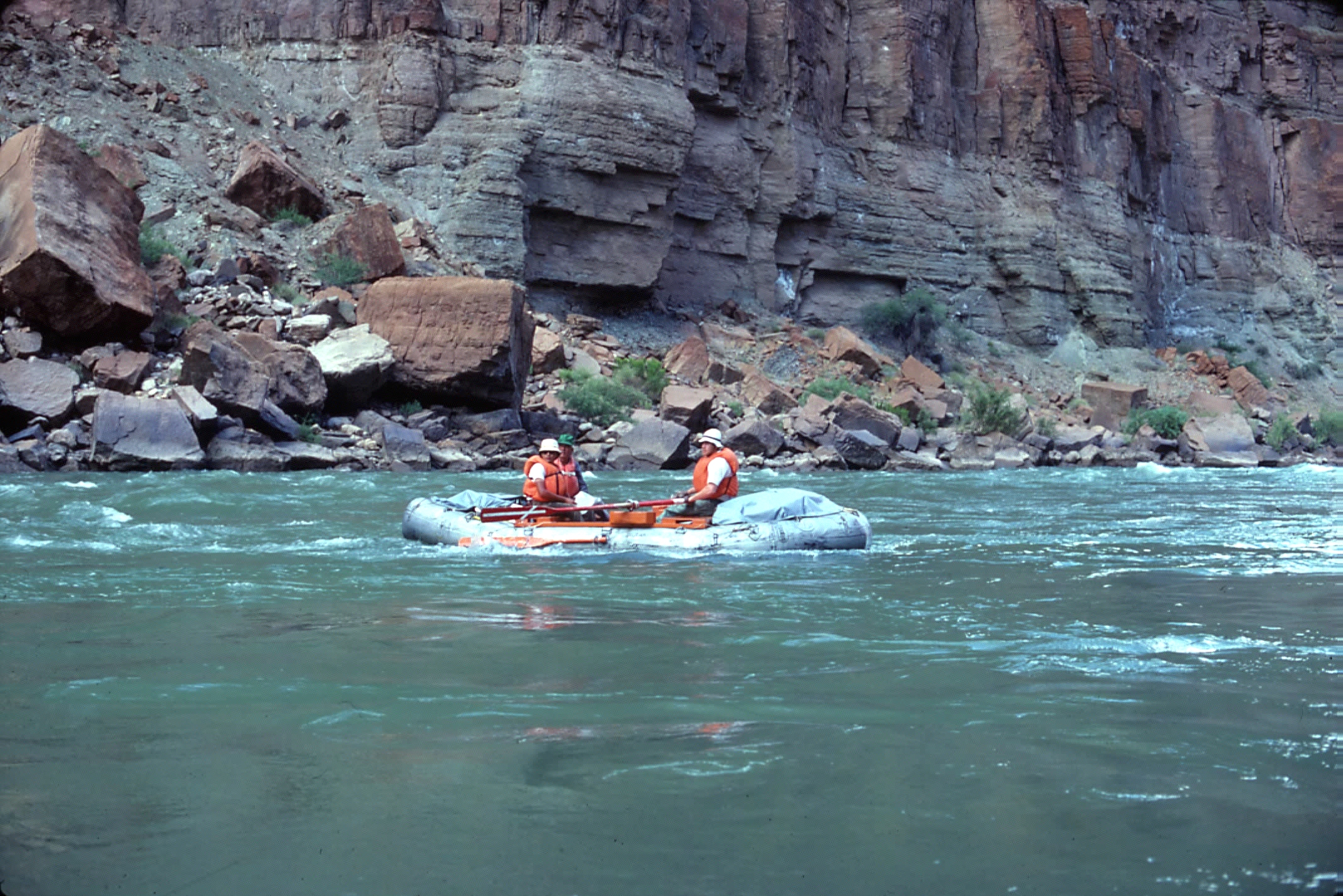
In the summer of 1978 I led a research trip down the Colorado River
through the the Grand Canyon, studying masive rock topples.
This view shows me rowing Joe Munroe’s Green River raft, one
of the first rigs marketed specifically for whitewater rafting, around
1965. It employed 16-inch diameter tubes, which meant a lot
of bailing. I purchased it from Joe shortly after the '78 trip and
used it for many years thereafter.
Each summer the geological engineering group at Berkeley took an extended
field trip around some part of the United States to view geologic
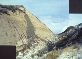
problems and situations. I led our June 1979 trip, which included
exploring the side canyons of Lake Powell, like Cathedral Canyon,
shown here. Partly because of my experiences at the Teton dam site, I beca,me increasingly fascinated by the impact of secondary joints
on slope morphology. This became the subject of my PhD dissertation.
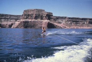
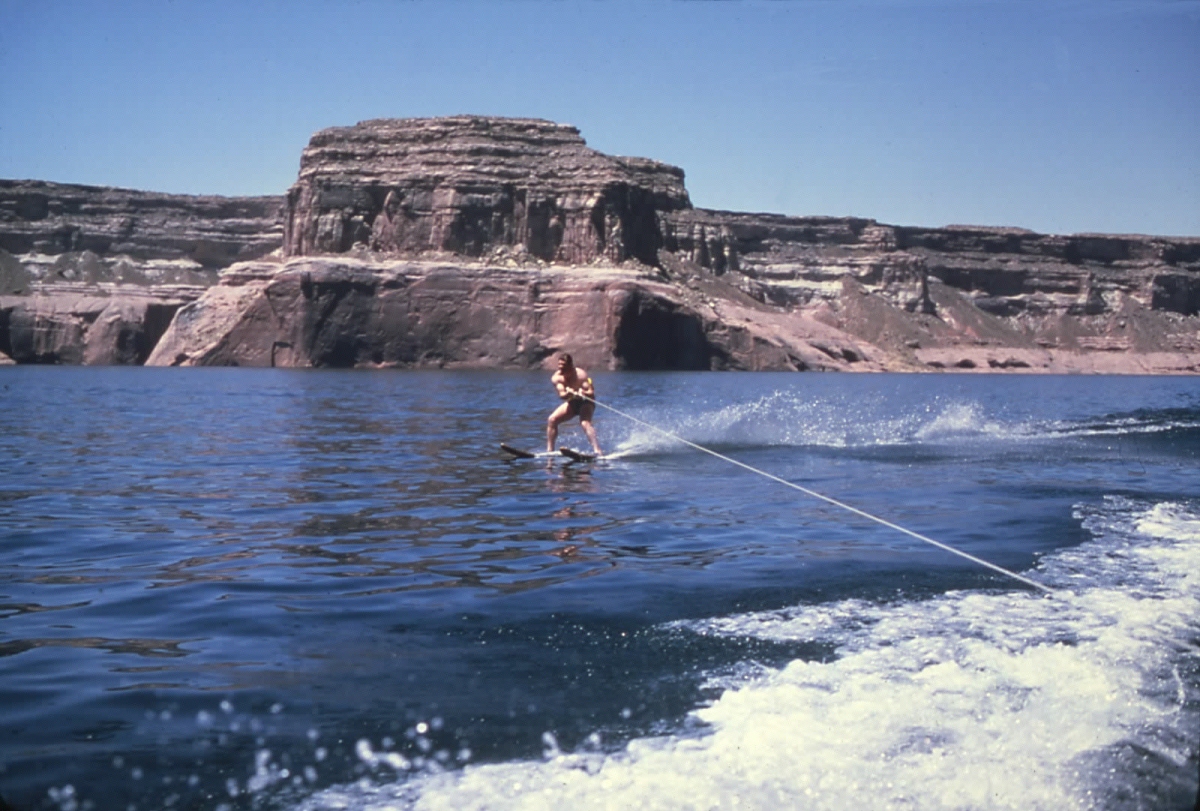
During
our June '79 trip everyone got a chance to do some waterskiing on
Lake Powell. This view shows me whizzing along on our way back
to Wahweep Marina. With 3,000 miles of shoreline and lots of slack
water, you can't beat the water skiing on Lake Powell. In those days I was still running and lifting weights.

My working desk between 1977-81 at the west end of 434D Davis Hall
at
U.C. Berkeley. This photo was taken around February 1980.
Note the bottle
of Mylanta antacid on my desk, a staple portion of
my regular diet during
the rigors of grad school.
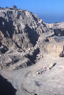
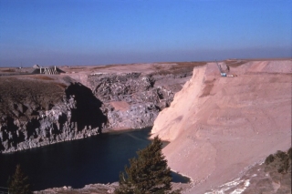
This is a picture of the upper quarry at Lime Mountain Mine near Paso
Robles, CA. Between 1979-81 they kept me employed with a series
of consultations that helped grubstake my graduate education.
By God's grace, I never took out a loan during 10 years of college.
I did all my own work at Lime Mountain, including the necessary surveying
with this old K&E transit. Mapping of the quarry faces had to be carried out while rappelling. The mine pits got very warm during
the summer, and I pot pretty sunburnt.
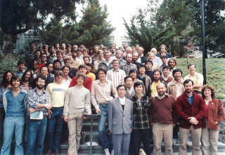
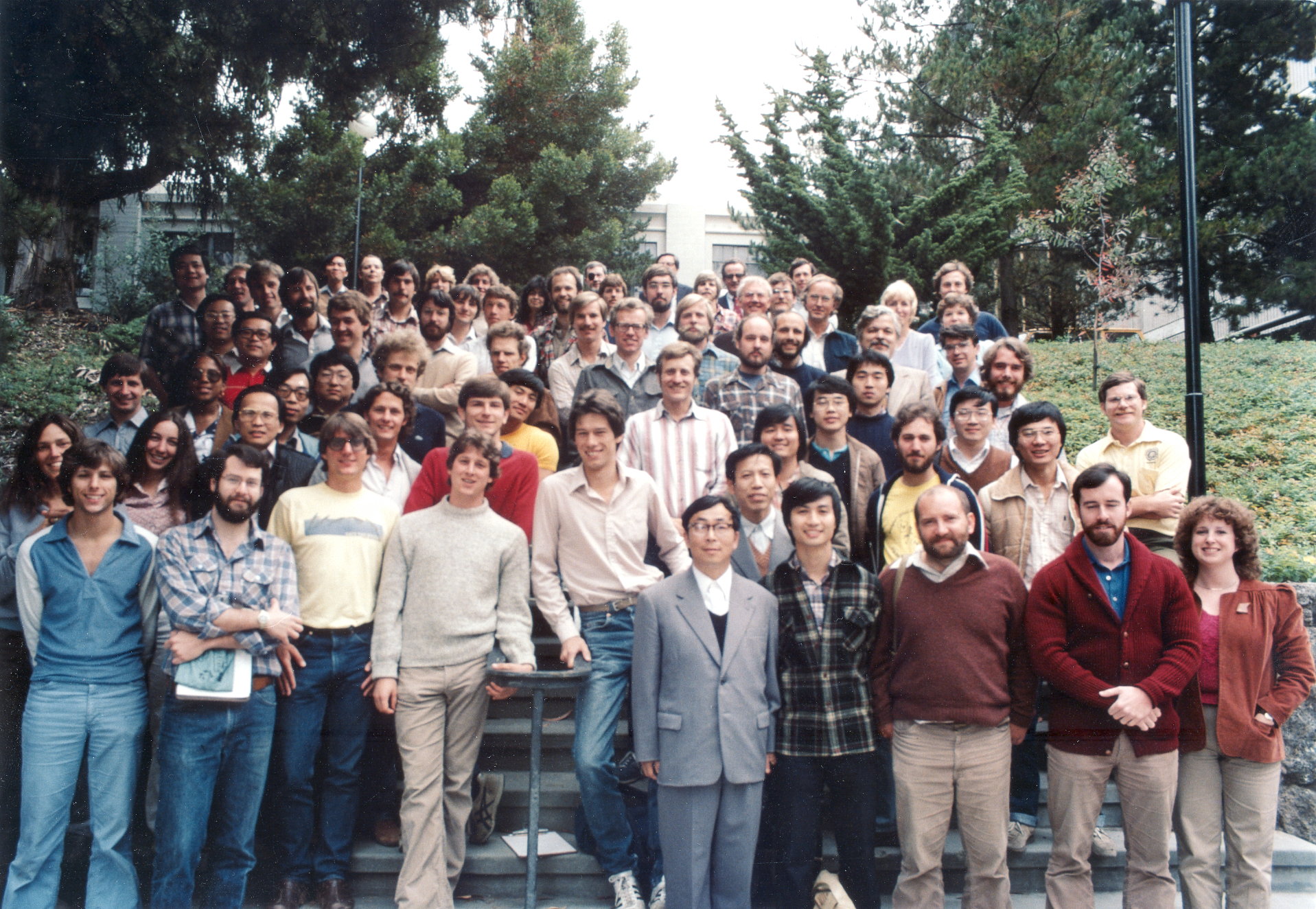
During the 1980-81 academic year we gathered graduate students, faculty
and staff of the geotechnical engineering group at Berkeley on the
steps of Davis Hall. I am at extreme right in second row, wearing
the yellow shirt. I was writing my PhD dissertation at the time
and working full time to support myself and my daughter.
Questions
or comments on this page?
E-mail Dr. J David Rogers at rogersda@mst.edu.