Tapeats Cave Canyon is located in Tapeats Amphitheater and contains
Tapeats Spring, which provides the majority of the water in Tapeats
Creek. Huntoon (1970) estimated that Tapeats Spring discharges
about 48 million gallons of water per day (mgd), making it the largest
spring on the north side of the Grand Canyon. Thunder River
Spring is the second largest spring on the north side, discharging
about 21 mgd. These two springs feed into Tapeats Creek.
The Tapeats Fault provides structural control of the cave, the spring,
and likely played a pivotal role in the triggering of the landslides.
This interrelation between faults, springs and landslides is apparent
elsewhere in the Grand Canyon.
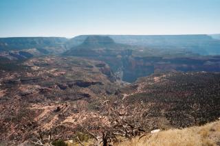
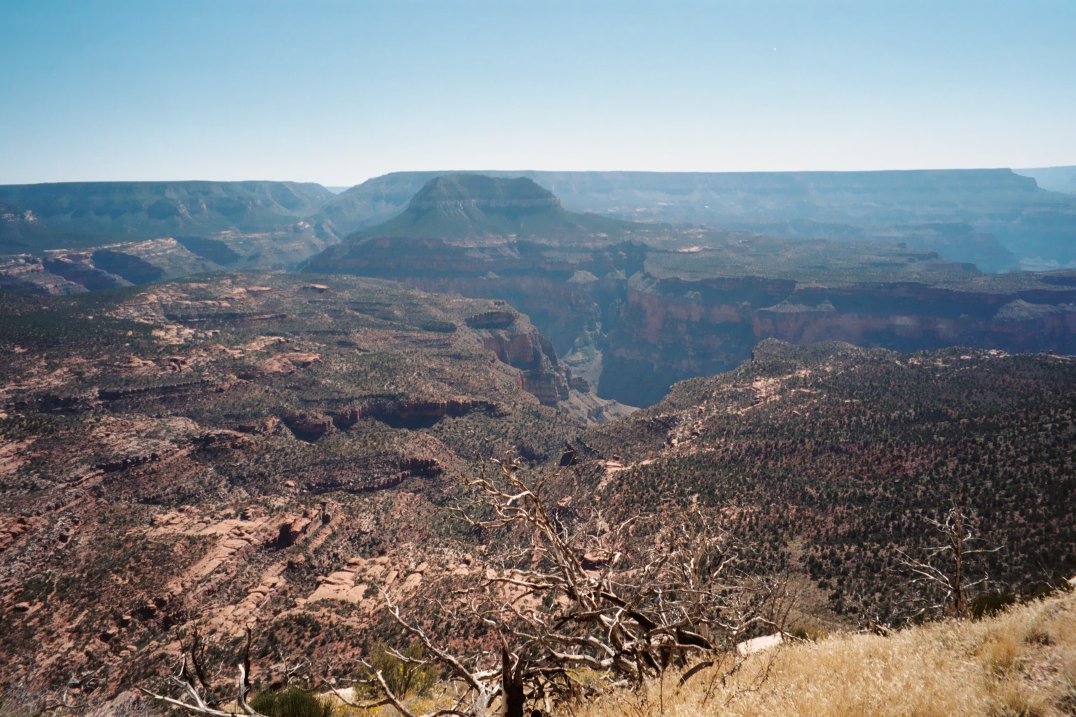
Overview of Tapeats Ampitheater and Tapeats Cave Canyon areas from
Monument Point on the north rim of Grand Canyon.
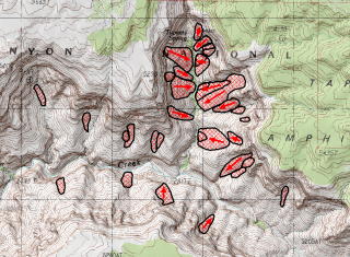
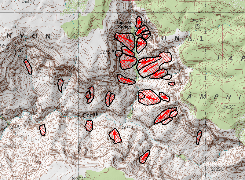
This portion of the USGS 7.5" Tapeats Amphitheater topographic
map has been annotated to show areas of landsliding we are mapping
in and around Tapeats Cave Canyon.
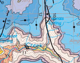
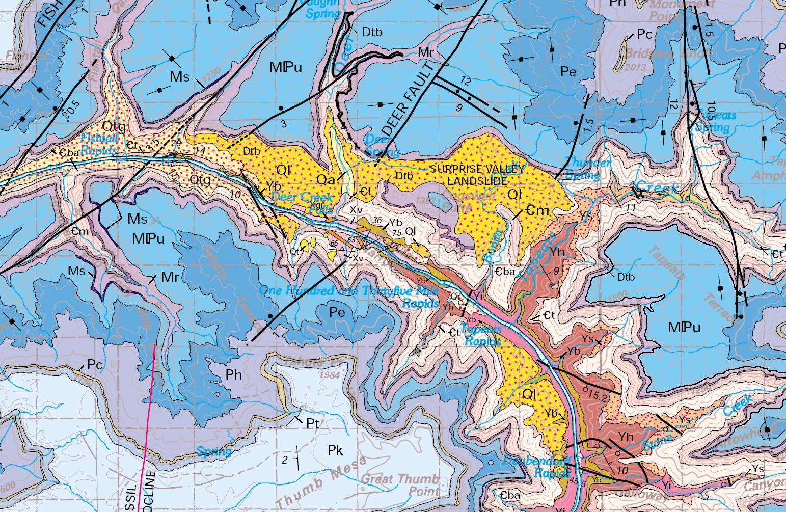
Portion of "Geologic Map of the Grand Canyon 30' x 60' Quadrangle,
Coconino and Mohave Counties, Northwestern Arizona" published
by the USGS in 2000. This map is of insufficient detail to show
the smaller slides that mantle the lower slopes in Tapeats Cave Canyon,
which floor in the Bright Angel Shale.
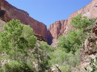
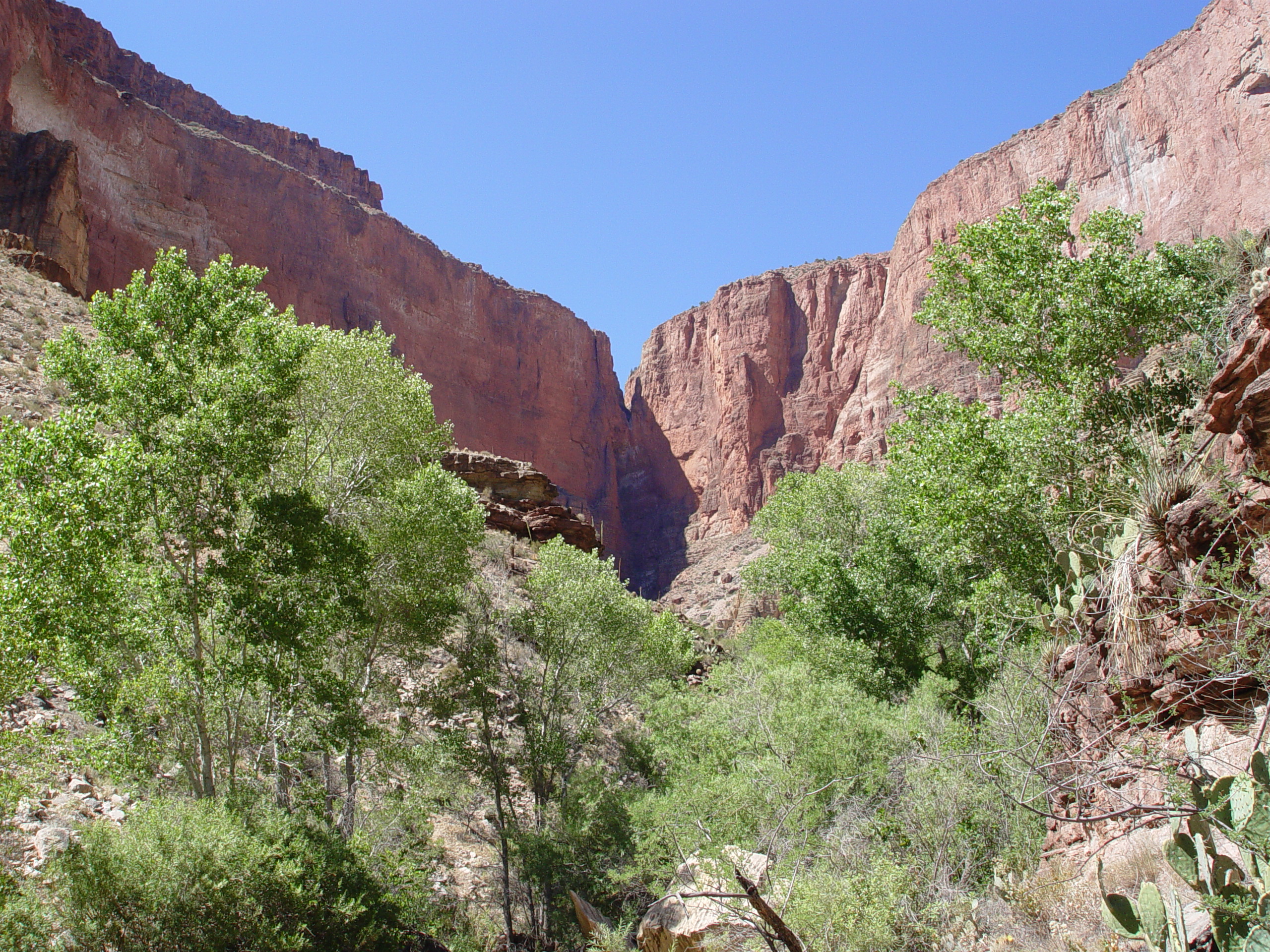
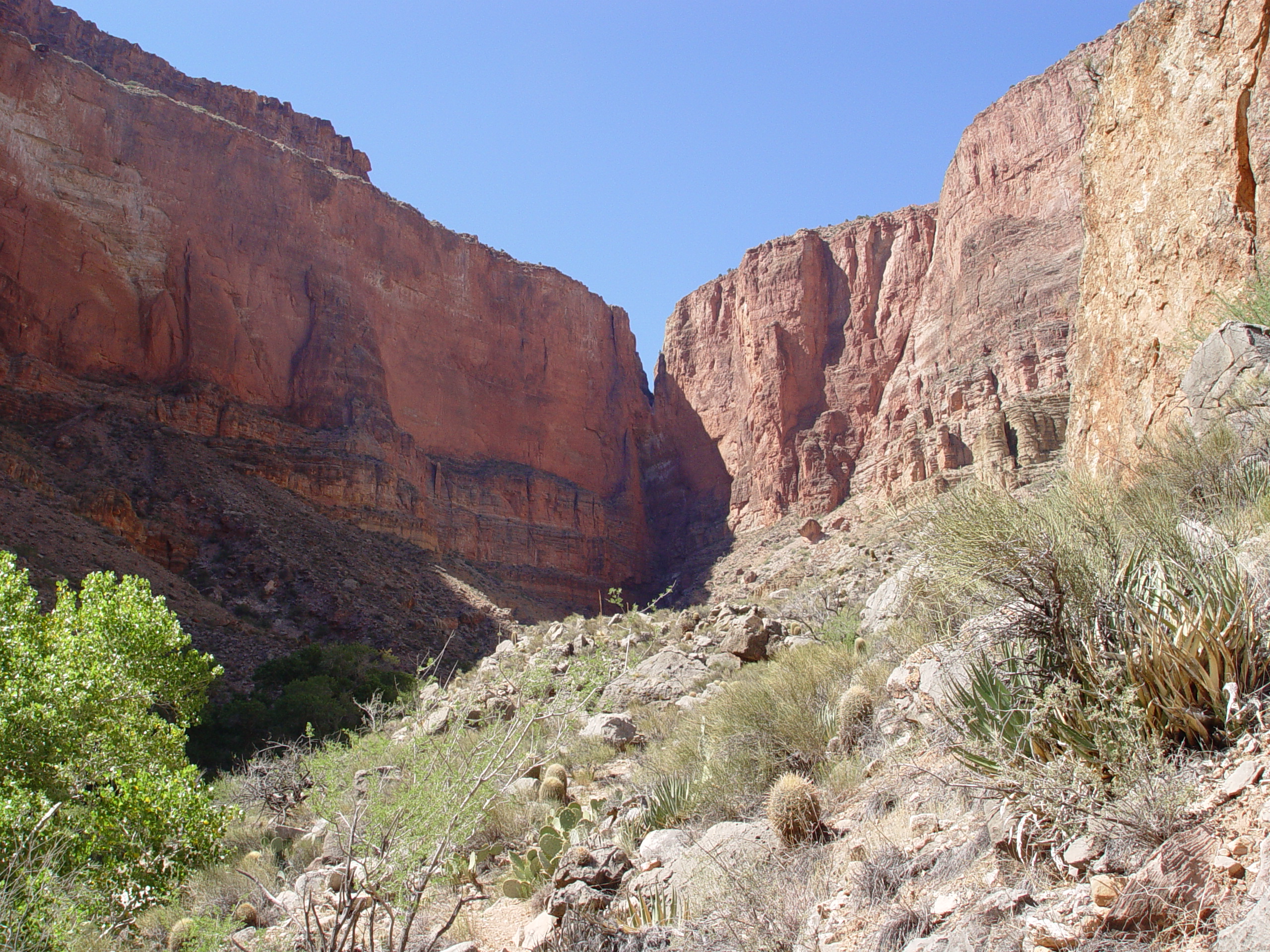
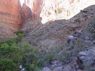
Ground view of Tapeats Cave Canyon looking at the fault-controlled
notch in the Esplanade. This view is looking upstream towards Tapeats
Spring, which lies below and to the right of the prominent notch,
along a splay of the Tapeats Fault.
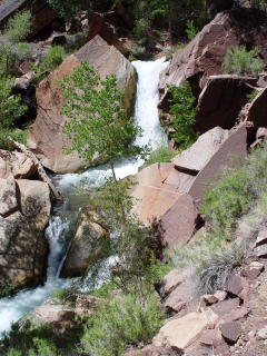
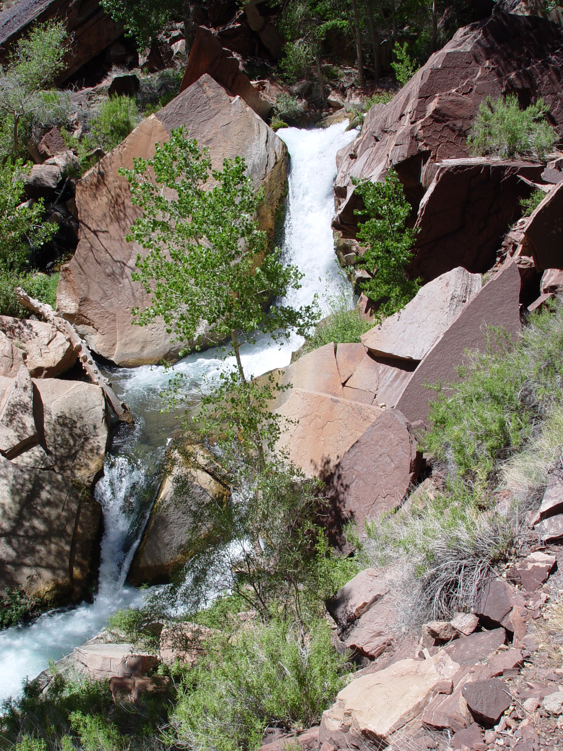
The Tapeats Spring branch of Tapeats Creek is typified by picturesque
waterfalls and choked with coarse debris, indicative of a channel
out of equilibrium. The channel profile exhibits classic signs
of modest hydraulic choking over a considerable distance.

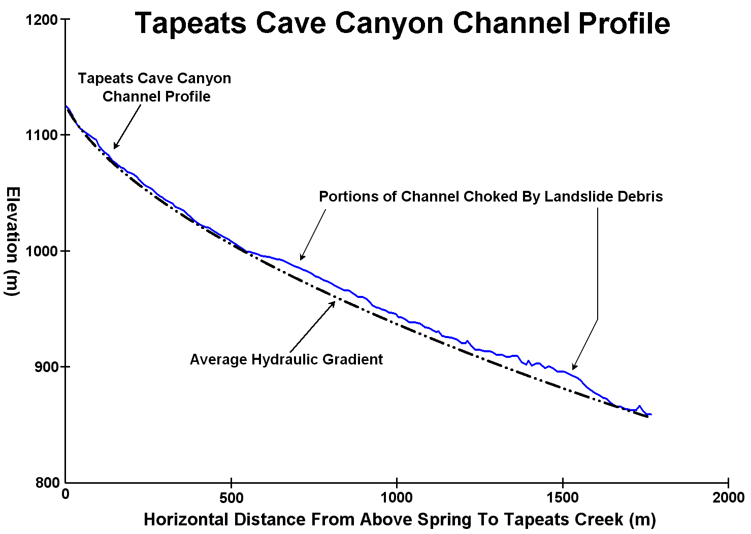
The profile of Tapeats Spring branch exhibits evidence of modest debris
choking, as shown in this diagram. The landslides impacting the channel
are relatively small in comparison to those in the Surprise Valley,
Deer Creek, Cranberry and Fishtail watersheds. Another factor
may be the nearly 50 million gallons of water per day that flows out
of Tapeats Spring, which provides considerable stream power to erode
blockages.

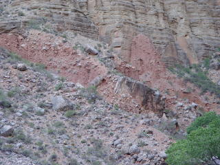
This view shows the jumbled landslide debris mantling most of the
exposed slopes in Tapeats Cave Canyon. The Tapeats Fault is
a normal fault with the western side dropping relative to the east.
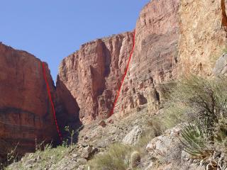
Closer view of the Tapeats Fault splay and the hanging valley.
The main fault (left) and the splay controlling Tapeats Spring (right)
are shown in red.
This Toreva block near Tapeats Spring has blocked the natural outlet
of the spring, causing water to percolate through the debris as a
series of pools and waterfalls in lieu of a discrete discharge, like
Thunder River. The basal failure surface appears to be developed
in the Bright Angel Shale, which has been shown to lose significant
strength when saturated. All of the large springs and many of
the smaller ones in this part of the Grand Canyon are surrounded by
landslides.

The back rotated blocks on the eastern side of Tapeats Cave Canyon
are larger and more numerous than those on the opposite wall.
This may be ascribable to increased pore water pressures being developed
on the foot wall side (east) of the fault due to secondary fracturing
and/or perching of water by fault gouge. The area east side of the
fault is also at a higher elevation and receives larger amounts of
precipitation than areas just to the west, so a larger amount of groundwater
likely percolates through the eastern wall of the canyon.

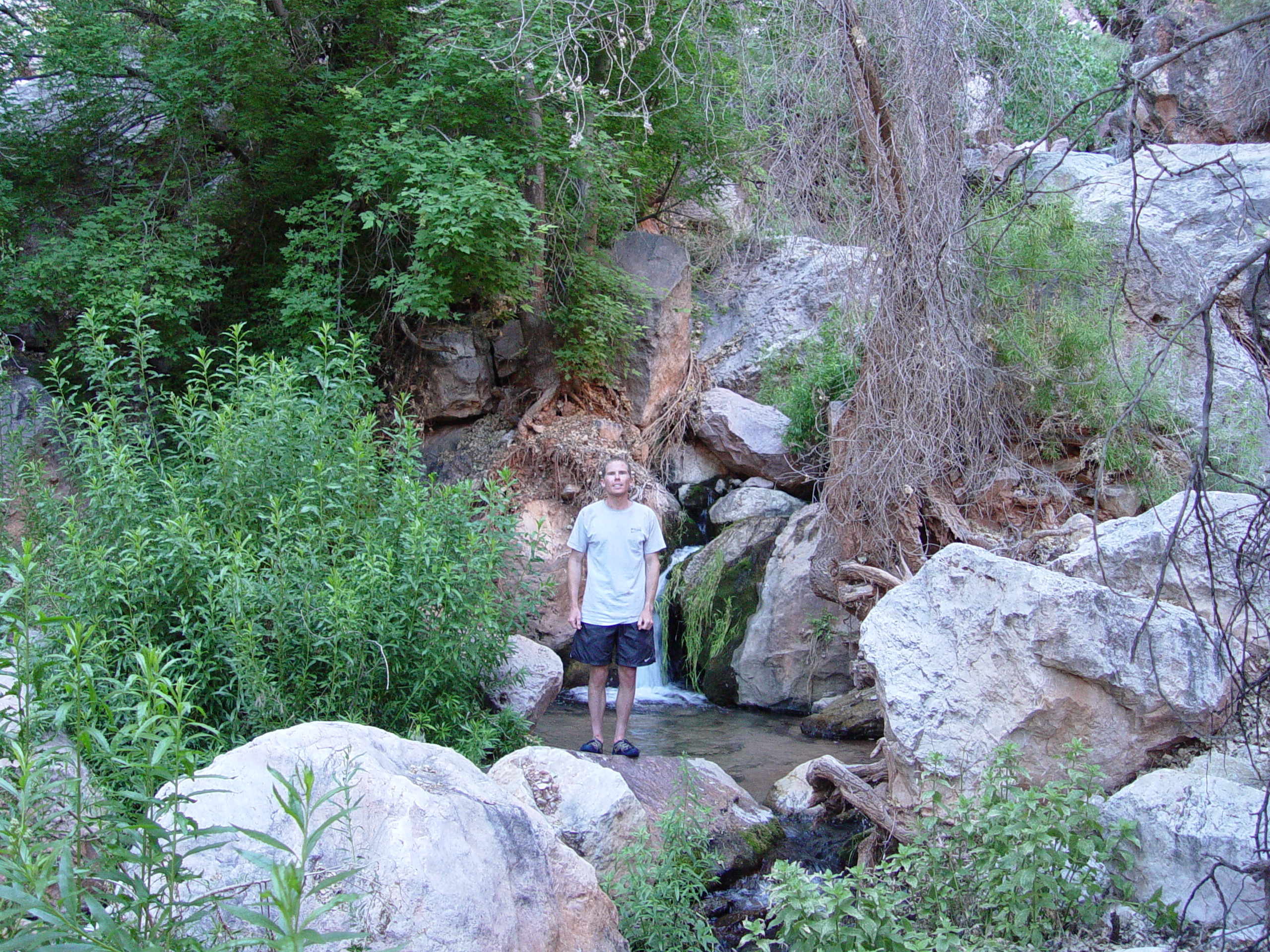
Conor
standing in one of the pools below Tapeats Spring. The springs
appear as water coming out of the ground in a series of small waterfalls
and pools. This is because water is percolating through landslide
debris that blocks the spring's pre-slide outlet.

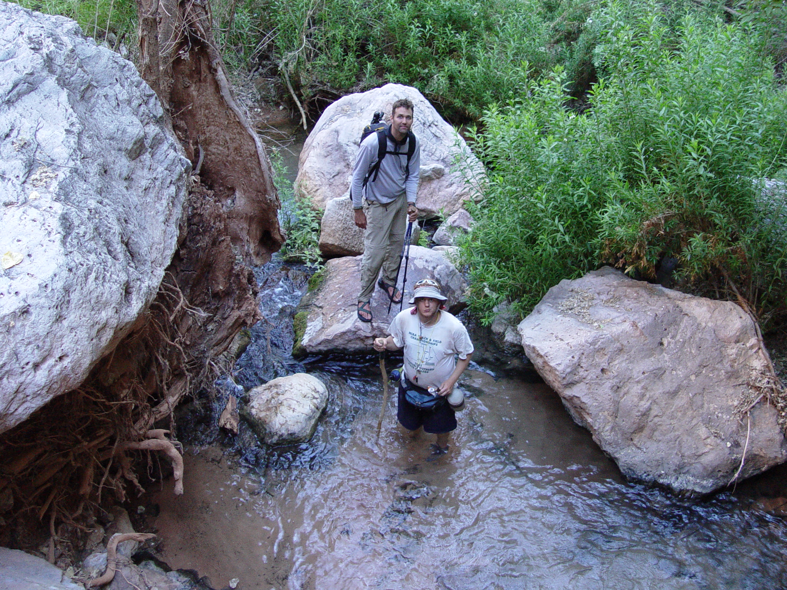
Garrett Euler and Mike McEuen enjoy one of the pools at Tapeats Spring.
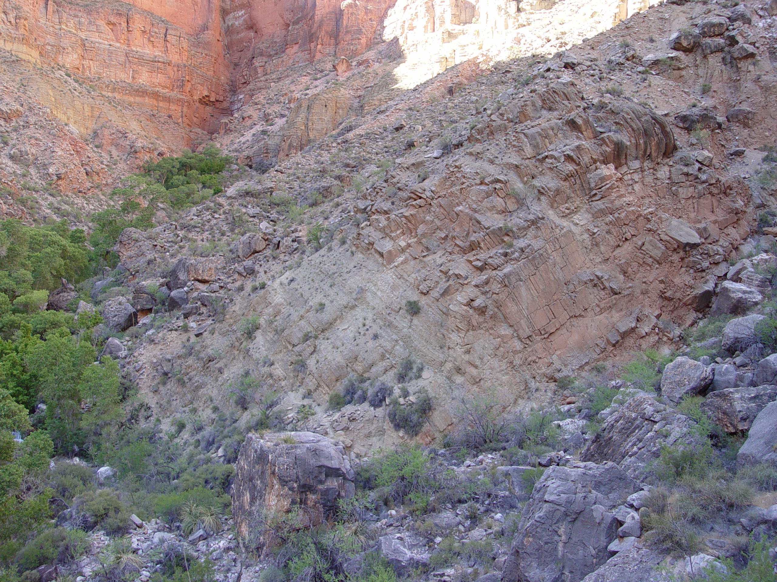
Indurated sediments mantle the Bright Angel slope in much of Tapeats
Cave Canyon. Some of these are coarsely stratified parallel
to the slope and appear to be talus accumulations. Others, which
tend to be horizontally stratified and more fine-grained, appear to
be lacustine sediments mixed with debris flow packages that were likely
deposited in temporary reservoirs caught behind landslide dams.
Based on the depths and vertical extent of these lacustrine materials,
we can deduce that significant portions of much larger landslide dams
have been excavated by discharge from Tapeats Spring.
Prmoninences of rock, which appear to be an incipient form of mass
wastage, appear in addition to the landslides mantling the slopes
in Tapeats Cave Canyon. The prominences, composed of the Redwall,
Muav, and Bright Angel Formations, appear to be slowly separating
from the canyon walls along nearly vertical planes as the underlying
Bright Angel Shale strains. These prominences are most noticeable
along the east wall of Tapeats Cave Canyon of the largest of these
features is present along the north side of Tapeats Creek, just west
of the mouth of Tapeats Cave Canyon. These features were identified
using aerial photos and appear to be a form of stress relief described
in the Grand Canyon in Huntoon (1973) known as high-angle gravity
faulting. It is likely that the existing adjacent landslides
serve to confine and buttress these formations and keep them from
failing completely. It is possible these features will evolve into
landslides sometime in the future when the existing landslide materials
are removed by erosion.
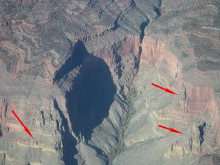
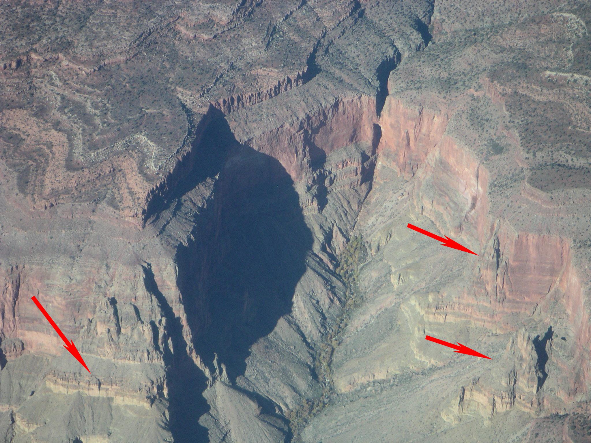
Prominences of
rock appear to be separating along vertical fractures on the east
side of Tapeats Cave Canyon and along the north side of Tapeats Canyon
west (left) of Tapeats Cave Canyon (indicated by red arrows) due to
straining of the underlying Bright Angel Shale. (Photo courtesy
of Alan Herring)

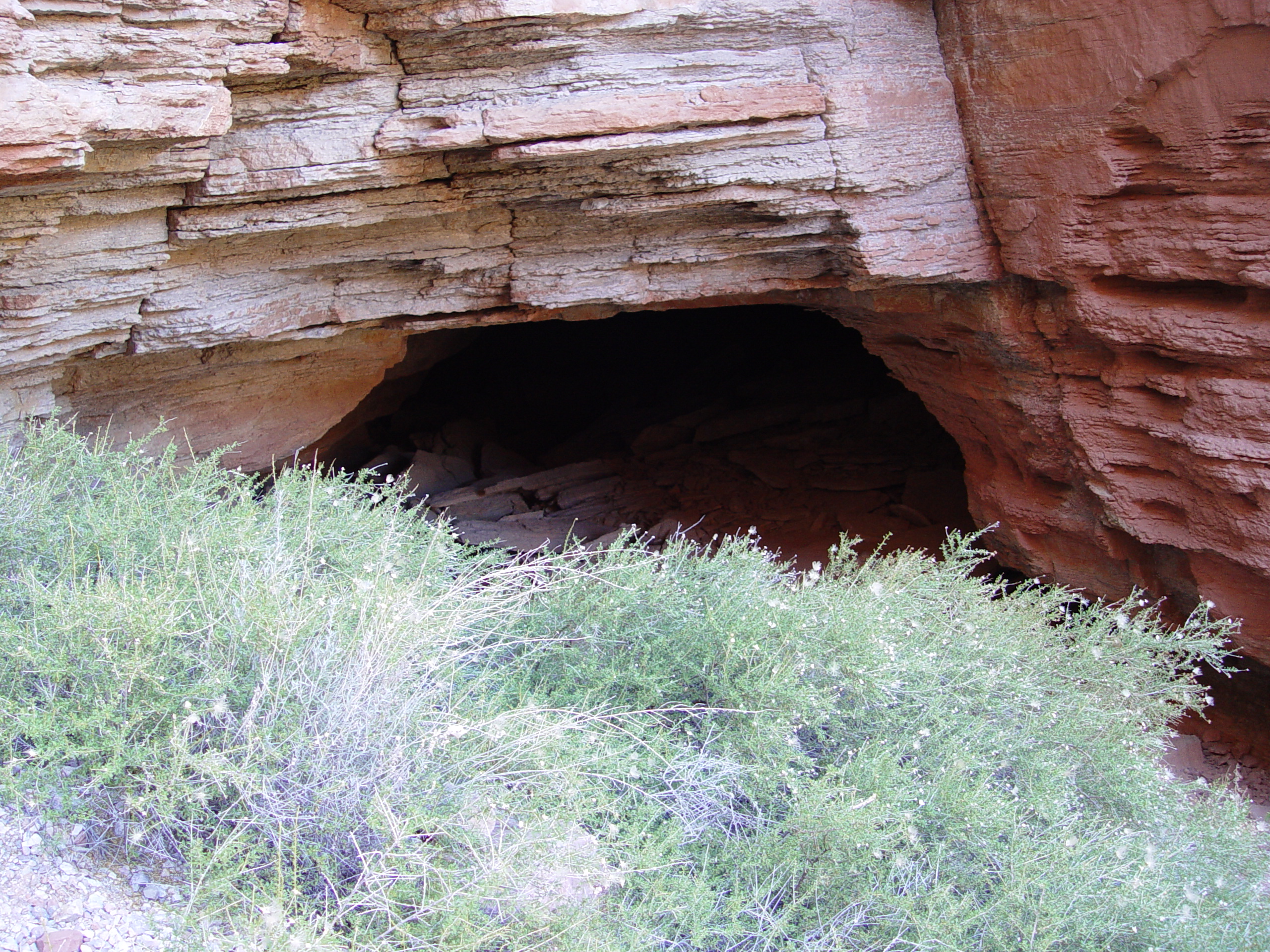
Mouth of Tapeats Cave, which is controlled by a splay of the Tapeats
fault. The cave entrance is slightly higher and just east of
Tapeats Spring. This smaller passage eventually joins the main
trace of the Tapeats Fault, where an underground river supplies the
spring discharge.
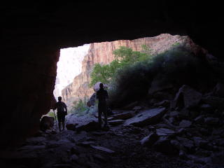
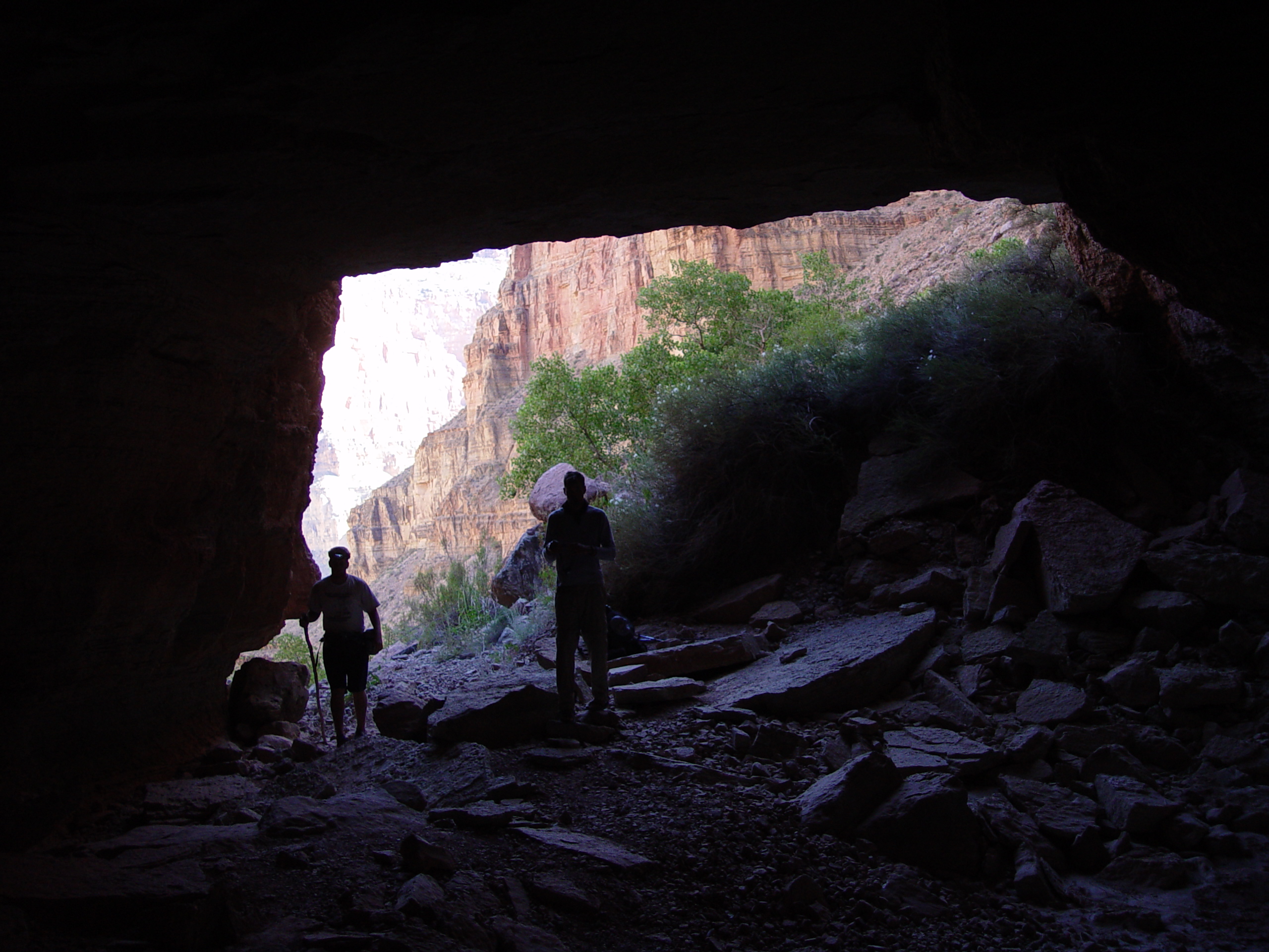
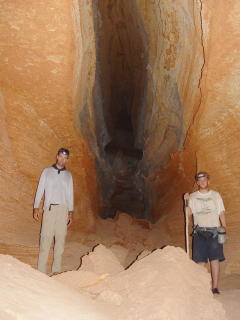
The outlines Garrett Euler and Mike McEuen provide an idea of scale
at the opening of Tapeats Cave. The entrance is nearly 20 feet tall.
View of fault-controlled passages inside the cave, developed in the
Muav Limestone. The fault easily traced in the ceiling of the
cave.
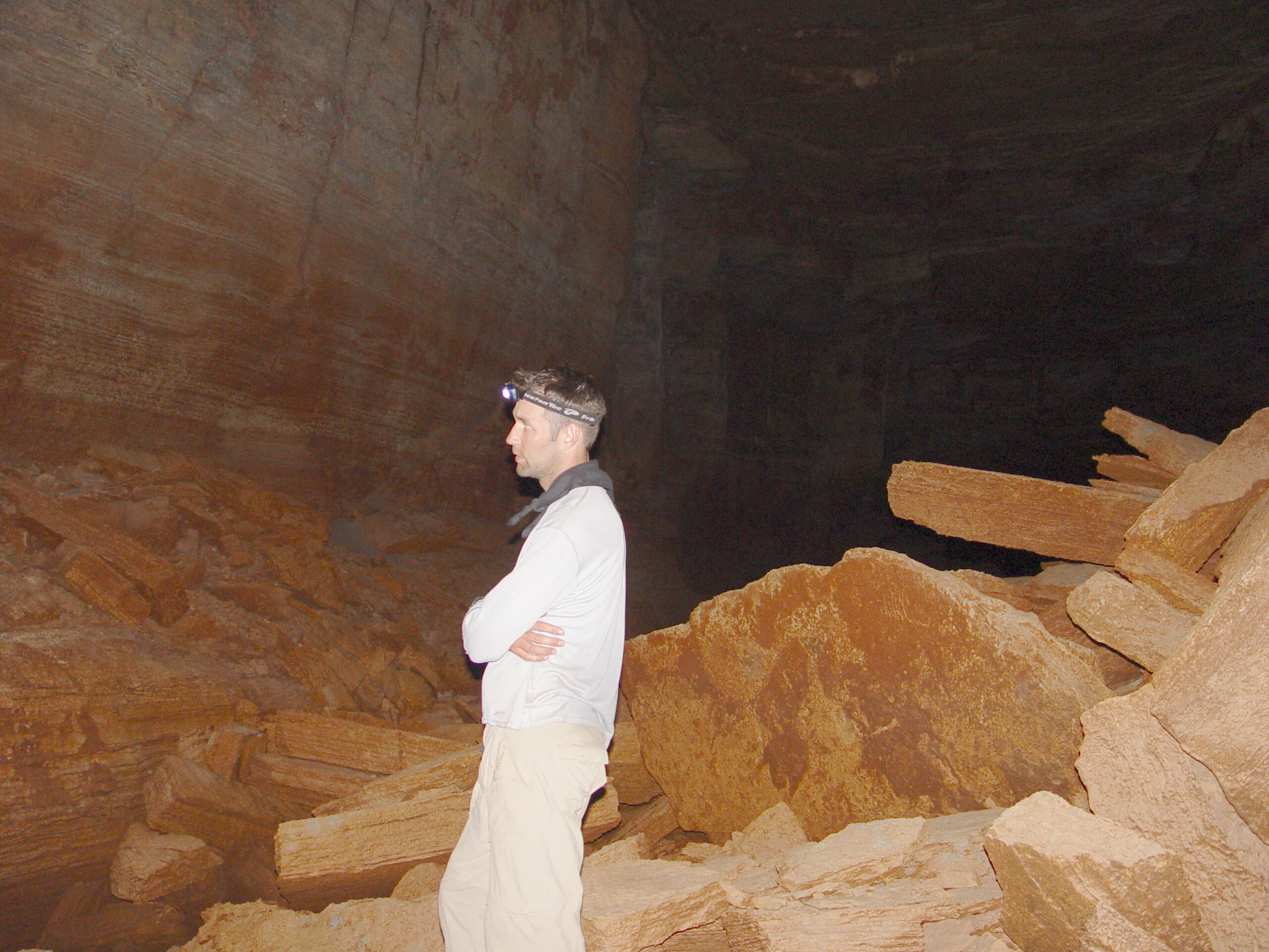
Garrett Euler investigates Tapeats Cave.
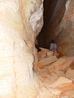
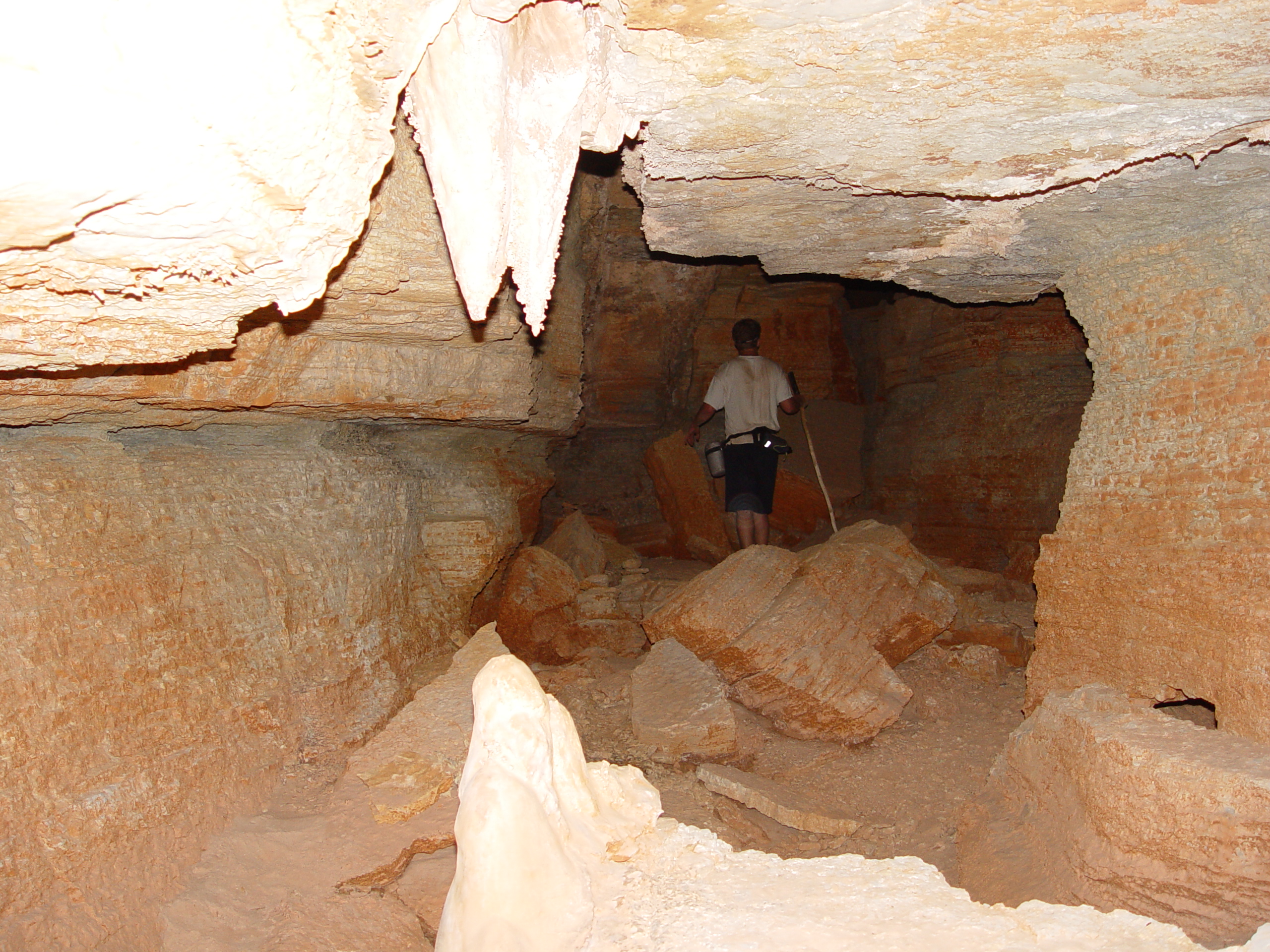
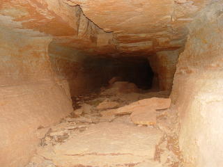
Mike McEuen investigates the narrow entrance passage of Tapeats Cave
, which is fault controlled. Ceiling collapses (breakdown) are
common in this reach.

Mike McEuen standing in the a large room where the entrance passage
joins the main part of the cave.

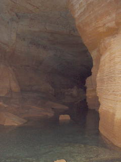
Upon entering the main passage of Tapeats Cave, the rooms take on
much larger dimensions and water is seen for the first time.
This water feeds Tapeats Spring.
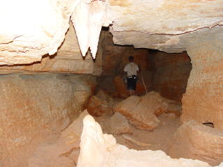
Mike and Garrett stand in a narrow passage of Tapeats Cave. According
to Peter Huntoon's 1970 PhD dissertation, there is around one mile
of underground passage in Tapeats Cave.
Questions or comments
on this page?
E-mail Dr. J David Rogers at rogersda@umr.edu
or
Conor Watkins at cwatkin@umr.edu.