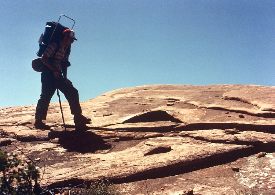
In 1979 I returned to the Canyon to study the landslides in and around
Surprise Valley, which I felt may be connected to the old lava dams
a short distance downstream. This shows an exfoliation A-tent
in the Esplanade Sandstone above Surprise Valley.

The
unofficial narrowest point on the river occurs near the beginning
of 135 Mile rapid. Only about 40 feet of unobstructed channel
exists between some rocks that jut out out of the channel on either
side (seen here). In the right background is an enormous buried channel
of the Colorado River, with its deepest point about 250 feet above
the present channel.

This
is a closer view of the buried channel above the right bank at Mile
135, at the entrance to Granite Narrows. The old channel is filled
with bedrock landslide debris. This undifferentiated debris
is shown to be contiguous with the much larger Surprise Valley Landslide
Complex, which occupies an old side canyon between the Esplanade and
Granite Narrows, which used to feed into Tapeats Creek (see geologic
map below).

At Mile 134.94 the Colorado River experiences it narrowest point in
the entire Grand Canyon, with a width of 76 feet between opposing
canyon walls. This determination was made in June 1965 by the
USGS-WRD survey during a flow of 48,500 cfs.

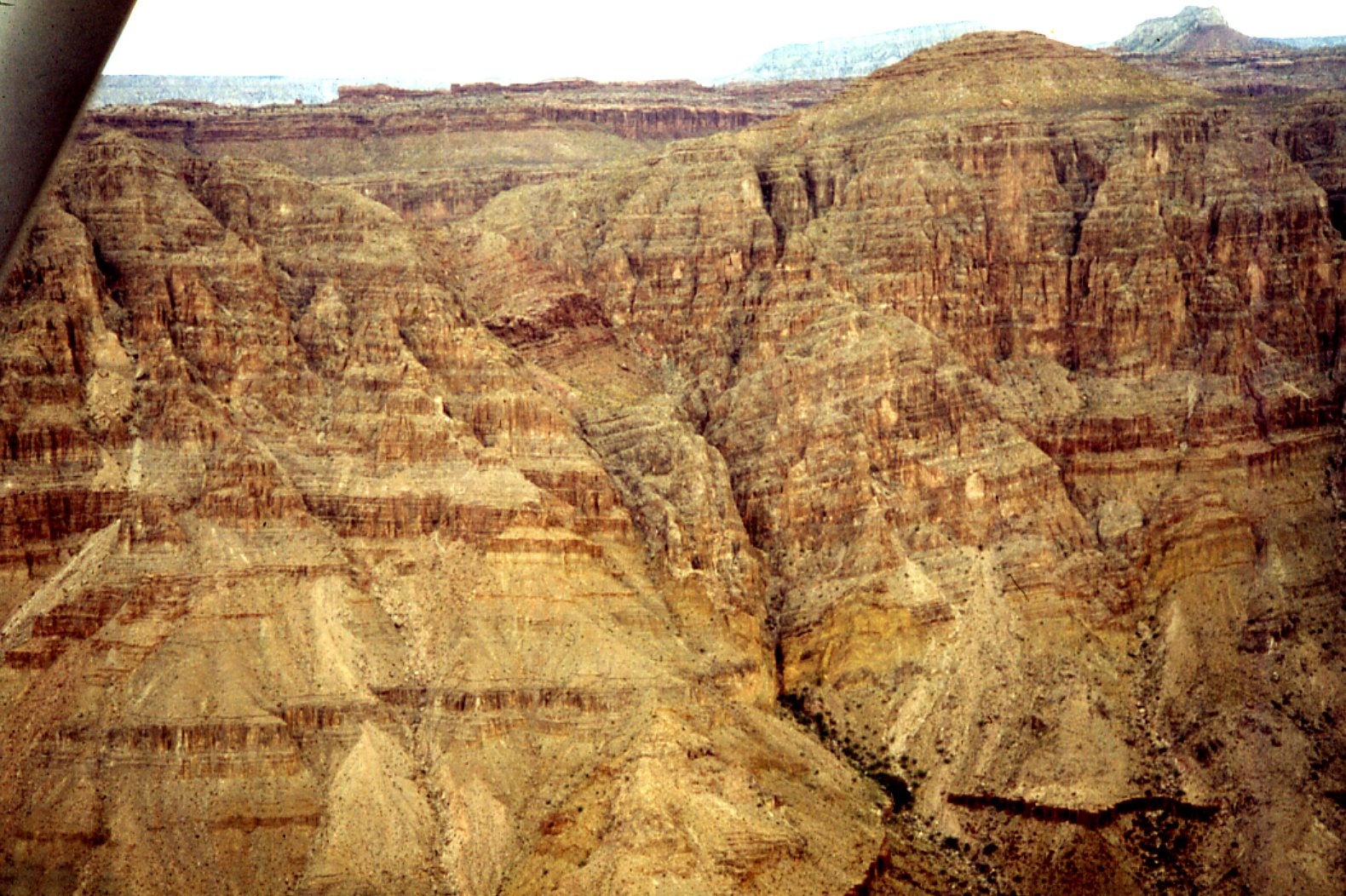
Low level aerial oblique view of the Mile 135 Landslide, which slumped
from the southern side of Cogswell Butte, into the Colorado River.
At the time the river channel was about 250 feet higher than present,
making this an older event (likely between 150 and 200 Ka).
I took this picture from a low flying Cessna 206 in September 1979,
before the Park Service instituted the present flight restrictions
in the Canyon.

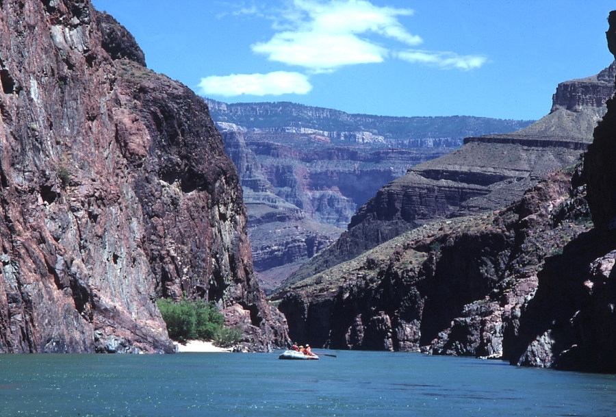
River view looking up the Granite Narrows below Surprise Valley, between
Bonita (Mile 134.3) and Deer Creeks (Mile 136.3). In this reach the
river reaches depths of up to 85 feet.

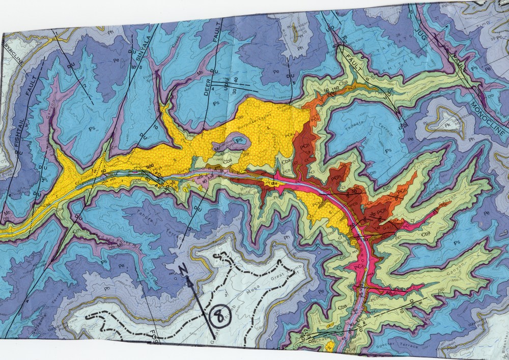
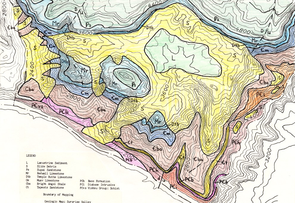
Portion of the
1976 Geologic Map of the Grand Canyon showing the Surprise Valley-Deer
Creek-Fishtail Canyon area. The areas underlain by extensive bedrock
landslides are shown in bright yellow. I became intrigued with studying
these landslides during my research trip in June-July 1978.

Detailed
geologic map of the Surprise Valley area that I made during the summer
of 1979, working with Marv Pyles and Eric Savage at U.C. Berkeley.

This
is the detailed landslide map of the Surprise Valley area we also
complied during our reconnaissance work in the summer of 1979.
The areas are mapped according to the types of landslides we observed.

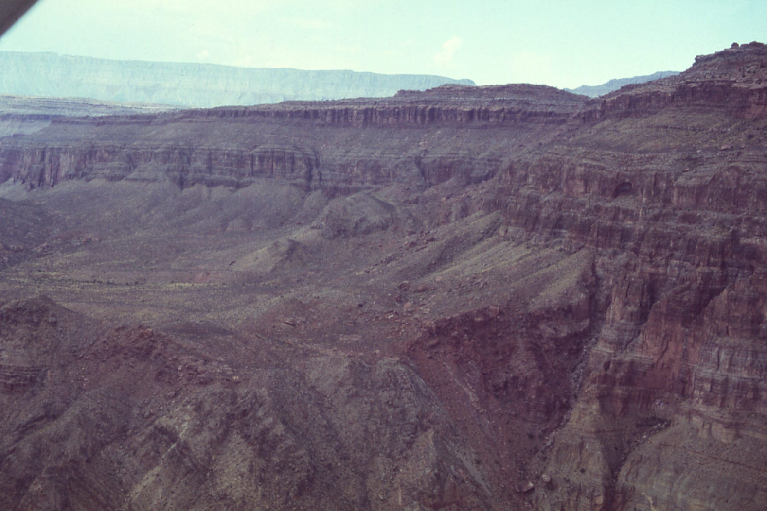
High
level aerial oblique view of the eastern escarpment of Surprise Valley
and the Thunder River Landslide complex. We studied the Thunder
River slide because it was the best exposed, with easy access to the
basal slip surface.

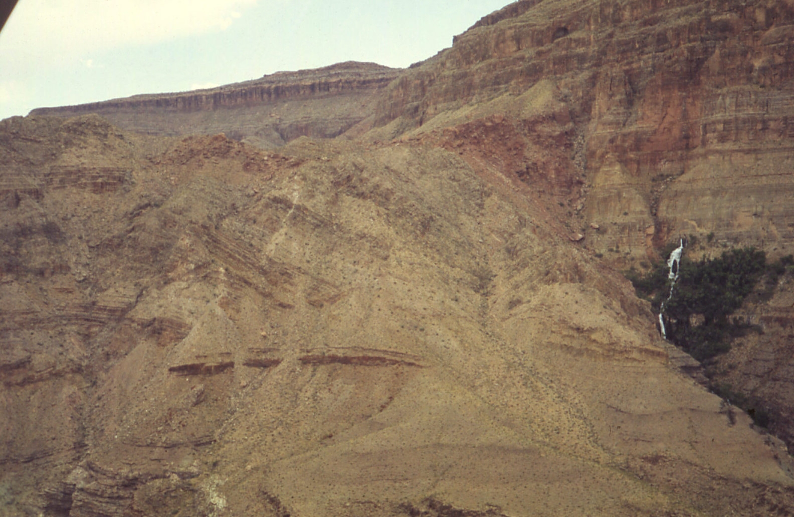
Low
level aerial oblique view taken in 1979 of the Thunder River Slide,
showing its proximity to Thunder River Spring, seen at right.
The fault-controlled spring likely played a role in fomenting this
movement, though softening of the shale through lake inundation or
rapid drawdown can also be demonstrated as failure mechanisms.

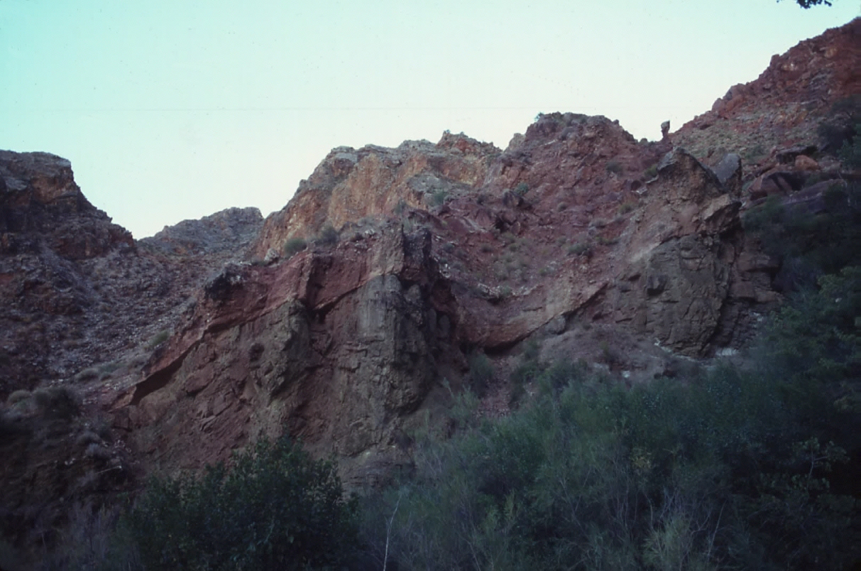
We were able to access the basal slip surface of the Thunder River
slide and take samples of the Bright Angel Shale for laboratory testing
back at U. C. Berkeley. A travertine cemented breccia zone between
30 to 40 feet thick lies above the basal slip surface, shown here.

This
shows the curvilinear transition zone of the basal slip surface adjacent
to Thunder River Springs, where it cuts through the upper Bright Angel
Shale. The cemented character of the slide debris above the basal
slip surface is ascribable to subsequent travertine cementation.

Trimmed
specimens of the Bright Angel Shale were tested in simple shear, under
dry and saturated conditions. Saturation was achieved by placing
prepared specimens in a consolidometer for 6 months under back-pressure
and evaluating the pore pressure coefficients. As far as we
know, these were the first direct shear tests on intact rock under
both dry and saturated conditions. Normal pressures ranged between
0 and 1100 psi. The tests revealed a 2/3 drop in cohesion upon
saturation. Such a significant loss of shear strength could
occur if the Bright Angel Shale was inundated by the rising waters
of reservoirs caught behind lava dams downstream. If inundation
were the triggering mechanism, the age of the Thunder River Slide
is likely something on the order of 750,000 years before present (750
Ka).

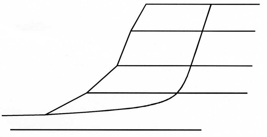
Initial assumed condition of the Thunder River Landslide for our back-analyses.
This condition occurred when the Tapeats Creek and the proto-Surprise
Valley stream had excavated to an elevation of just under 3000 feet,
through the Boxcar/Rampart Cave Member of the Cambrian age Bright
Angel Shale. The failure mass was just under 2000 feet high!

The landslide initiated as a composite wedge failure, with one wedge
sliding horizontally and the other dropping vertically, as depicted
here.

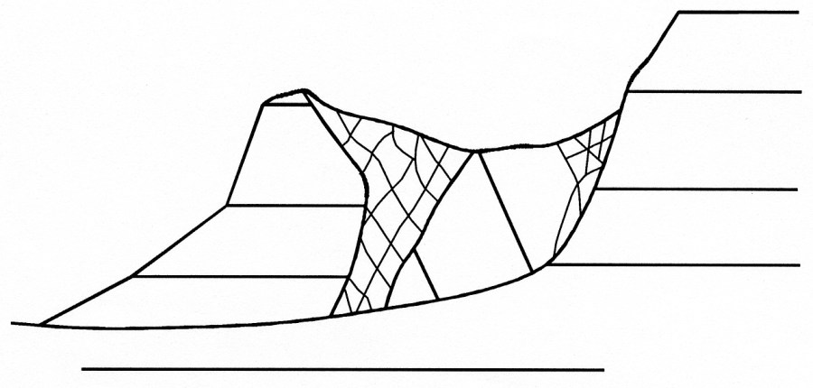
As
the passive wedge continued to translate towards Tapeats Canyon, a
brecciated zone developed between the back-rotating block and the
passive wedge.

Sliding of a passive toe wedge on a weak bedding plane, brecciation
of a middle zone and back rotation of the heel of the slide mass,
all appear to have occurred concurrently. This is how the Thunder
River Landslide appears today. In 1979 we called it a “block
glide with rotated graben”. Using current nomenclature this
would be termed a “composite landslide”, because it exhibited
two or more styles of movement simultaneously.
Questions or comments
on this page?
E-mail Dr. J David Rogers at rogersda@umr.edu.