This view shows the extensive deposits of travertine exposed on the
walls of the Inner Gorge of the Canyon near Mile 126. The plethora
of travertine observed across the spectrum of both carbonate and non-carbonate
units caused me to ponder its source.
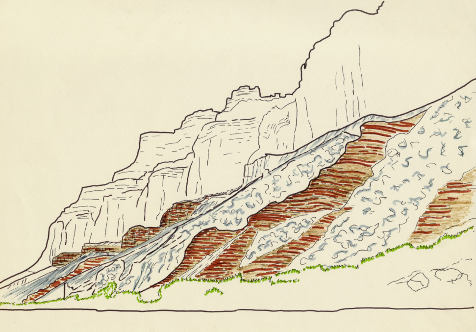
This
view shows travertine cemented colluvial detritus armoring slopes underlain
by the softer Bright Angle Shale along the river channel near its confluence
with the Little Colorado.

Field sketch of the scene depicted above. I hadn’t previously
observed travertine deposited on dense micaceous shales. It likely
precipitated from other sources, discussed below.

The classic model for travertine formation is that it emanates from
dissolved carbon dioxide (CO2) in percolating groundwater, creating
a weak carbonic acid (H2CO3). This weak acid then reacts with
limestone to form soluble calcium acid carbonate, CaH2(CO3), which is
precipitated when the water evaporates at some exposed surface (usually
springs).
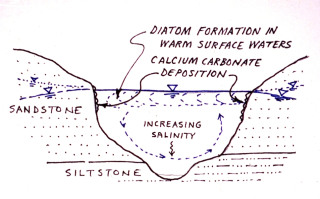
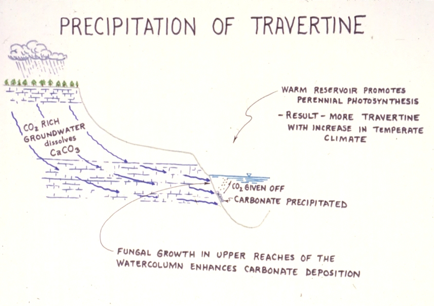
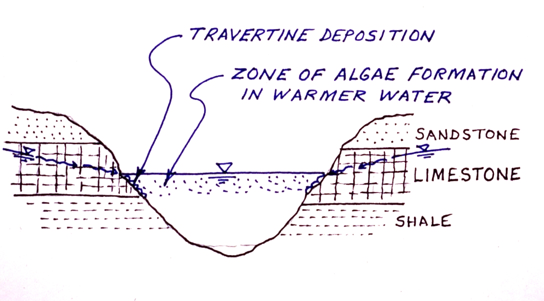
Observations of travertine formation at nearby Lake Powell have generated
alternative models for travertine formation in semi-arid climates, such
as the mechanisms sketched here. In this scheme diatoms and phytoplankton
breeding in the warmer surface waters of a eutrophic lake cause a seasonal
rise in pH, which enhances carbonate precipitation.
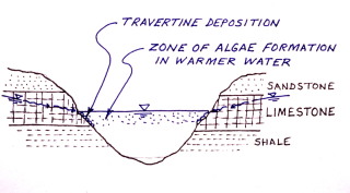
In this model carbon is fixated by algae in the warmer surface waters
of a lake. A summertime rise in the pH of the surface waters can
trigger calcite precipitation in the lake and along its shores.
This mechanism would enable travertine to be precipitated in the warm
water zone.
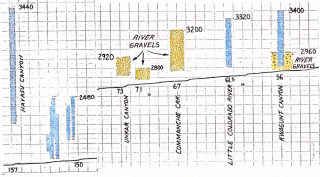
Longitudinal profile segments of the present day river channel, showing
vertical extent of travertine and river gravel deposits preserved on
the Canyon walls between Miles 56-73 and 150-157. The travertine
seems to crest around elevation 3440, irrespective of the underlying
stratigraphy. The highest lava dam extended up to about elevation
4125.
_sm.jpg)
Similar
longitudinal profile comparisons, between Miles 115 and 157, across
the Kaibab Uplift. The lacustrine sediments appear to peak around
elevation 3120 while the travertine extends to around elevation 3480.
In 1979 I suggested that these were remnants of the lakes that must
have been impounded behind the lava dams in the western Canyon, downstream
of Mile 178.

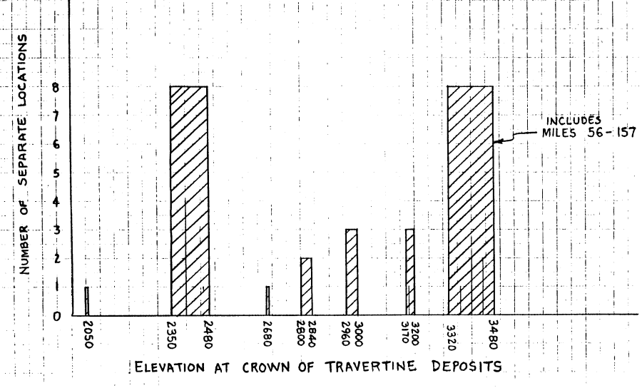
Histogram
illustrating elevation correlations between travertine deposits taken
over the entire Grand Canyon, based on the 1976 geologic map.
The absolute level correlations make a convincing case for the travertine
being deposited in Pleistocene lakes formed behind lava dams in the
western Canyon..
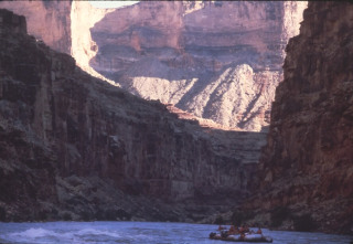
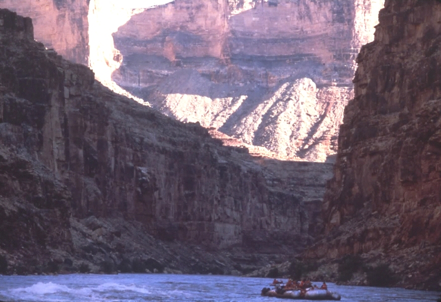
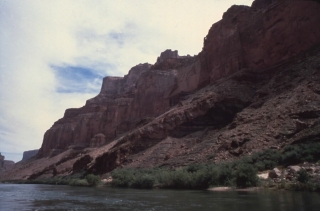
During my forst pass through Marble Canyon I noticed what appeared to
be two ancient carbonate bleach lines high on the cliffs above the gorge,
downstream of Tanner Wash, Mile 15 (see above image).
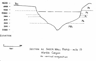
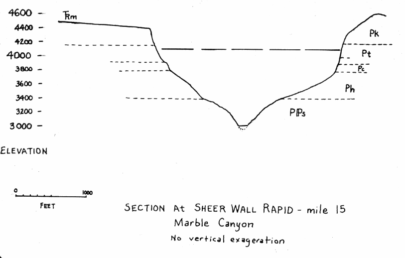
Cross
section of Marble Canyon near Mile 15, where above photo was imaged.
I’ve sketched in the maximum lake level of the Toroweap lava dam,
around elevation 4125. This appears to correspond with the "bleach
lines" shown in the preceding photo, which appear on the Toroweap
formation.

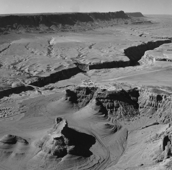
Aerial
oblique view of the Navajo Bridge area of the Vermillion Cliffs near
Lee’s Ferry, at Mile 4. The Moenkopi shales at the base
of the escarpment are unusually rounded and subdued, suggesting that
they were inundated beneath lake waters in the relatively recent geologic
past. These cliffs would have been inundated by lakes impounded
behind the highest lava dams, up to elevation 4125 feet.
Questions
or comments on this page?
E-mail Dr. J David Rogers at rogersda@umr.edu.

|


.jpg)