Prior to the '78 trip, I had never rowed a raft in whitewater. Grand
Canyon was my "baptism under fire." Looking back, its amazing
that I managed to make it through the entire trip without flipping
my 18-foot Havasu II raft, shown here in Soap Creek. My confidence
grew with each day's small sucesses.

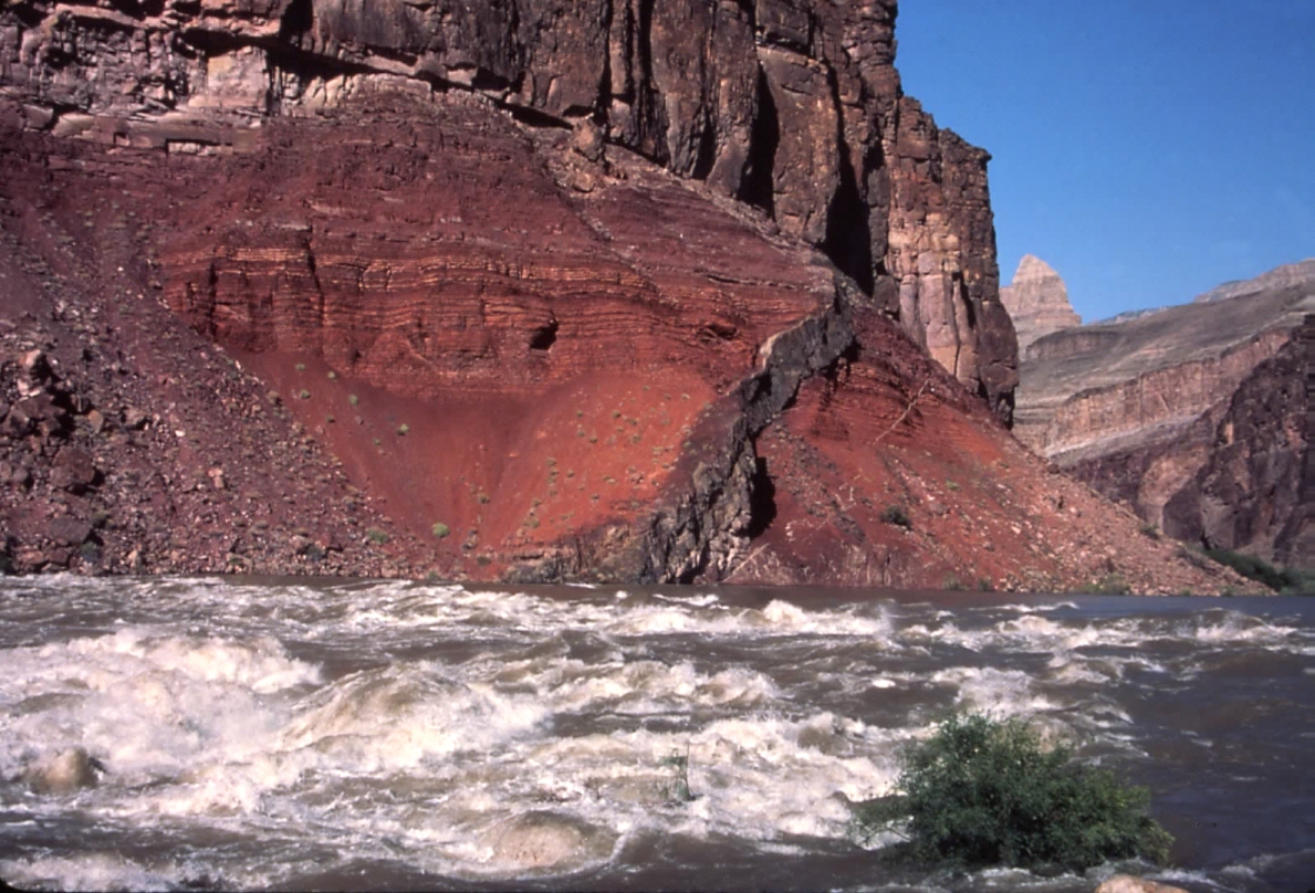
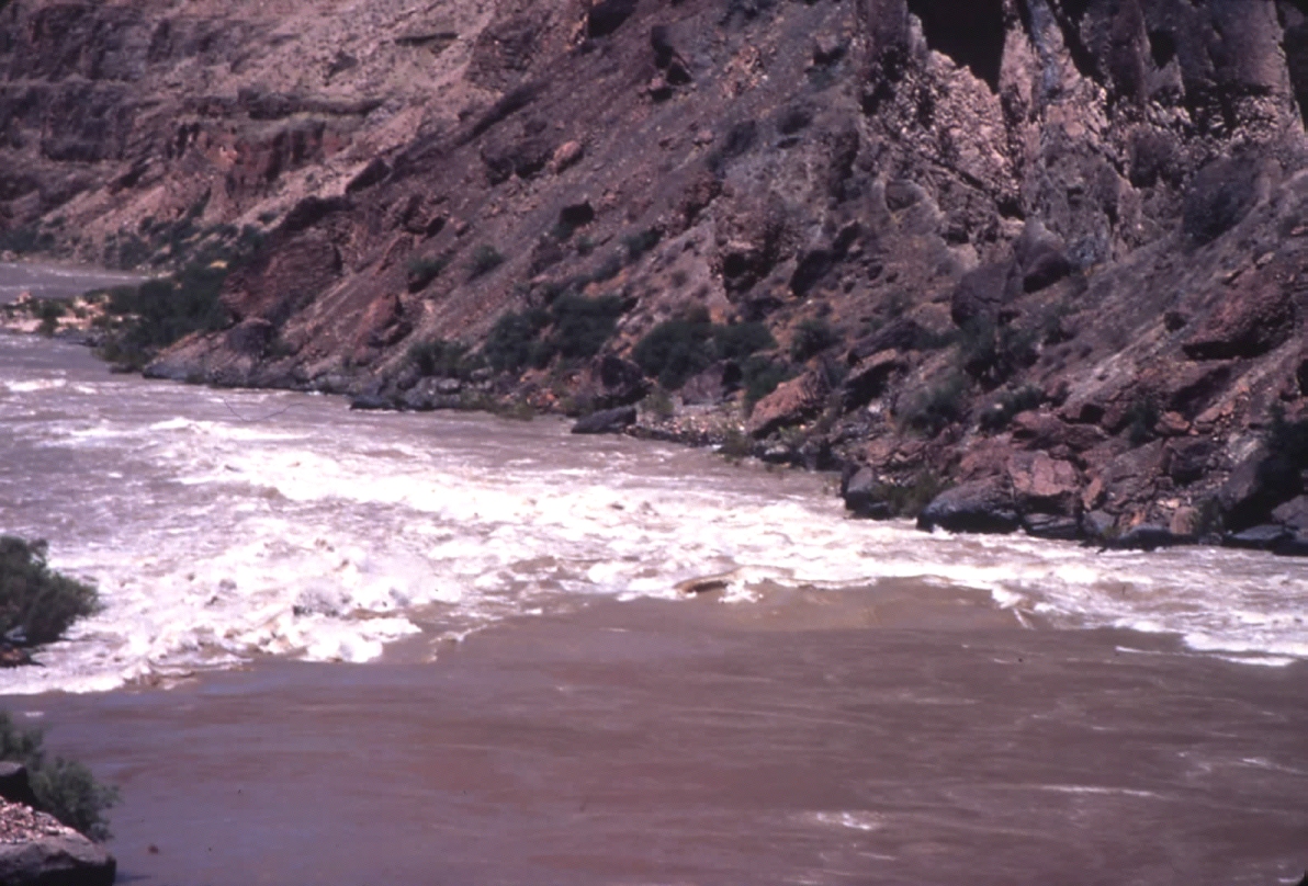
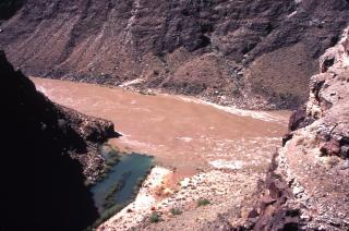
Hance
Rapid at Mile 76.5 stands sentinel at the river's entry into the Granite
Gorge. The river drops 30 feet as it passes through a natural
constriction formed by the Red Canyon detrital fan, emanating from
the Canyon’s South Rim. The diabase dike cutting through
the Hakatai Shale is one of the most photographed features in the
Grand Canyon.

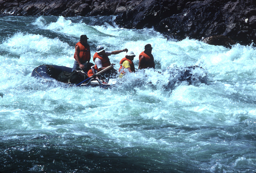
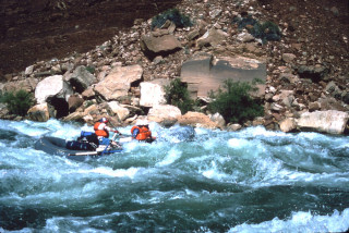
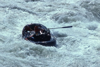
We heard all sorts of terrible things about Crystal Rapid (Mile 98),
but managed to skirt the big hole with little trouble on my first
pass in 1978 (shown here). During our 1983 trip another rafter was killed in Crystal the day before we ran it. In 1984 another rafter died after flipping over in Crystal, the same day we passed through.
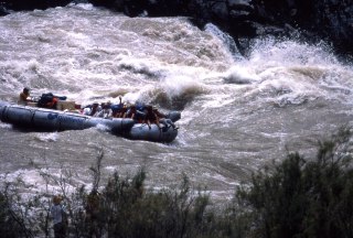
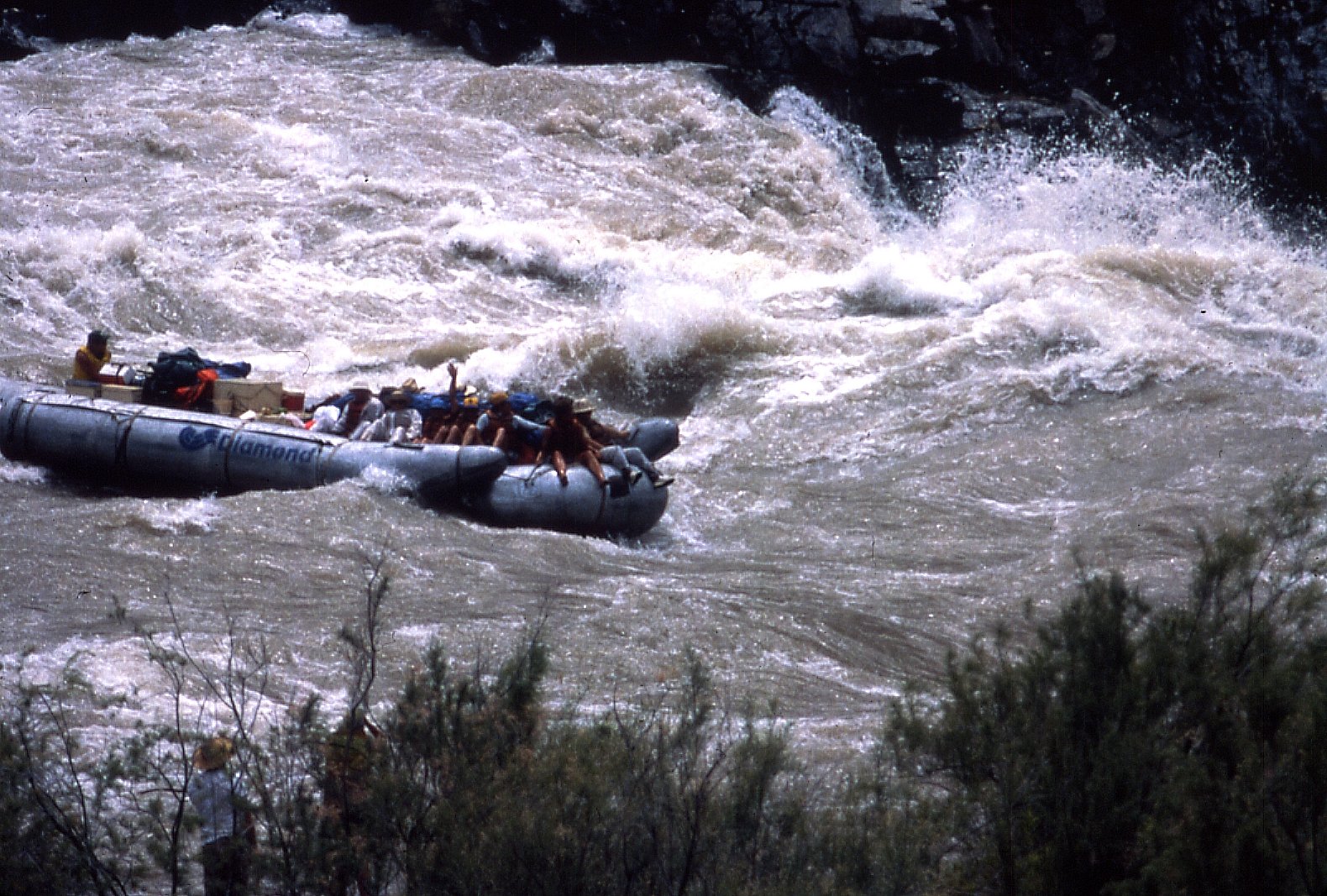
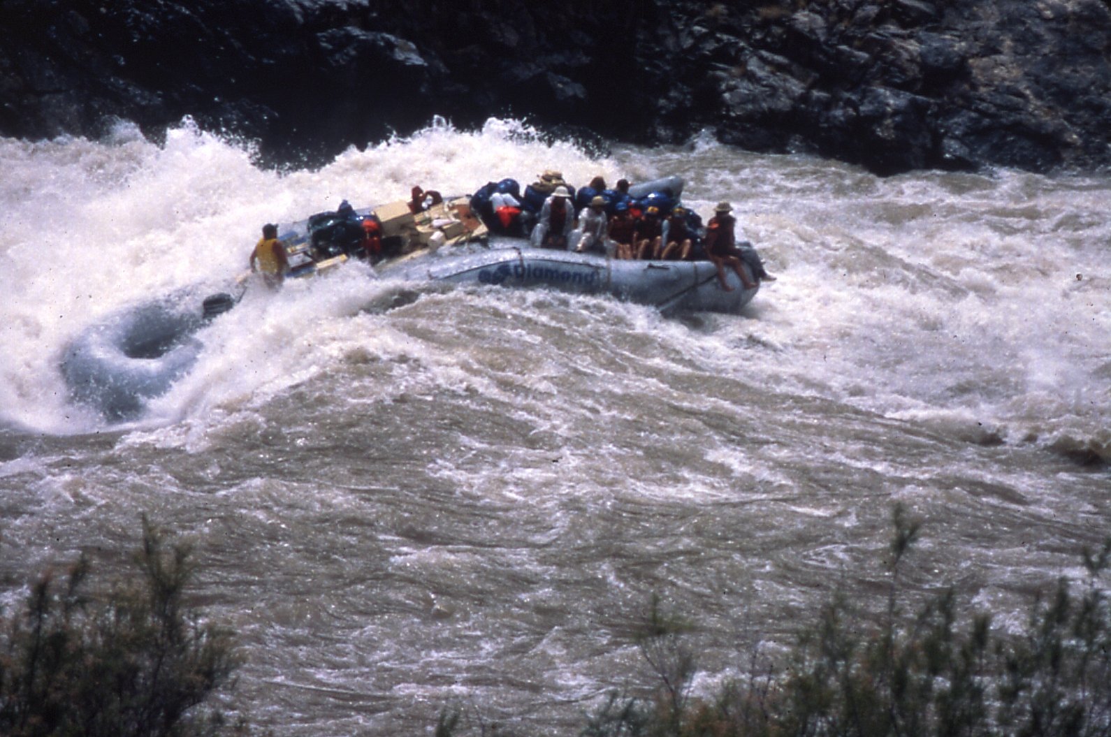
This shows one of Diamond Tour’s 37 foot baloney boats running
Crystal Rapid on Sunday June 26, 1983, when the river was flowing
about 69,000 cfs. The big hole at Crystal was about 25 feet
high and 60 feet wide. A Tour West rig had flipped the previous
day, spilling everyone and killing one.

The Diamond rig skirted around the right side of the big hole in accordance
with sound judgment and everyone seemed relieved.
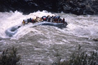
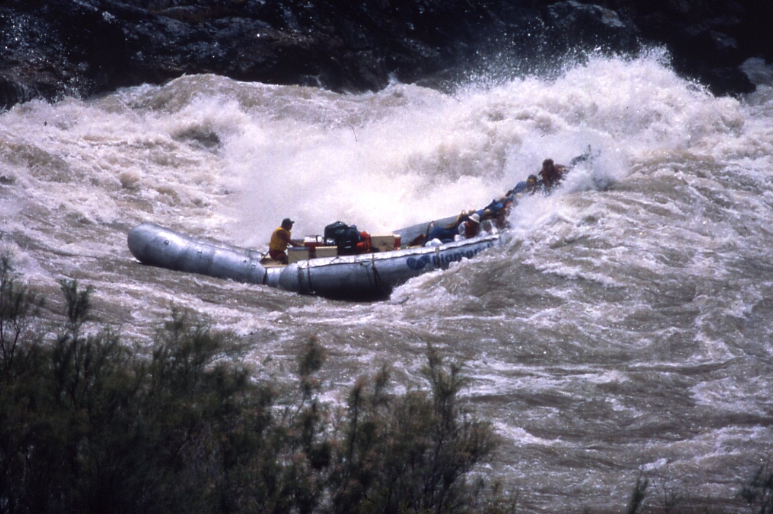
This view shows the flexibility of neoprene rafts, which is their
hallmark. Our group ran Crystal without incident that day, but
the memory lingers, just like someone who’s experienced combat.
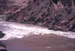
Flooded mouth of Tapeats Creek on June 28, 1983, when the Colorado
River was flowing 79,000 cfs. The entire lower campground was
inundated and few people were on the river. Most of the rapids were
washed out, including Tapeats Rapid, shown here. This abnormally
high flow was caused by cavitation damage to the spillway tunnels
at Glen Canyon Dam. The Bureau of Reclamation increased the
flow dramatically over the last few days of June to sweep out debris
that was clogging the spillway tunnels.
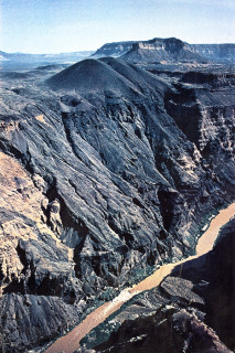
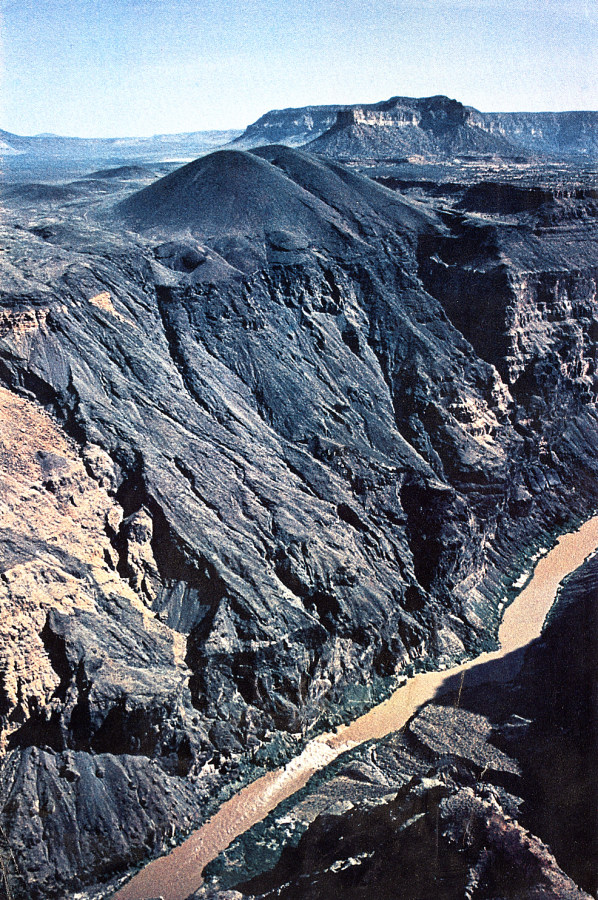
Aerial
oblique view of Vulcan’s Throne and Lava Falls, near Mile 179.
Vulcans Throne is a 700 feet high cinder cone that erupted along the
Toroweap fault about 10,000 years ago. Lava Falls is caused
by detritus emanating from Prospect Canyon, at lower right.

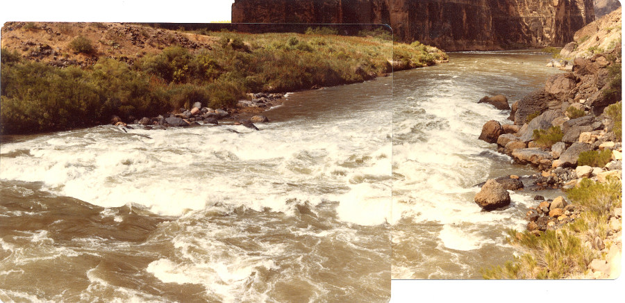
The big test of any boatman’s mettle under average flow conditions
is Lava Falls at Mile 179, where the river drops 20 feet in about 500 wild, frothing, bone-chilling yards (the river drops another 19 feet over the following half mile). The sheer scale of its waves
cannot be comprehended in this view, where the river stage is about
11,000 cfs. During the historic low flow of 500 cfs in late 1911 the
Kolb Brothers photographed Lava Falls. These images clearly show rocky
debris as the source of the falls, with four large boulders of basalt
forming the linear Ledge Hole in center stream, at left center in
the above image. These were likely freighted by debris flows emanating
from Prospect Canyon.
I
managed to make it through Lava Falls and the entire Canyon without
getting flipped on my attempt at rowing, in great measure due to the
coaching I received from Karl Oschner. I did lose an oar and
two passengers in Lava Falls on my first pass in June 1978, shown
here.

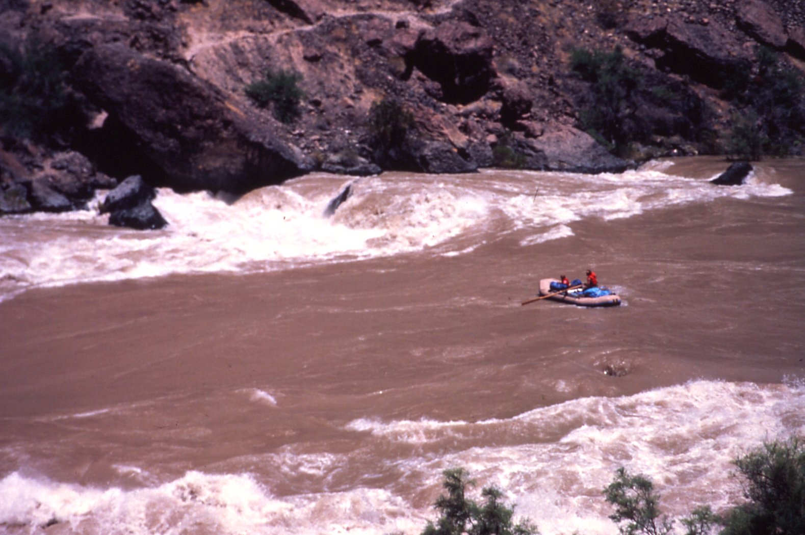
This view
shows the 14 foot Miwok navigating Lava Falls at almost 93,000 cfs
on June 29, 1983. The normally churning rapid was an enormous
wash-out and an easy run, provided one didn’t stray too far
to either side of the enormous tongue pictured here.
Another
view of Lava Falls at almost 93,000 cfs on June 29, 1983, looking
downstream. There were some big rollers and the boats filled with
water, but no tactical rowing needed to effect a safe passage.
Questions or comments
on this page?
E-mail Dr. J David Rogers at rogersda@umr.edu.