
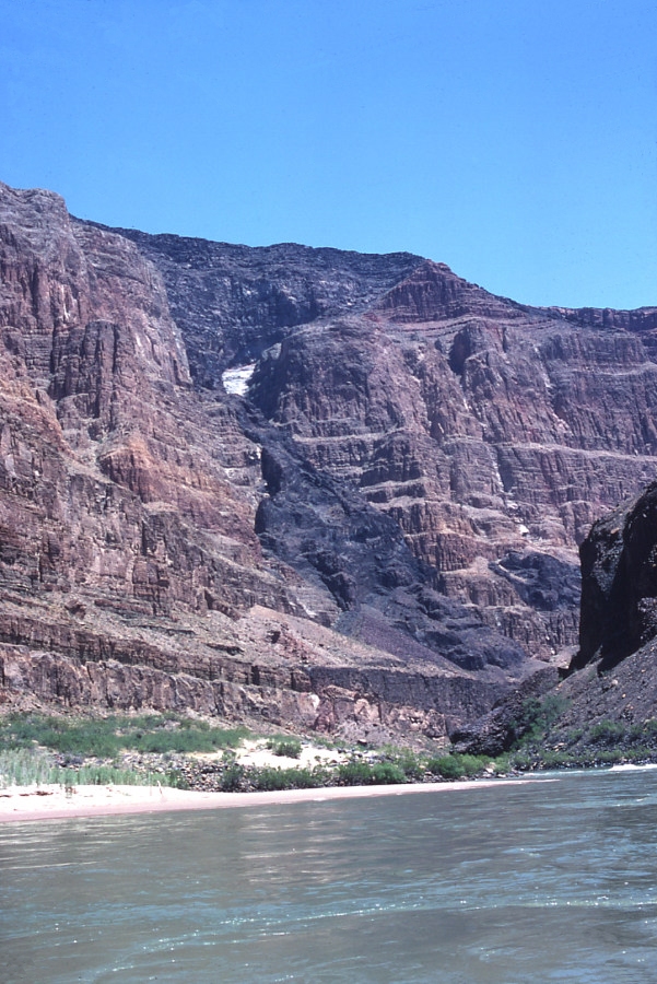
Looking upstream
near Mile 186 at the lava cascade emanating from The Esplanade, 3000
feet above the Inner Gorge, down Whitmore Wash. This lies directly
above the Hurricane fault. These lava flows periodically dammed
the Colorado River on at least 26 occasions, beginning about 1 million
years ago.
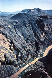
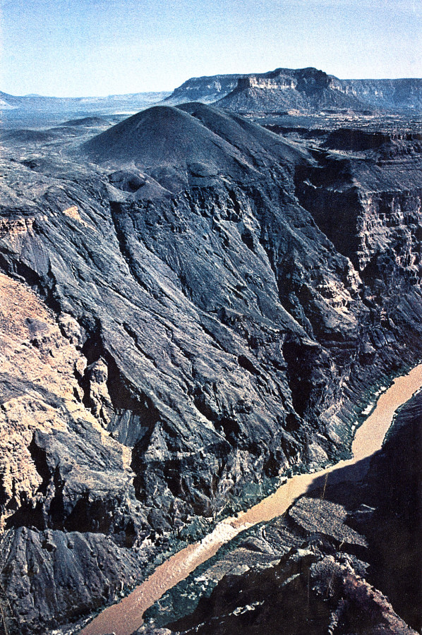
Aerial
oblique view of Vulcan’s Throne and Lava Falls, near Mile 179.
Vulcans Throne is a 700 feet high cinder cone that erupted along the
Toroweap fault about 10,000 years ago. Lava Falls lies directly
below.
I am indebted to discussions with Professor Kenneth Hamblin at Brigham
Young University, who did the pioneering work on unraveling the sequence
of lava dam emplacement and removal in the western Grand Canyon.
The following figures are taken from my article Evidence of Cataclysmic
Erosional Events in the Grand Canyon of the Colorado River, Arizona,
written by myself and Marv Pyles for the Second Conference on Scientific
Research in the National Parks held in San Francisco in November 1979
(and published in 1980):
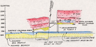
This is a sketch of the oldest lava flows exposed at Lava Falls near
Mile 179, along the Toroweap fault. These flows are about 1 million
years old (1Ma). There appeared to be about 150 feet of vertical
offset along the fault since the flows were deposited. This same
scarp is only about 16 feet high on Vulcan’s Throne, 3000 feet
above.
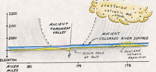
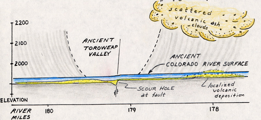
My conceptual sketch of how ancient Toroweap Valley would have appeared
at the beginning of Lower Canyon Flow time, about 1.16 Ma. We opined
that the Colorado River was probably about 300 feet higher than present,
which was not the accepted belief at the time. Today, it is accepted
that the Colorado River in this area is incising at a rate of about
0.4 mm/yr, or about 1.3 feet every 1000 years.
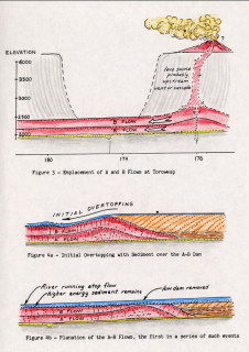
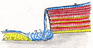
Conceptual sketches illustrating the emplacement of Lava Flows A and
B at Toroweap, and their subsequent overtopping and planation by the
proto Colorado River. The remains of high energy sediments can
be seen on top of B Flow on the right bank at Lava Falls.
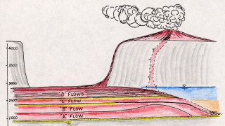
This illustrates the emplacement of C and D flows at Toroweap.
A cobble layer lies upon a planated surface above C flow, similar to
that observed above B Flow.

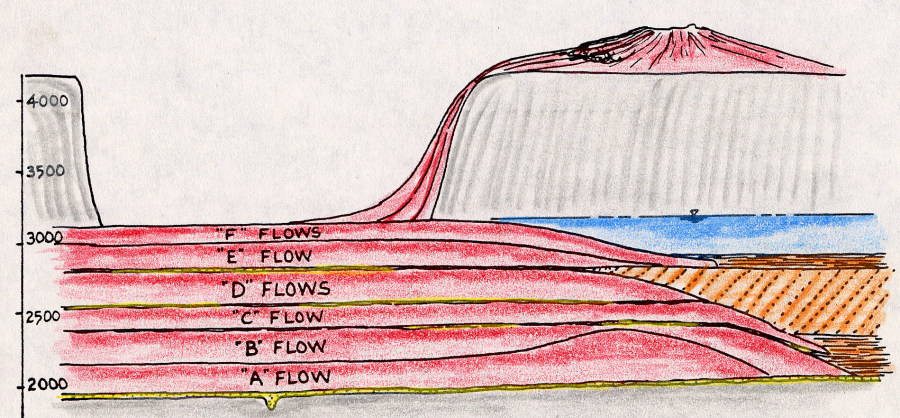
This shows E and F flows cresting at Toroweap, creating a composite
lava dam about 1138 feet above river level. The sediment (shown
in orange) must have accumulated to at least the height of D flow to
have deposited the cobbles on its planated surface.
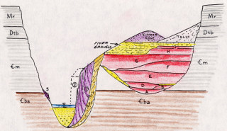
Generalized
section through an abandoned channel of the Colorado River near Mile
183, taken from Hamblin (1969) with some corrections I made in 1979.
Prof. Hamblin subsequently incorporated these and many other refinements
in his final synopsis of the lava dams, published in GSA Memoir 183
in 1994.

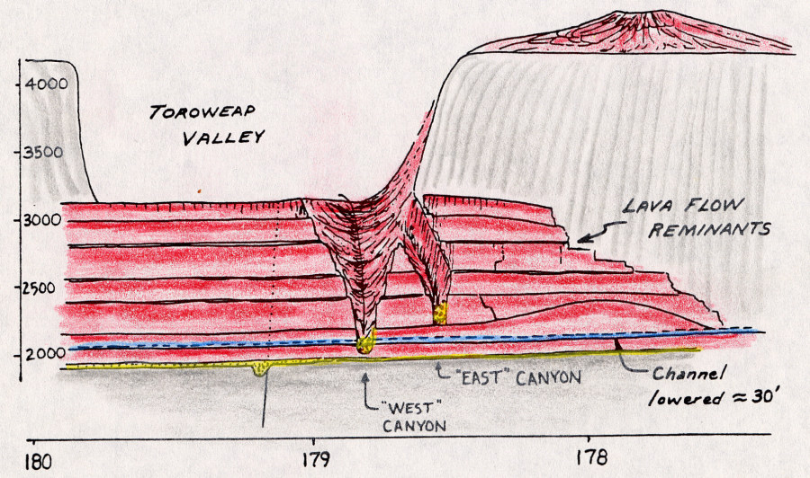
Sketch depicting the hiatus between Lower and Middle Canyon Flows at
Toroweap, when the lava dam was removed and two side canyons emanating
from Toroweap Valley excavated through Flows A thru F.
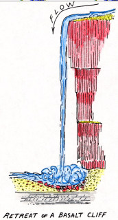
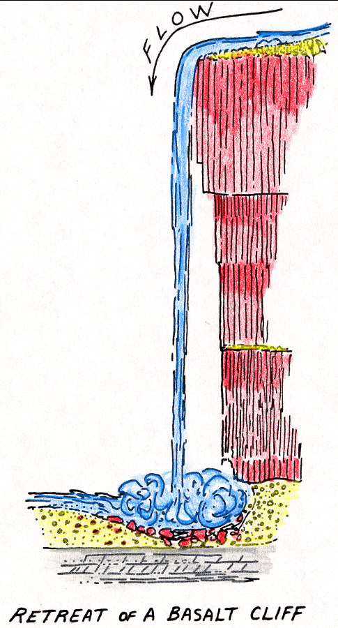
Typical negative slope observed in retreat of basalt cliffs in the western
Grand Canyon. This is caused by the pervasive columnar jointing
and spring sapping along intermittent cobble beds (shown in yellow).

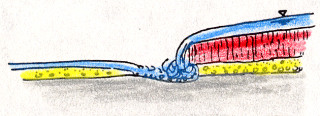
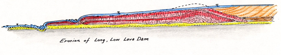
Conceptual sketch of the initial stages of erosion of a long, low lava
dam via overtopping.
Conceptual sketch of toe-headward removal of a long, low lava dam.
Note plunge pool scour of the underlying channel bed.
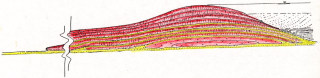
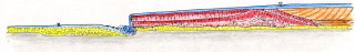
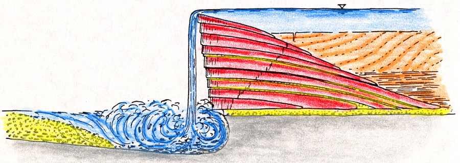
Large composite ash/flow lava dam showing snout of furthest flow downstream
at far left, up to 75 miles downstream. From a geologic perspective
these lava dams were short-lived structures. The highest dam at
Toroweap appears to have reached about 2460 feet above the ancient river
level, about 3-1/2 times higher than Hoover Dam!
Conceptual
sketch illustrating the onset of erosion at the distal snout of a lava
dam when the dam is initially overtopped.
Conceptual sketch of the waterfall and plunge pool enlarging itself
as it retreats upstream. The flows may actually have been removed
as a series of toe-headward cuts, where successive flows lapped onto
one another. A modern-day corollary can be observed today in Iceland
along the Mid-Atlantic Rift, where water drops over receding vertical
falls.

Near the apex of the lava dam the overpour and plunge pool may have
achieved their maximum dimensions. If the basalt was pervasively jointed,
an enormous wedge failure could be expected, extending at about 50 degrees
upward from the undercut toe, as sketched here.
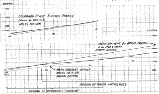
Surface profile of Colorado River from Mile 145 to 200, with the mean
gradient dashed in (between Lees Ferry and the Grand Wash Cliffs).
The channel profile upstream of Toroweap (Mile 179) exhibits an abnormally
low gradient, suggesting hydraulic choking in vicinity of Lava Falls
and Prospect Canyon, which has overwhelmed the channel with detrital
debris.
Questions
or comments on this page?
E-mail Dr. J David Rogers at rogersda@umr.edu.

|


