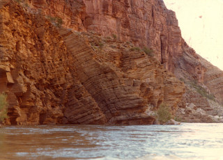
Between
Miles 144-179 the Colorado River flows through a relatively quiescent
reach of the Grand Canyon. In this area small anticlines have
formed along the river channel in the Muav Limestone, as shown here.
They are curiously absent in the northwest-trending reaches of the channel.
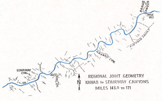
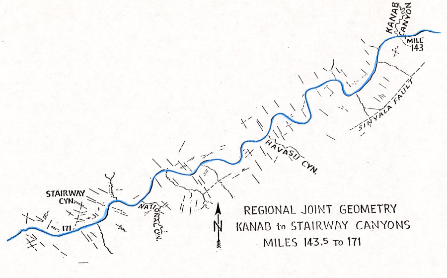
Systematic joint suites mapped on aerial photos along the Inner Gorge
between Miles 143 and 171. The river channel is highlighted in
blue. The most pervasive suite appears to be aligned northwesterly.

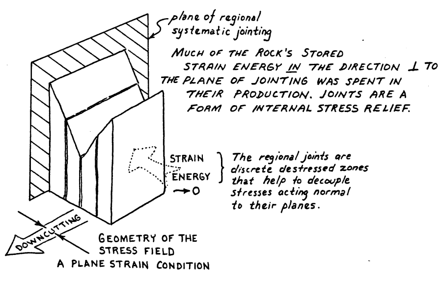
When systematic joints are aligned parallel to the channel in northwest
trending reaches, they would theoretically be accorded additional upward
drainage, as shown in this sketch.
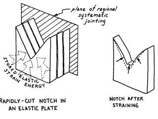
But, when the pervasive systematic joint suite is situated transverse
to the channel, less upward drainage would be expected. This suggest
that the river anticlines preference for southwest-trending channels
may be due to uplift during rapid drawdown events, as might have been
expected when the lava dams downstream of this area breached and their
reservoirs drained.
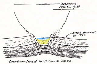
Sketch of deformation that would be expected to occur under conditions
of rapid drawdown of a reservoir pool 2400 feet deep in the area between
Kanab and National Canyons. An uplift force of almost 150,000
pounds per square foot could theoretically develop, lifting the underlying
Bright Angel Shale and Muav Limestone, as sketched here. This
is easily demonstrated today using finite element codes with similar
loading conditions.
Questions
or comments on this page?
E-mail Dr. J David Rogers at rogersda@umr.edu.

|