Next: References Previous: Acknowledgments

![]()
![]()
Next: References
Previous: Acknowledgments
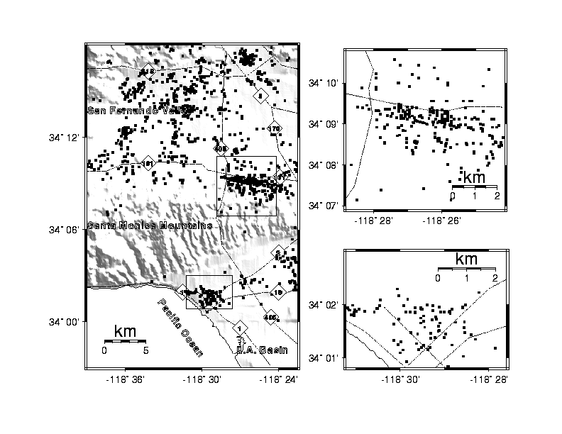
Figure 1. Distribution of red-tagged buildings and topography. The coordinates of the red-tagged buildings are from Marshall and Stein (1994). Diagrams on the right are enlargements of the inset areas.
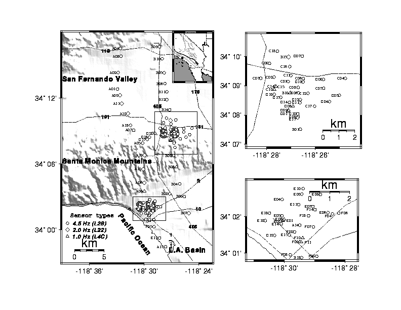
Figure 2. Station locations, station numbers, and sensor types. Circles are 4.5 Hz (L28) sensor stations, diamonds are 2.0 Hz (L22) sensor stations, and triangles are 1 Hz (L4C) stations. The inset at the center upper right shows the location of the larger map (small black square). The Sherman Oaks (SO) and Santa Monica (SM) areas are enlarged at the right. Numbered lines are highways; highway 2 is Santa Monica Boulevard.
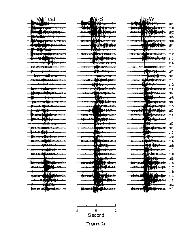
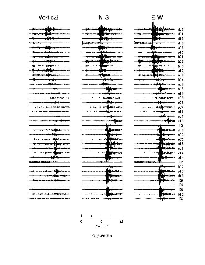
Figure 3.a;b Record section from event 093-09-09 showing the vertical, north-south, and east-west components. Only the first 12 seconds after the first arrival are shown. The traces are aligned with the first P-arrivals at 1 sec and are plotted using the same scale.
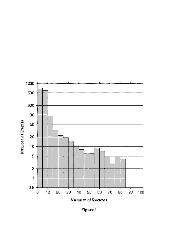
Figure 4. Histogram showing the distribution of events as a function of the number of stations that recorded them. The width of bin is 5. Note that logarithmic scale is used on the Y-axis. More than 1000 events were recorded by less than 10 stations.
Figure 5. Epicenters of the 53 aftershocks which were recorded by at least 40 of the stations. Diamonds indicate major numbered highways. The epicenter of the main shock is indicated by the star.
