In 1937, Parry Reiche recognized the Toreva block as a unique style
of landslippage in a Journal of Geology article titled "The Toreva-block,
a distinctive landslide type." The name emanated from his
type locality in the vicinity of Toreva, a small town in the Hopi
Indian Reservation near Black Mesa in northern Arizona. Toreva
is located on the southern end of Second Mesa about 100 miles due
north of Winslow, AZ.
He subsequently
noted the occurance of these slides throughout the Colorado Plateau
and pointed out their presence along the Vermilion Cliffs, in the
Grand Canyon, and other areas, mostly escarpments. Toreva blocks
have also been termed rotational landslides, earth and rock slumps
and slump-flow landslides. This type of slide most often occurs
where weak shales are overlain by more competent beds, such as sandstone
and limestone . The weaker rock typically shears along a lystric
failure surface, which Leo Rendulic first recognized to be log spiral
shaped in 1935. As the sliding block translates it rotates backward
along the log spiral shaped rupture, casuing the block to rotate backward
towards their scarps. The Cretaceous Mancos Shale is responsible
for the failures observed near Toreva.
Original
Parry Reiche article The Toreva Block, a distinctive landslide
type
-From Journal of Geology Vol 45, No 5, 1937

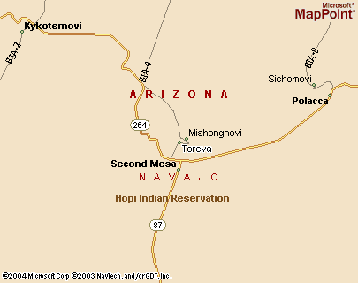
Vicinity map of the area surrounding Toreva on Second Mesa on the
Hopi and Navajo Reservations in northeastern Arizona. We have
also recognized similar landsliding along First and Third Mesas.
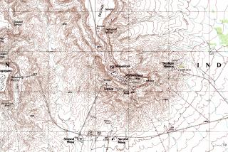
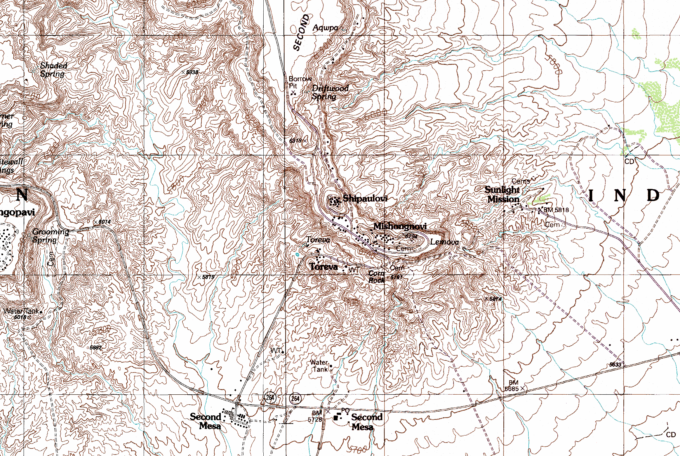
This topographic map (click map for better image) shows the incised
escarpment surrounding the southern end of Second Mesa.
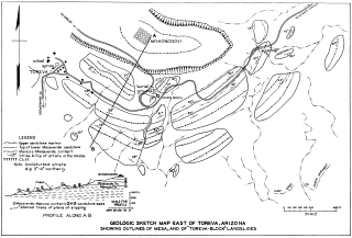
This is Reiche's sketch showing a plan view and cross section line
through the Toreva blocks bordering Second Mesa. Reiche was
working for the U.S. Soil Conservation Service at the time he authored
the original article.
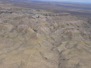
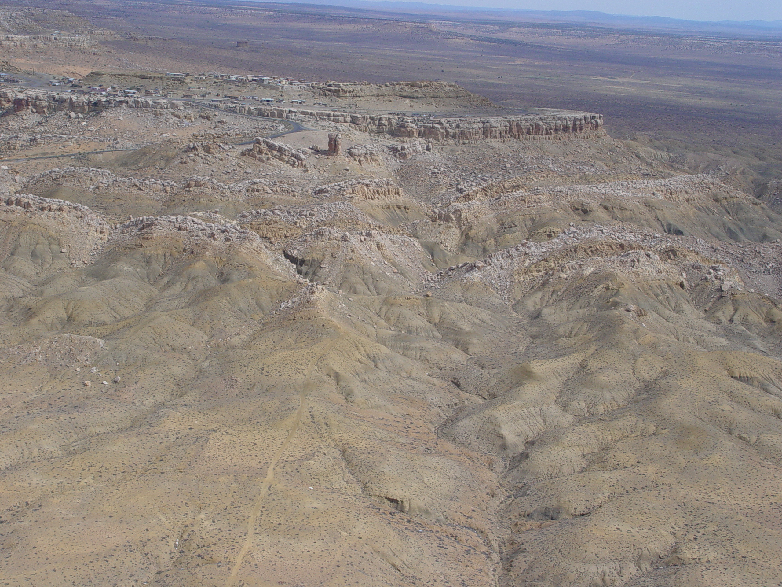
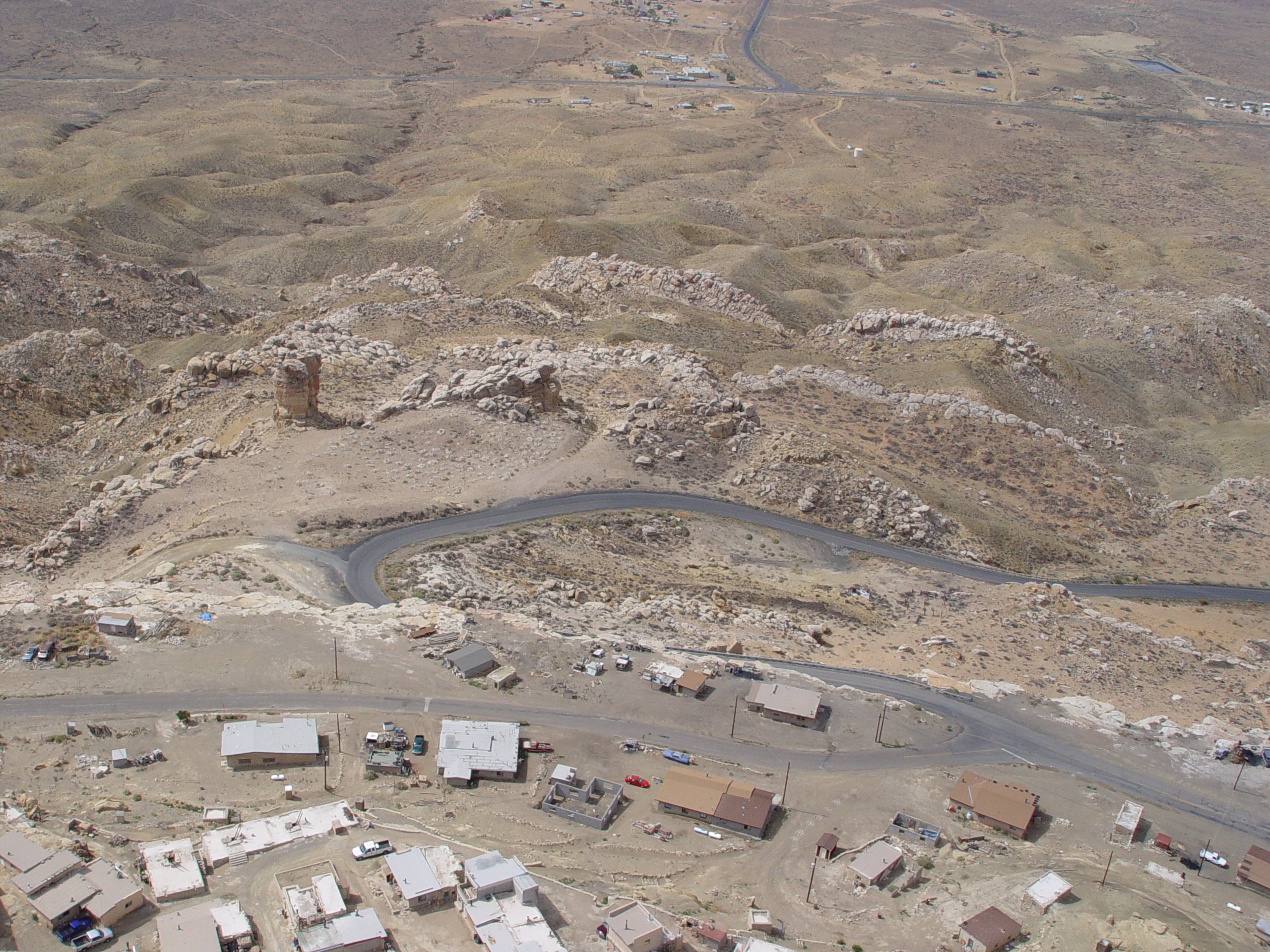
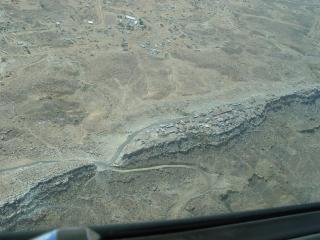
This arial view looking north at the southern
tip of Second Mesa shows the front of several Toreva blocks that have
failed at the type locality. Note that the mesa is capped with
the lighter colored Mesaverde Sandstone Formation.
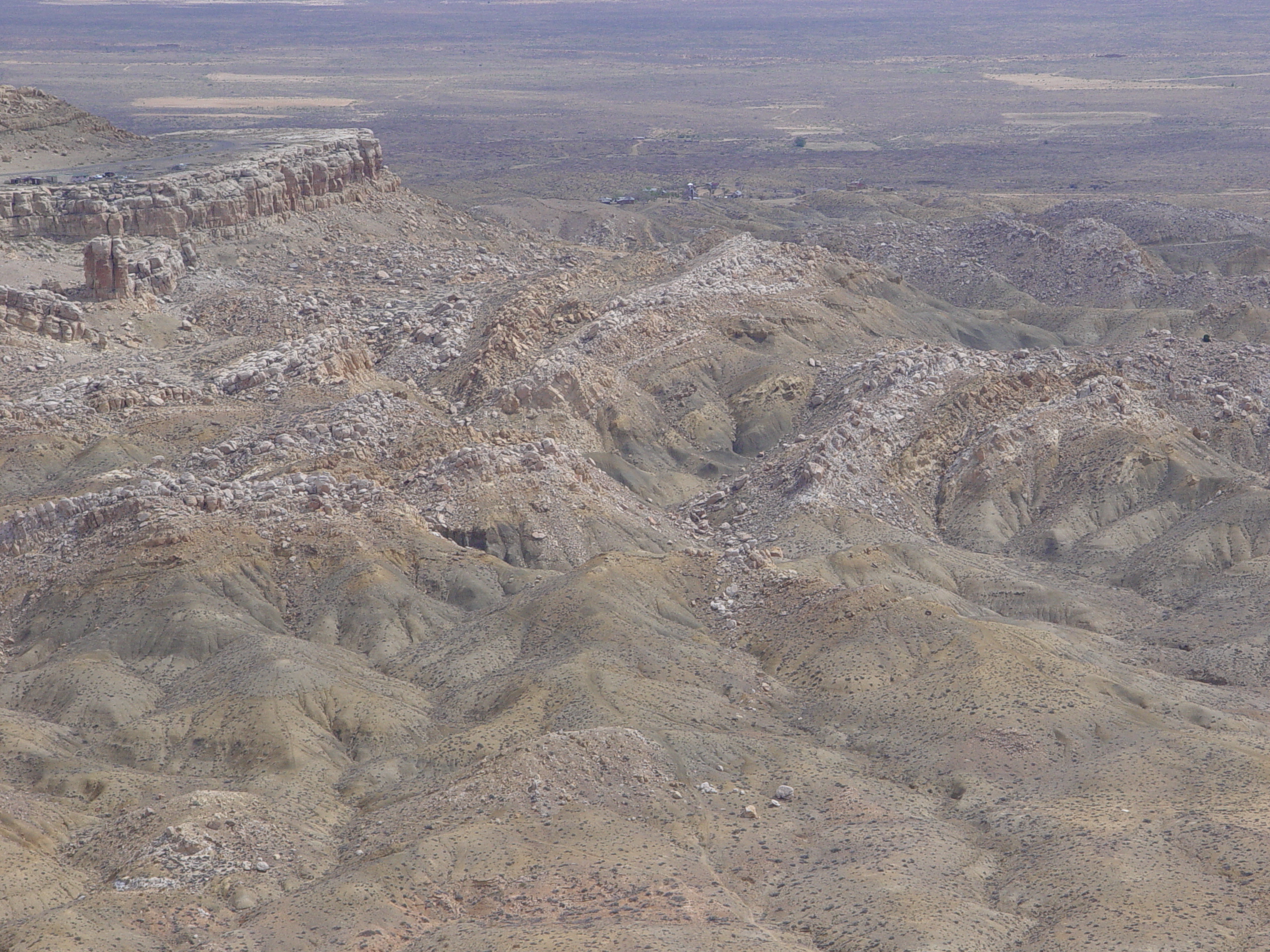
An aerial oblique view looking down the strike of several Toreva blocks
shows repeating tilted strata of of both the Mancos and Mesaverde
Formation.
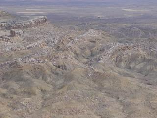
Closer view
of the Toreva Blocks at the southern end of Second Mesa

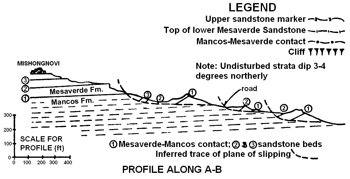
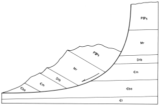
Geologic
cross section along the southern tip of second mesa showing repeating
strata and inferred failure surfaces (from Reiche, 1937). A-B
is denoted in Reiche's shetch above. Note failure of slides
against the northerly regional dip.
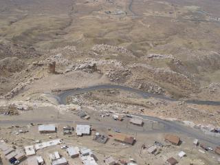
The Toreva Blocks at Second Mesa as viewed from above and behind.
One can see the repeating strata of the Mancos and Mesaverde Formations.

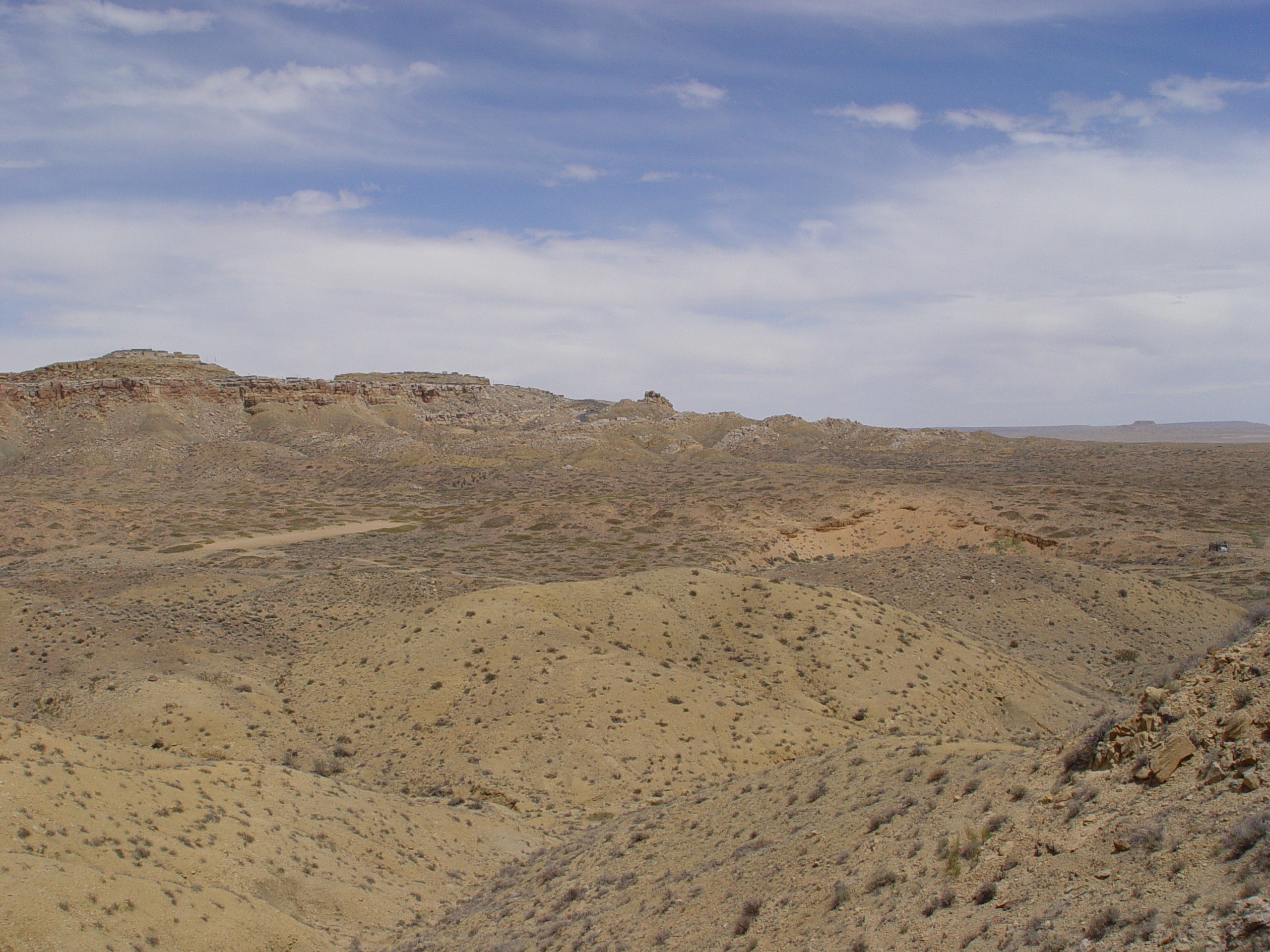
Wide angle view of the southern end of Second Mesa showing a series
of retrogressive slumps near Toreva, AZ

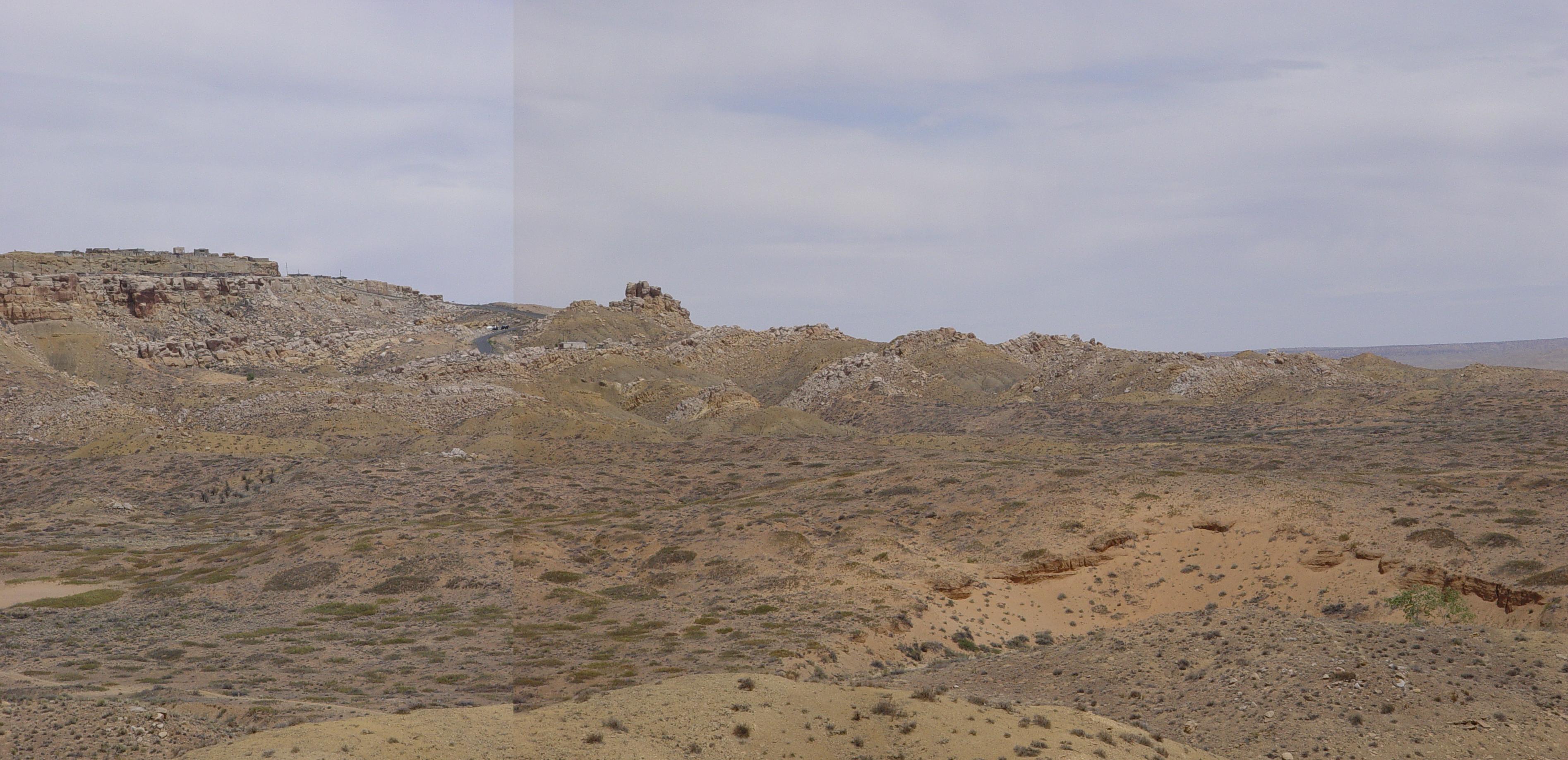
This combination of two pictures clearly shows the landsliding and
repeating tilted strata near Toreva, AZ
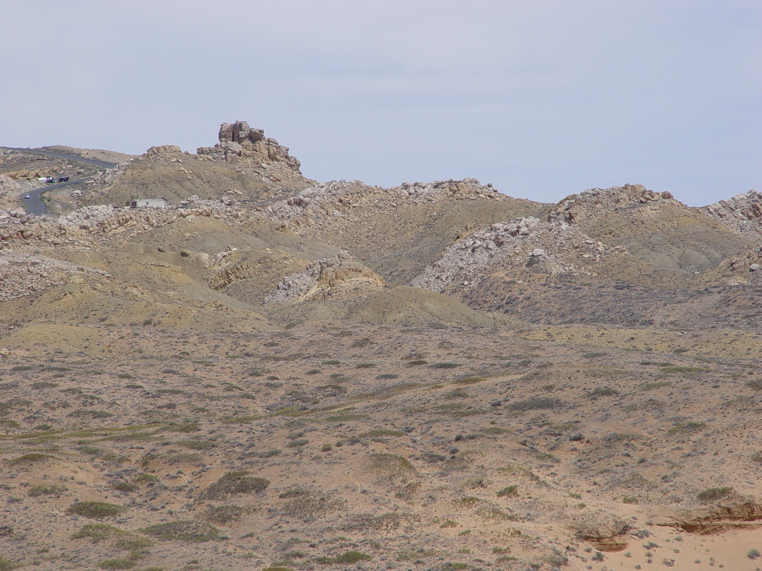
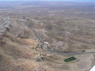
This closeup shot of the Toreva Blocks shows several of the slumps
at the southern end of Second Mesa. Notice the mobile home trailer
on the slide for scale.
Sketch of a typical Toreva Block with a log spiral shaped failure
surface in Surprise Valley in the Grand Canyon. Note the back-rotated
beds. Toreva Blocks along the Vermilion Cliffs exhibit similar
profiles, but within different formations. The slides at Toreva
floor in Mancos Shale while those in the Vermilion Cliffs occur mostly
in the Petrified Forest Member of the Chinle Formation. This
sketch is taken from "Geology of The Grand Canyon, 3rd Edition",
1979.
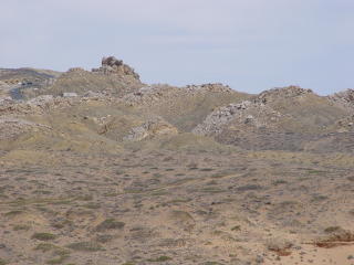
This portion of nearby First Mesa on the Hopi Reservation shows a
mesa in its final stages of erosion. One may notice the regional
joints, which are open near the left of this image.
Questions or comments
on this page?
E-mail Dr. J David Rogers at rogersda@umr.edu
or
Conor Watkins at cwatkin@umr.edu.